
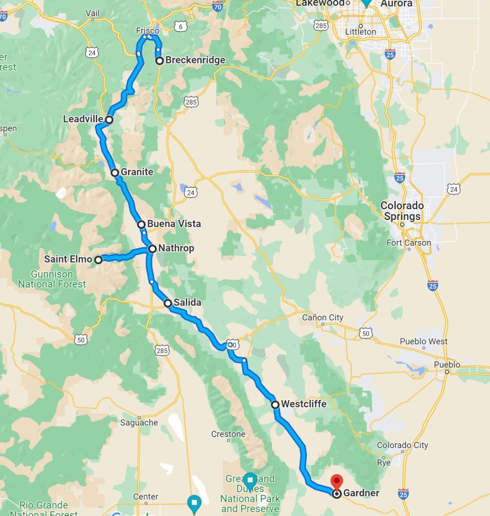
There are ways home from the well-known ski resorts that do not involve traveling 85 miles per hour on I-25. It takes longer, and involves long stretches of minimal civilization, but it’s worth the detour.
In 2022, it was time to head home from our bi-annual family ski trip to Breckenridge. Instead of taking the main thoroughfare with all the other travelers, we headed north out of Breck, toward Dillon Lake and Frisco, areas that aren’t unique and similar to Breckenridge. Large SUVs fill the roads with traffic, carrying families dressed in their winter gear, ready for expensive outdoor or indoor entertainment. The snow on the roads is slushy and sloppy, as cars spin their wheels on top of it. Scattered through Frisco are businesses that cater to tourists: gift shops, bars, ski gear, all sitting behind fancy retail entry ways.
Abbey’s Coffee was crowded, but provided a nice break and much needed caffeine. We waited patiently for the one employee to serve us drinks and tipped her well, as she appeared to be the only staff on the clock, trying her best to serve all the impatient tourists.
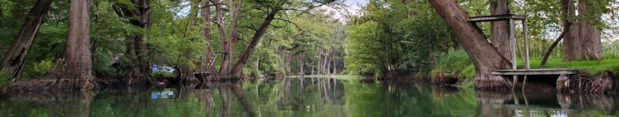
After Frisco, the road takes travelers south toward Copper Mountain, one of the many ski areas we have yet to experience.
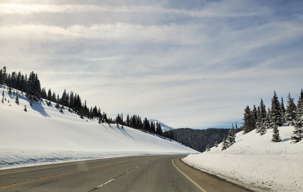
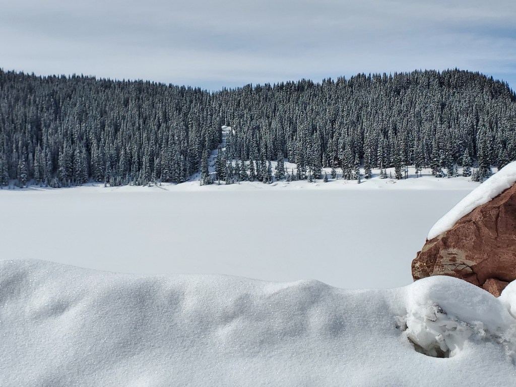
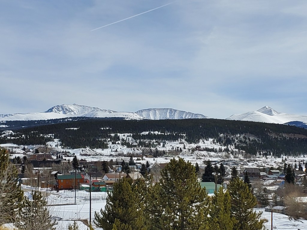
Snow covered mountains surround the highway on both sides, offering views that are not available in our parts of the world.
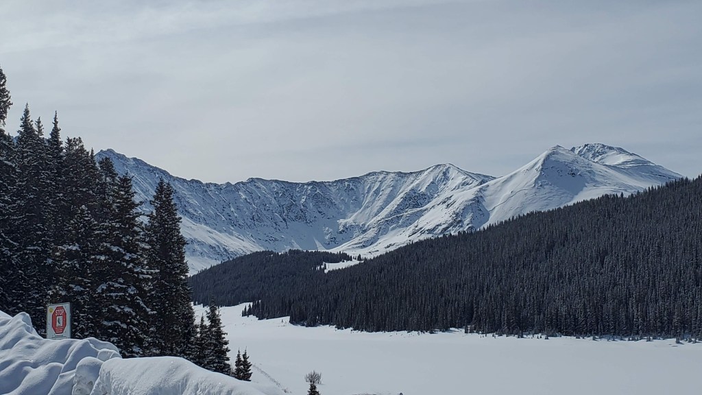
It’s almost impossible not to stop every few miles and get out to enjoy the quiet and the scenery.
Instead of heading down out of the mountains, we followed the road to higher elevation, finding ourselves at 10,152 feet in the town of Leadville, the highest incorporated town in the US.
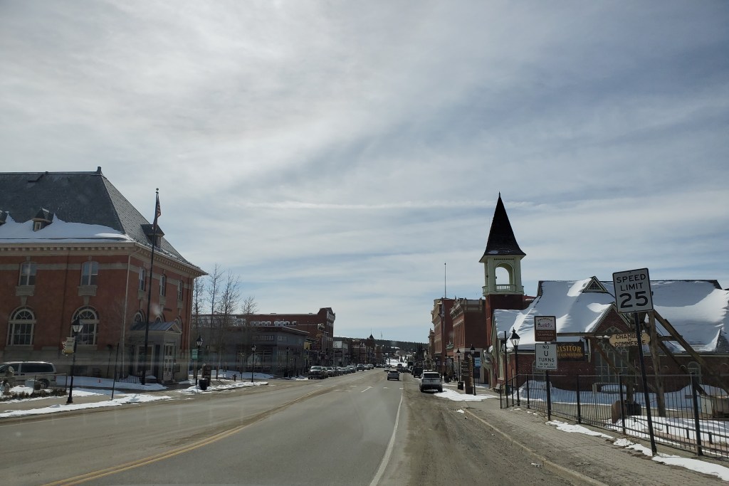
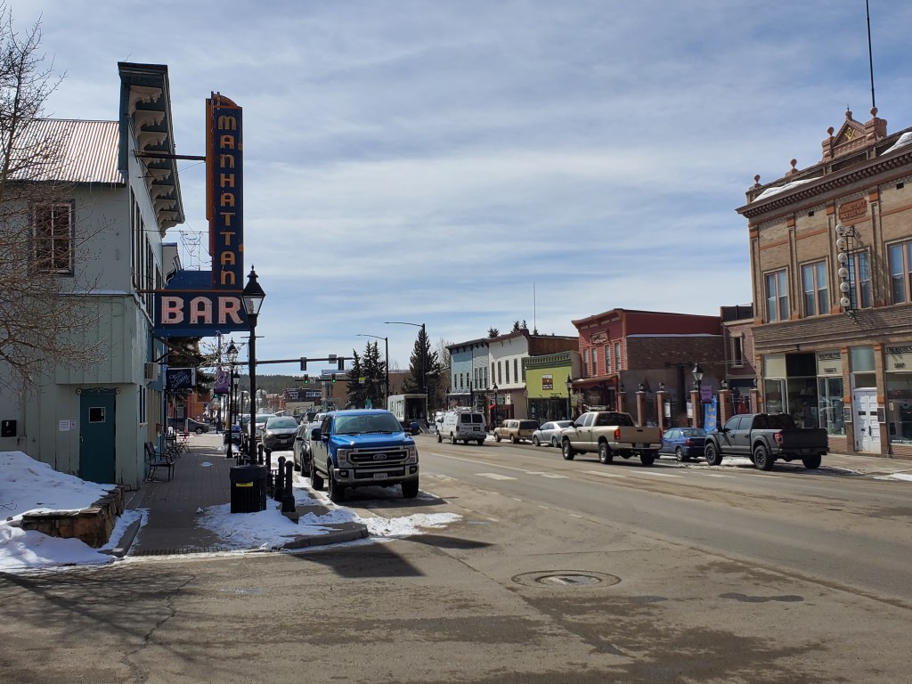
Mining was the industry that gave most towns in the area their start, and Leadville is not different. The first miners did not have comfortable lodging options, residing in tents near the mines and calling their new settlement “Slabtown”. Wandering around the town in 2022, we wondered if the stickers in the gift shop would be profitable with Slabtown on them.
The late 1800s were a time of much production in the area. As the mines proved profitable, early settlers starting making their way up the mountain. Bricks were hauled up with wagons to construct local businesses. There were churches, hospitals, banks and a small school and a mayor from Vermont well known for his extravagant lifestyle named Horace Tabor. At some point during his time in Leadville, he abandoned his wife of 25 years for a mistress half his age. His new partner (who had a daughter named Silver Dollar) likely enjoyed his riches and status in the community. Until those things didn’t exist anymore. At the time of his death, Mr. Tabor’s fortune had disappeared during the panic of 1893. He left the mistress penniless, but convinced her the price of silver would rebound, and she spent the rest of her life in Leadville waiting for that to happen. The last three decades of her life were spent in an unheated cabin, where she finally froze to death at the age of 81.
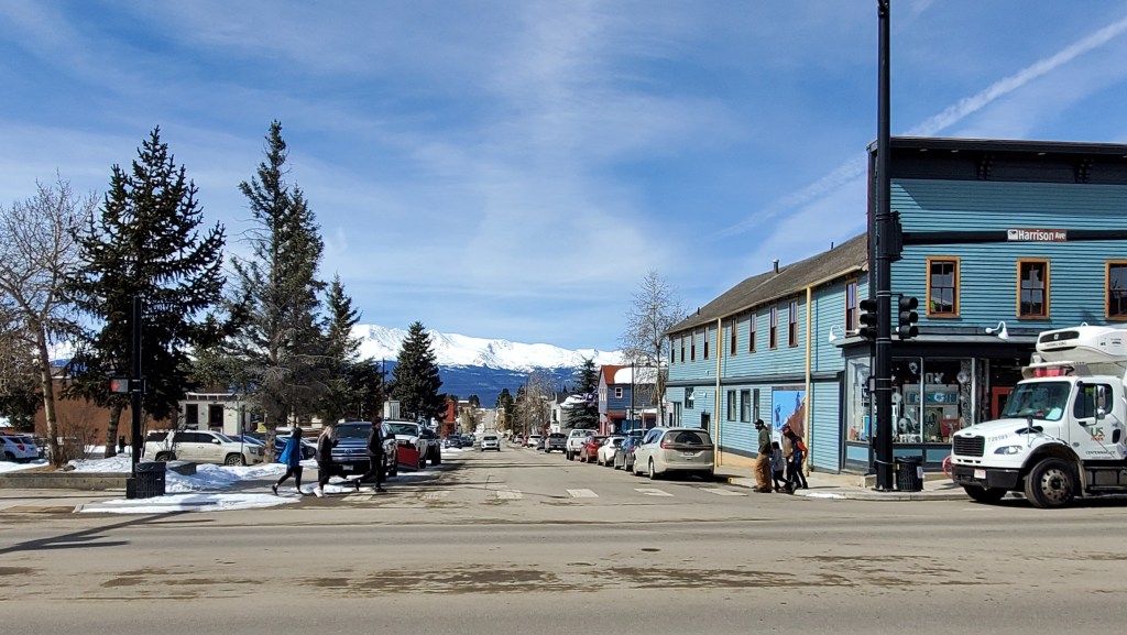
Today, most tourists are not aware of the second Mrs. Tabor’s fate. Outdoor recreation opportunities have replaced mining as the economic driver for the area. Challenging racing events take place in the area, such as the Leadville 100 Trail Series. Athletes flock to the area to challenge their bodies without giving a second thought to the price of silver.
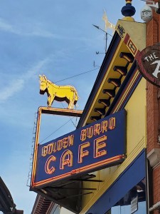
We didn’t stop for food in Leadville, despite all the dining options. Most are typical Colorado: plant based and environmentally friendly, like the Golden Burro, which entices hungry tourists with this fantastic neon sign and tofu on burgers made of plants.
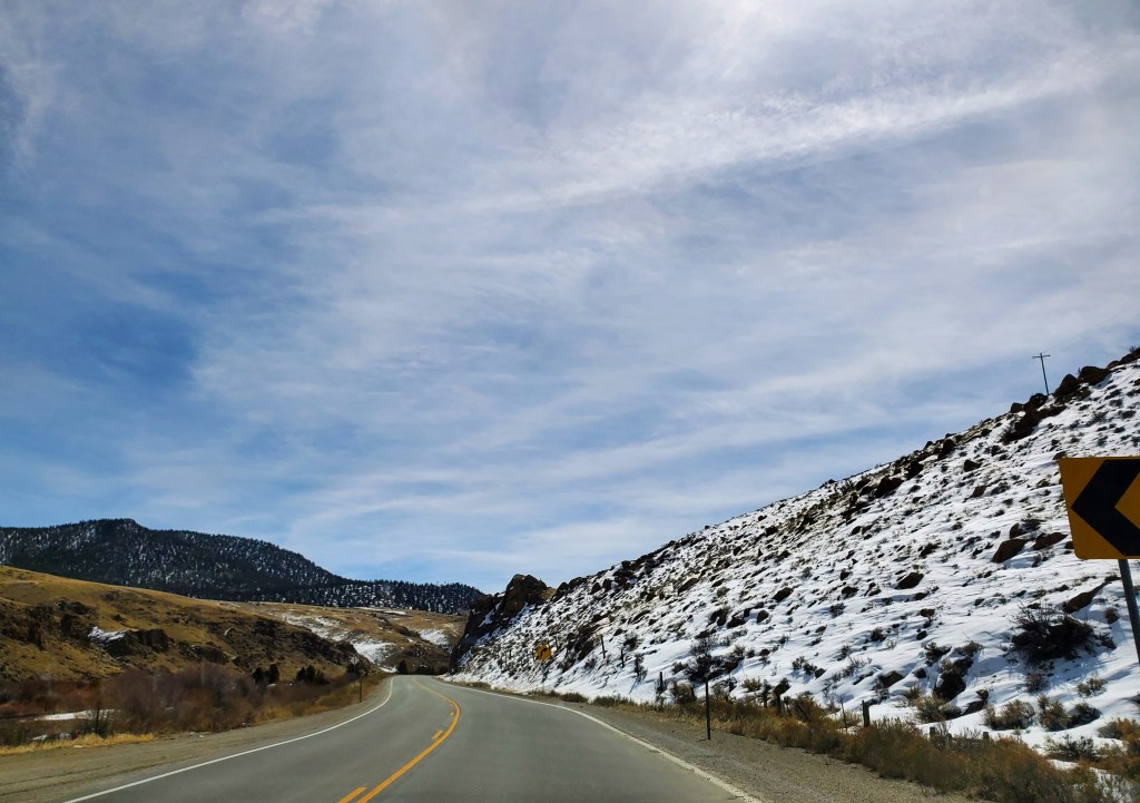
Leaving Leadville requires downhill driving. We followed the road south as the snow faded and we saw more green grass and brown dirt.
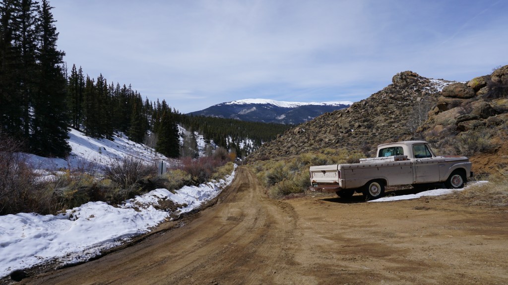
There’s not much left of Granite. It’s a small spot on the side of the highway, and if you didn’t know it was there, you might keep driving. Most would say that would be the better option, because it’s just a collection of barely standing log homes and sketchy dirt roads leading to off the grid ranches. Crossing a bridge over a small creek, we found little homes and old sturdy pickup trucks, parked in no discernable order.
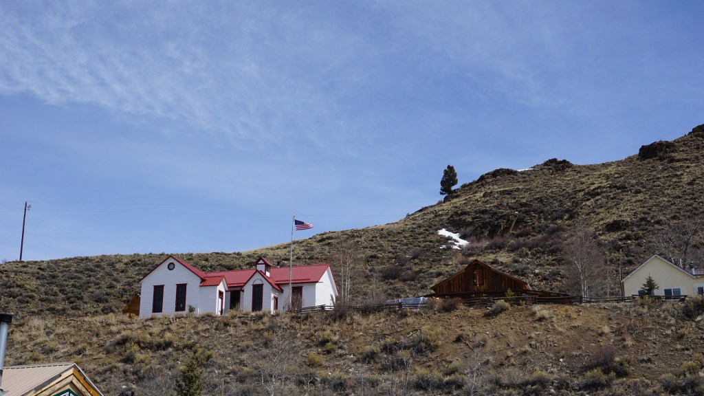
Like Leadville, Granite started as a mining camp during the Pike’s Peak Gold Rush. Early prospectors rushed to the area in search of riches. Their children needed a place for their education, and a schoolhouse went up on the top of a little cliff. The children would have had an excellent view then. Now, the school overlooks the highway and the vast Colorado plains beyond. It’s also located on private property, not accessible to curious history nerds.
Granite is desolate and lonely, unlike its southern neighbor, Buena Vista. Heading into the town whose name translates into beautiful view, we discovered a tiny tourist spot in the middle of nowhere. The downtown area was full of people wandering around, construction indicated more space is needed to accommodate all the people.
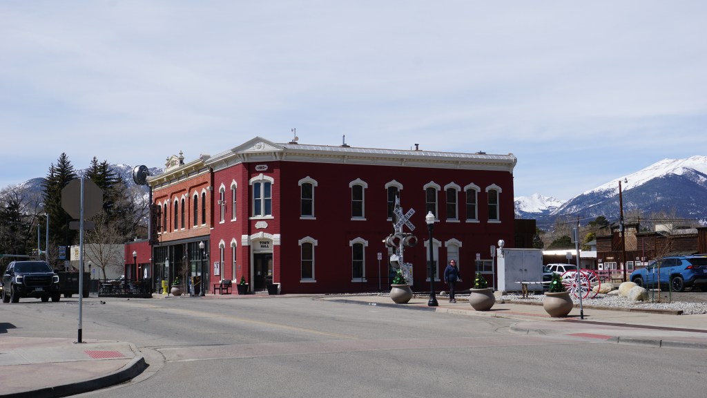
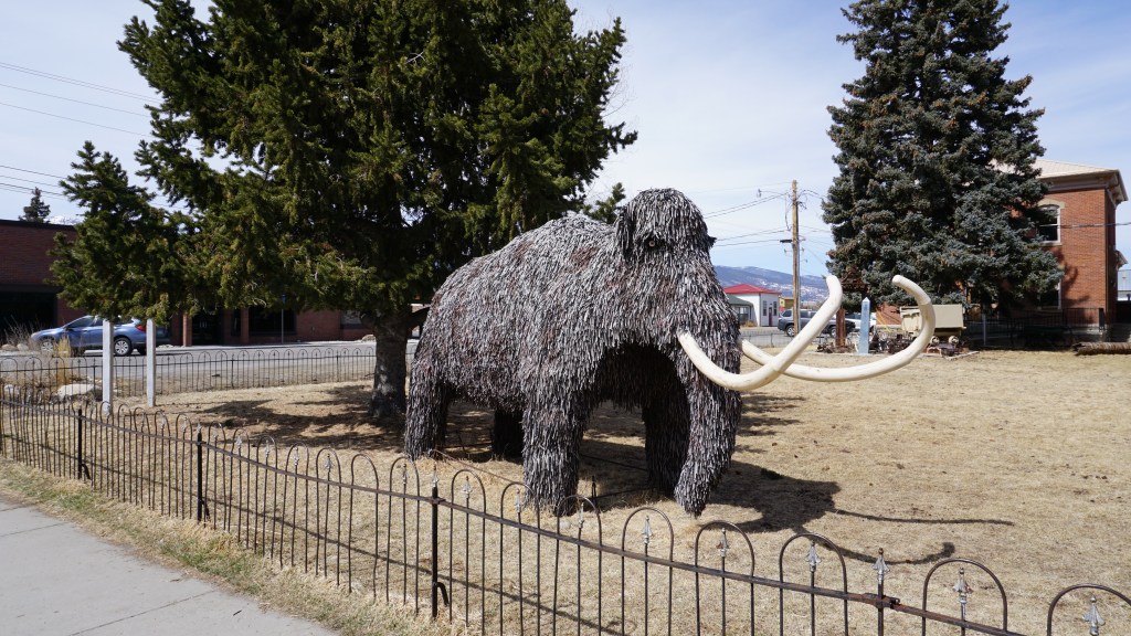
There’s lots of people, a big red town hall and one big woolly mammoth, quietly observing the town.
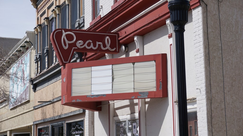
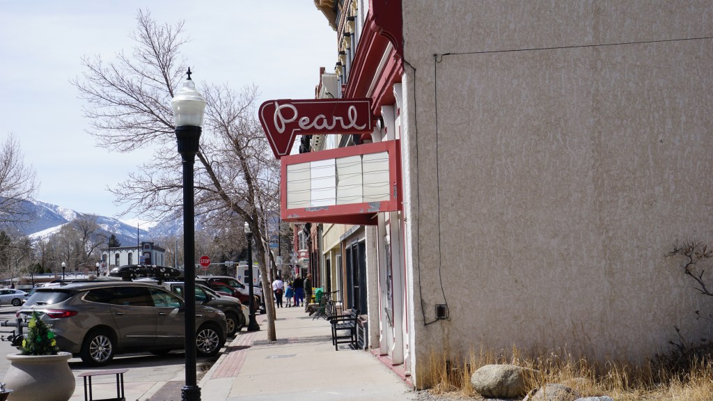
Named after the owner’s mother, the Pearl Theater opened in the 1950s, ending its decades long existence as a local tavern called Joe and Tony’s, owned by two local men named… .Joe… and Tony. According to sources the descendants of Pearl Groy owned several theatres in the area at one point. Today, it appears the Pearl has shut its doors.
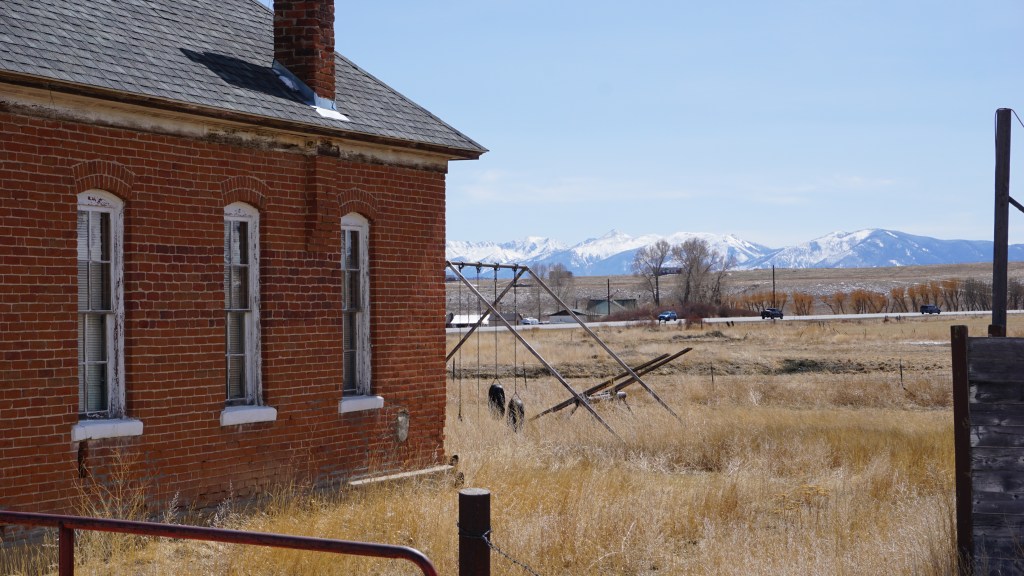
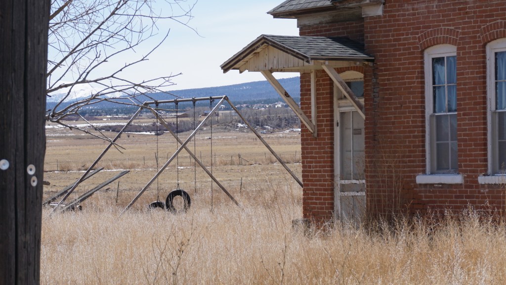
South of Buena Vista one of us noticed a small abandoned building at an otherwise unexciting crossroad, so we flipped a quick u-turn and went back for photographs, as if we had unlimited travel time.
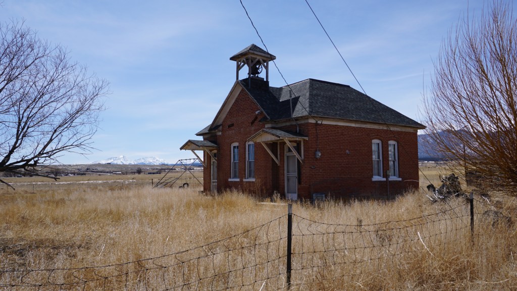
This is the Gas Creek School, which was the only school in the district from 1909 to 1958. One teacher supervised and instructed all students, who were typically from ranching families in the remote area. After the school closed, the building was utilized as a community center. It’s significantly well preserved (like the one in Granite) for its age. There’s even an ornate bell tower. You can almost hear the bell ringing, signaling the children to find their way to the building from the playground. We considered our family members who are also educators and the stress the profession has caused, especially during COVID. We considered the level of stress this teacher must have dealt with – all the students in this tiny claustrophobic building – did it even have a bathroom? And where did they eat lunch? Where did said teacher live? So many questions. We hoped she had a good retirement plan and access to BetterHelp.
Since we stopped for a minute, we decided to checked the map. Not far to the west, a Google green flag popped up. What was this? We zoomed in an found a want-to-go marker on a town called St. Elmo, a little place buried in the mountains. We checked the time, and double checked the map. It was getting late, but when would we be here again? Reversing course, we headed west. Away from home.
Google had promised St Elmo was only sixteen miles away. But you must also consider the road conditions. Fortunately, we were prepared for this. We had equipped the all-wheel drive car with snow tires prior to leaving Texas.
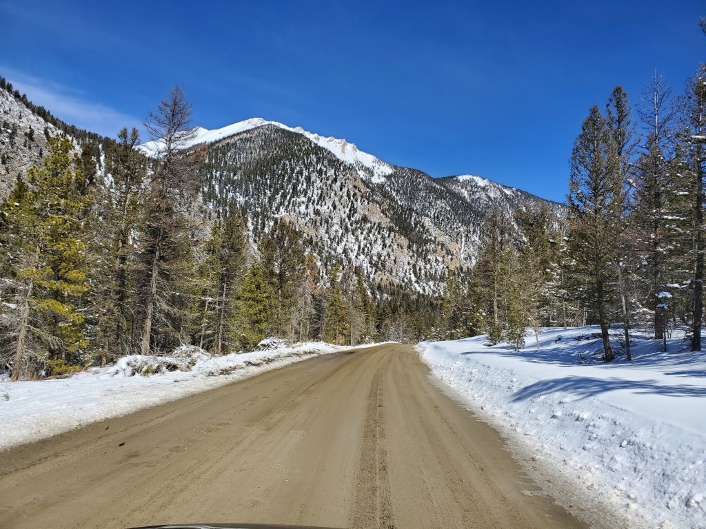
We were thankful for those tires when ten miles in, the road stopped offering so much dirt.
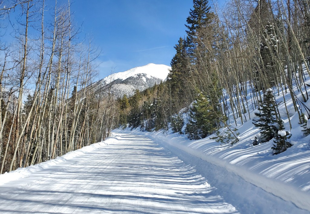
They held up well, carrying us up and over hills, through the valleys in between snow covered mountains.
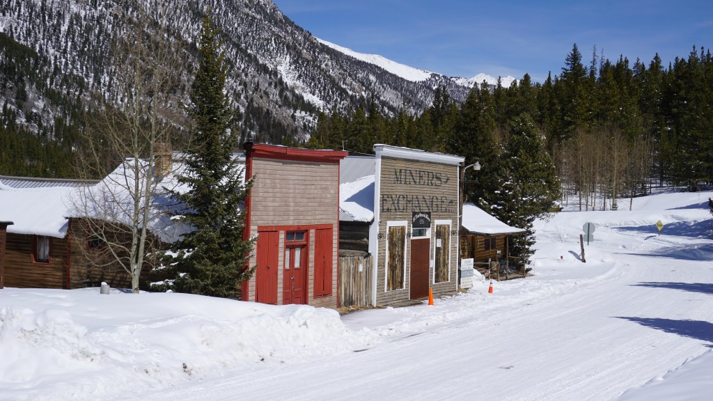
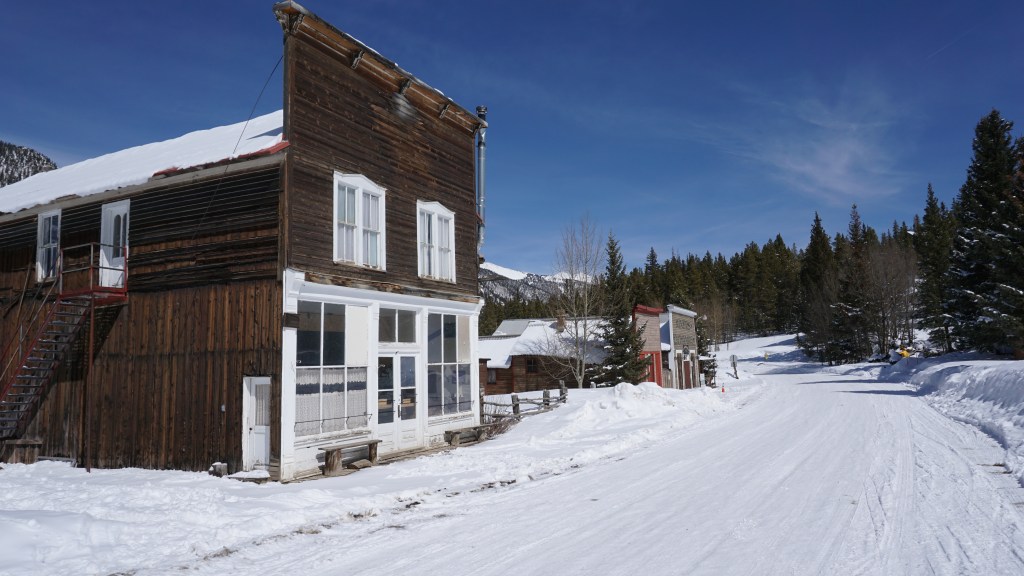
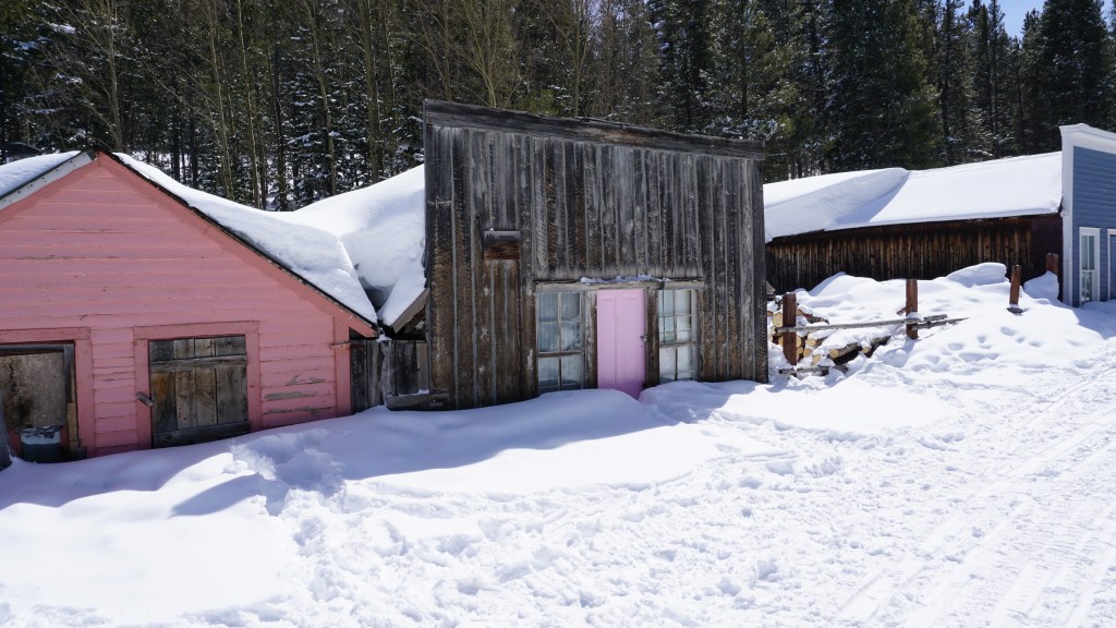
At the end of the road, we found what were looking for – a ghost town buried in the mountains. Welcome to St. Elmo.

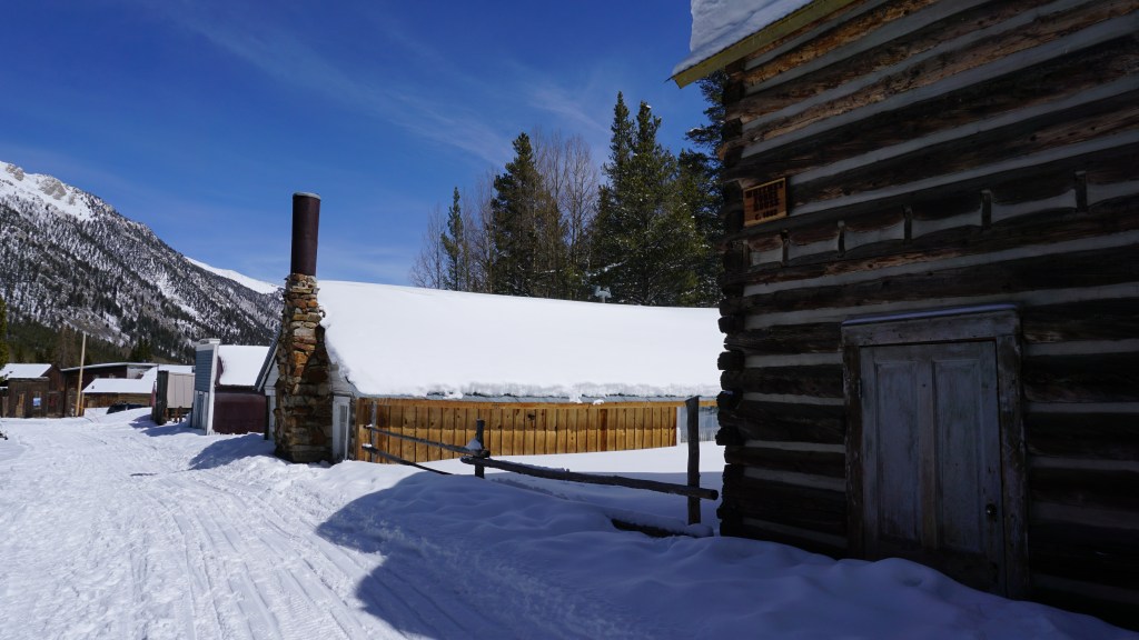
The scene was similar in its early days; the 1880s was a booming time for the area.
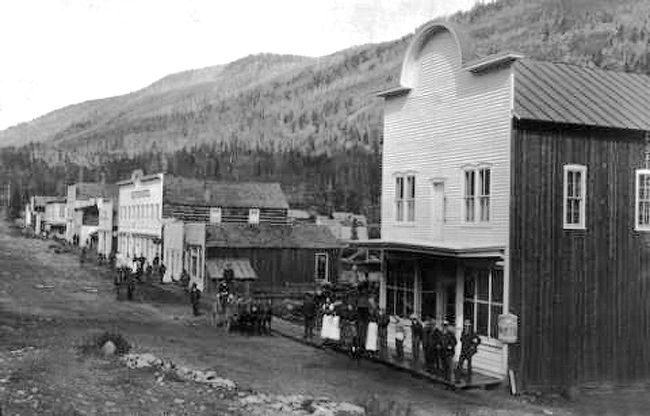
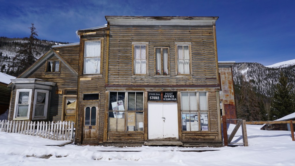
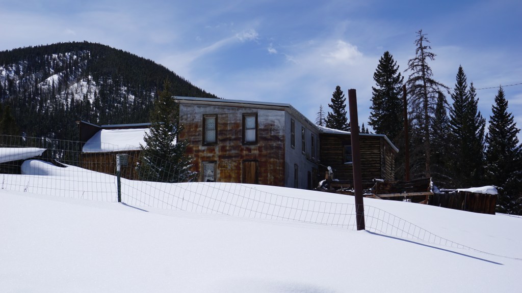
As with most towns in the area, gold and silver was discovered and the people quickly followed. Evidently possessing not even an ounce of creativity, the early settlers proposed the name Forest City. Even the post office scolded them for lack of originality, stating there were already too many towns with such a boring name. One founder was reading a romantic 19th century novel at the time, and liked the title: St. Elmo. The post office approved. A railroad came through shortly after the town’s explosion in population, attracting many single male miners. Dance halls and bars quickly followed, and the place was well known for late night intoxication and lewd behavior (also not unusual for newly established towns in the area). An elite well-known family in the area, the Starks, operated the hotel and several other businesses in the town, successfully at first, then hung in there while the town’s population declined, miners leaving for more profitable lands and business owners closing shop. All that was left was tourism, and St. Elmo tried its best to attract outdoor enthusiasts. The family ran the businesses until they couldn’t anymore, and legend has it they continued to live in the town without water or electricity for many decades past. The post office officially closed in 1952. No one knows what happened to the Stark family, but there are tales of ghosts wandering through town with dirty clothes and tangled hair.
Today, there’s still some interest in the recreational activities in the area, like snowmobiling and fishing. There’s a few cabins buried in the woods, and the general store is still open, but there are no hotels or bars in town anymore. Despite a fire in 2002, the town has been well preserved and is listed on the National Register of Historic Places.
Another ghost town: check. Google want-to-go flag status updated to “been there”. Exploration complete, we retreated to the vehicle and prepared for the sixteen miles back to Nathrop, stopping at a few quiet places along the way.
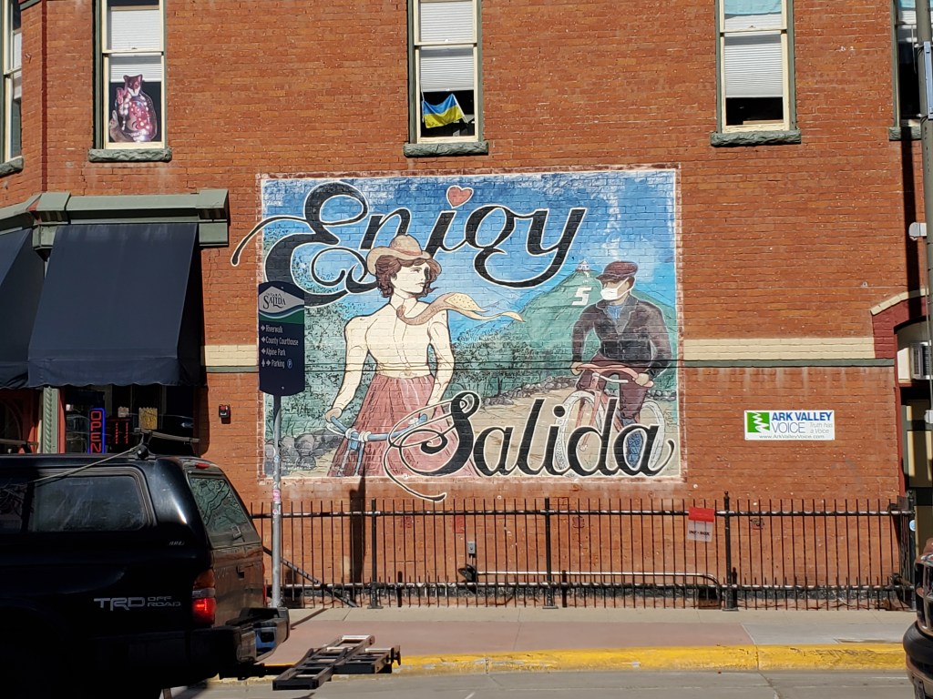
We found our way back to 285 and headed south, planning on minimal stops going forward. But we know how that goes. Twenty miles down the road, we decided we had to stop in Salida. We were hungry. They had sandwich places. And it looked like such a cool little town.
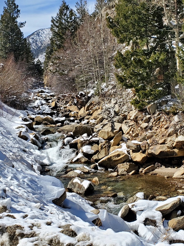
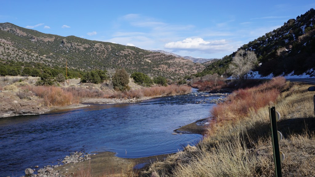
Turns out, it is a cool little town. Tucked in between several different mountain ranges, Salida is well-known for it’s mountain bike trails nearby. There were bikes everywhere in town. The Arkansas River winds through the north side of town, picturesquely placed beneath a beautiful mountain range and offers water sporting opportunities. We left our boats at home on this trip, but we marked the map for a return visit. For several reasons: the biking, the boating, the bars… (when we decide it’s safe to drink again, which would turn out to be sooner than expected). It’s easy to understand the insanely high cost of living in town. We checked Zillow and confirmed our suspicions – million dollar homes in and out of town. We might be able to afford a closet here.
Salida received its name in the early days. A wife of a railroad executive commented on the beautiful valley that opened up as the train exited the canyon from the north. Salida means “exit” or “outlet”. She must have been a resident or visitor of significance, but even that was not enough to earn her first name rights in the history books. We do know that her husband’s name was Alexander and we know he was not the person who suggested the name that stuck, but his name is recorded… you get the idea.
There was mining in the area in those early days, but that wasn’t the sole economic driver for the town. Salida’s location provided a spot for train repair, necessary as trains passing through were going from Denver to Salt Lake City and back. The busy trains occasionally needed a tune up, and Salida became the place. Salida burned twice in its early days, but recovered from both fires and gradually transitioned into a popular tourist town as the mining industry died down.
Sweetie’s Sandwich Shop was a low-key lunch spot, perfect for a break from the car and crowd watching from their windows. One chicken salad and a meat-loaded Dagwood later, we took one last detour through the town and headed out.
Headed southeast out of Salida, the road follows the Arkansas River along the base of the mountains.
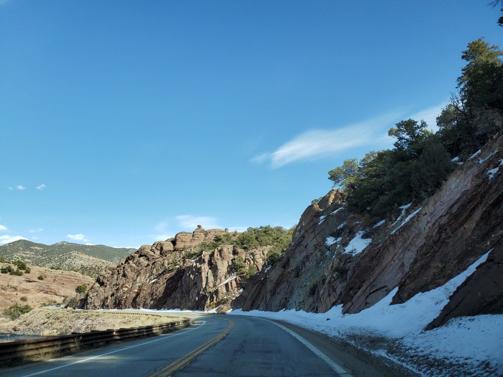
If you were to continue to follow the river, you’d find yourself at the Royal Gorge in Canon City, where the Arkansas River has carved an impressive gorge in the mountains. After that, the river winds its way through Kansas, Oklahoma and then, of course, Arkansas, where it flows through Fort Smith, a spot we pass through on annual trips to the Buffalo National River. We considered the fact that this was the same river.
Eventually the roads starts to straighten and flatten itself and while the river heads west, the road veers south. Towns are small here and far between. One of those is Westcliffe, a small spot on the map. While it’s small and sparsely populated, the homes are still pricey. Not Salida prices, but still more cash than these Texans would want to hand over for a place near the mountains.
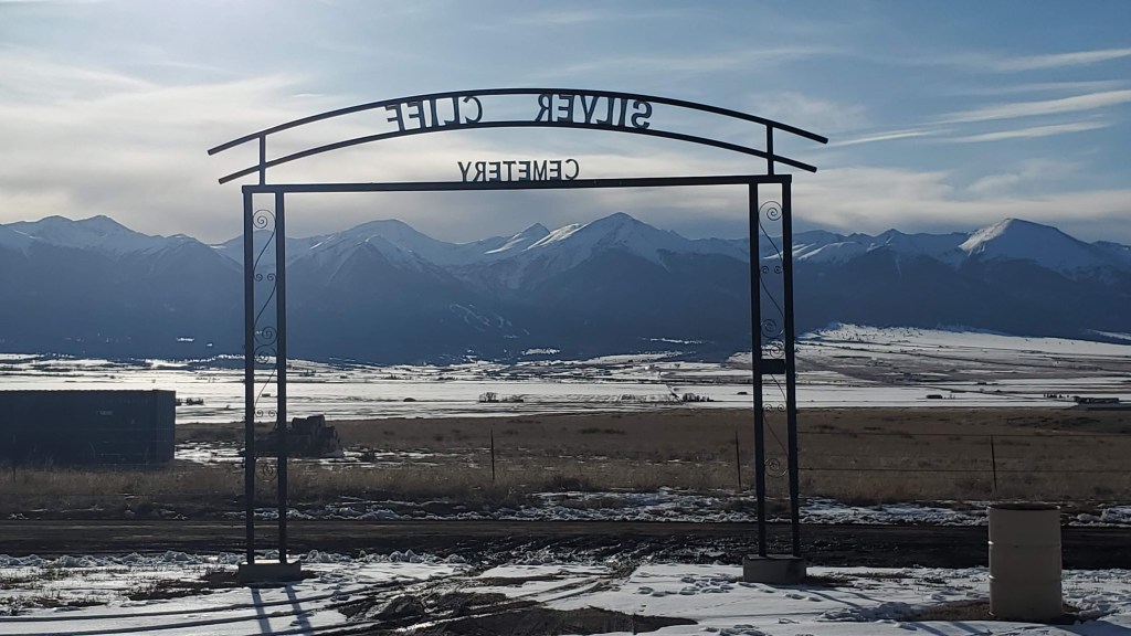
About a mile south of Westcliffe, there’s a cemetery that has incredible views of the mountain ranges in the distance. There’s not just expired folks in the Silver Cliff Cemetery – there’s also dancing blue lights. Allegedly.
The tale of the mysterious lights was started in the late 1800s when a group of miners traveled through the cemetery after dark, looking for a shortcut to town.
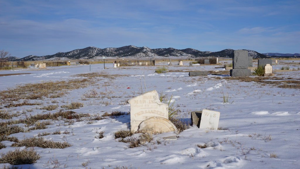
They wished they had just stuck to the original route when they found themselves surrounded by little blue and white dancing orb lights. They got out of there quickly, and spread the word through town about the haunted graveyard.
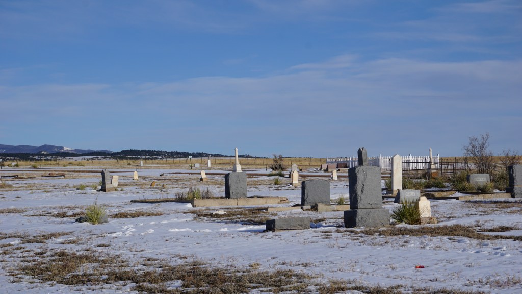
Since then, locals and tourists have camped out in the area, waiting for the lights. Some see them, some don’t. The ghosts were well behaved on our visit, but it was in the afternoon. Maybe they were just waiting for the sun to go down.
The road south out of Westcliffe is quiet, peaceful and the scenery is spectacular.
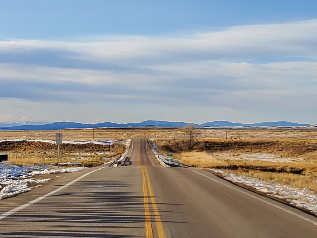
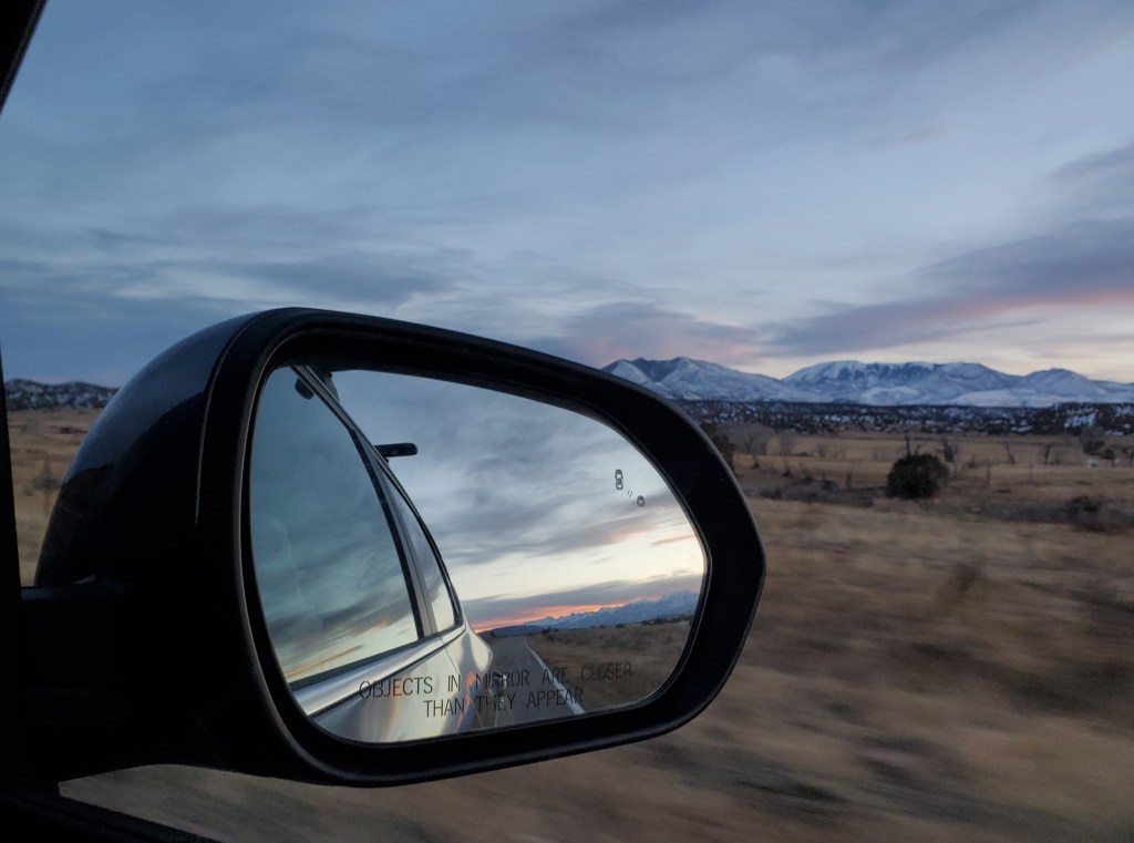
The mountains begin to fade in the rearview, and long stretches of golden fields surrounded us on both sides.
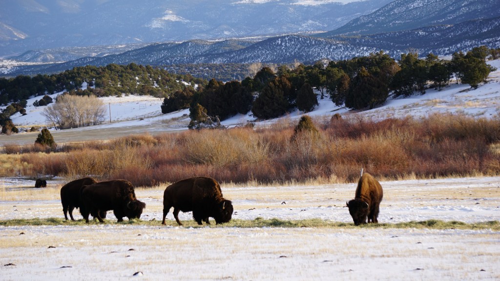
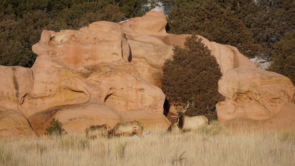
There’s wildlife enjoying their existence in this wonderland, quietly eating grass, blending in with their surroundings and knocking antlers.
When the sun started to disappear, we stopped a few times to capture it before it fell over the mountains.
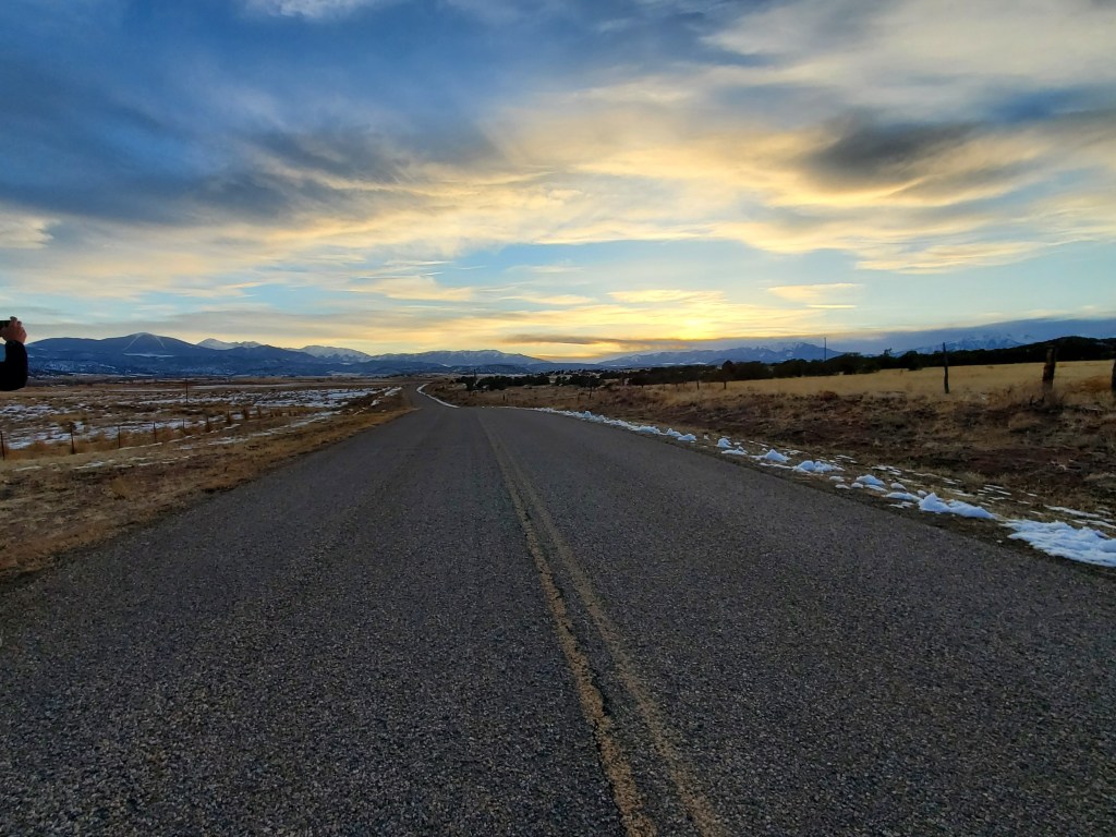
The evening didn’t end here, as we continued the drive all the way to Amarillo. But the light ended somewhere near Gardner, and we turned off the cameras, turned on the podcast, and Googled “coffee in southern Colorado for insane travelers”.
Had we taken the standard path home, we would have missed:
- A woolly mammoth …
- Sandwiches in Salida …
- Historic schoolhouses (2)
- Ghost towns (2)
- Buffalo, elk, and a whole lotta mountains
See? Worth every hour of lost sleep.
