
The Longest Drive
Mid-week arrived during our planned sojourn across Oklahoma and Arkansas. After an exciting start, it was time for our yearly visit to the Buffalo National River in Arkansas. Bit of background before we get to 2021 …
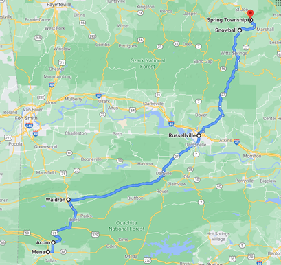
We picked Arkansas as a summer trip location randomly in 2011, having spent quite a bit of time south, southeast, and west of the home base on prior road trips. Stretching our legs a bit, we spun the compass (okay, we looked at Google Maps …) to see where we could get to in a four-day holiday weekend without spending the whole time in the car. At the time, AirBnB was still a dream in some Silicon Valley propellerhead’s brain – we had VRBO and Home Away and “bed and breakfast near …” in Google. Neither of us having been in Arkansas, and calculating we could tolerate what looked like about 7.5 hours of driving, we tripped over a 100 year-old farmhouse that was now a vacation home in the ghost town of Snowball.
That first year, we managed to burn about 12 hours driving to Arkansas, arriving in Snowball far past midnight, but survived to spend the weekend just exploring the area with cameras in hand and not a single plan in mind. Anyone who’s visited central Arkansas in mid-July can testify that “comfortable” and “outdoors” are not words used together to describe the weather. Having seen a lot of trees, fought off a lot of bugs, and sweated rivers, we wondered what else there was to do in this state. A billboard advertised canoe trips on the Buffalo River (which we’d seen from a high cliff looking over the valley), taking off from the tiny town of Gilbert. The rest, as they say, is history.
What followed was on and off ten summers of floating the Buffalo National River over a weekend in June or July, depending upon intersections of increasingly crowded schedules across two divorced parents and their Brady Bunch of children. Excellent times that generated some great memories that we’ll write about someday.
Having been through 2020 with some trips that began to feel like planning D-Day, we found that this year the Buffalo was down to just two of us, with no additional family members. This felt pretty serendipitous, since it was exactly ten years ago this week when we’d stumbled into the Buffalo National River area.
Wednesday 2021 07 07
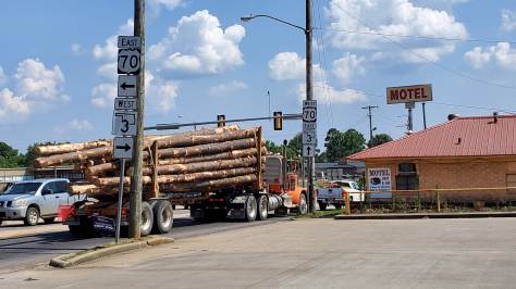
With memories of our first trip in mind, but with a lot more schedule flexibility, we secured boats and bikes (for the most part) on the almost brand new Kia Seltos. One of our party operates on a strict regimen of finding the next meal and coffee – combined with a need to pack in 6 sets of 300 steps, a 3000 step block, and a total of 10000 steps in a day (thank you, American healthcare system), our drives are generally not non-stop. We didn’t get too far before the first stop, northeast of the metroplex in Bonham. Blending both sets of requirements, a quick walk coincidentally placed us at the local coffee shop – Stay Grounded Coffee Cafe – where we were impressed with the setup (remodeled inside an old Sonic Drive-In building), the friendly people, and the menu. We ordered coffee and lunch (both excellent) and killed all the birds with the stones … or something.
Back on the road and aware that the day was already slipping past noon, we drove through Honey Grove and Paris, an area we’re familiar with. We have made a habit of riding in the Tour de Paris almost every year for the past five, including our gravel cycling club’s Sunday ride, Hell of the North Texas. We checked calendars to see if the tour would work this year, but didn’t sort anything out while speeding through town – more later.
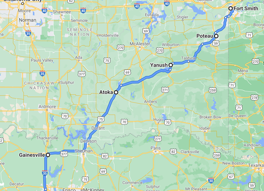
North out of Paris we finally crossed the Oklahoma border into a small town called Hugo, where there are circus showmen buried in the local cemetery. There is a map maintained by one party with what are literally hundreds if not thousands of “Want to go” tags tied to Atlas Obscura – the Hugo cemetery is one.
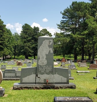
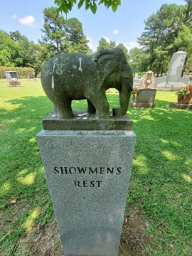
We stopped for a walk and pictures but weren’t super impressed with this weird attraction. It didn’t help that it felt like it was about 105 degrees with southeastern Oklahoma humidity blanketing us while wandering the graveyard. It was determined deceased circus people are more interesting on cool days. Moving on through the countryside, we worked our way to Valliant and Broken Bow without finding anything convincing us to plan a return visit.
Broken Bow was crowded, noisy, and packed with tourist trap hotels and restaurants. Getting out of town, we of course had to hit Gypsy Brew for coffee, dodging potholes to protect our oversized bike hitch rack (thanks for the engineering expertise, U-Haul).
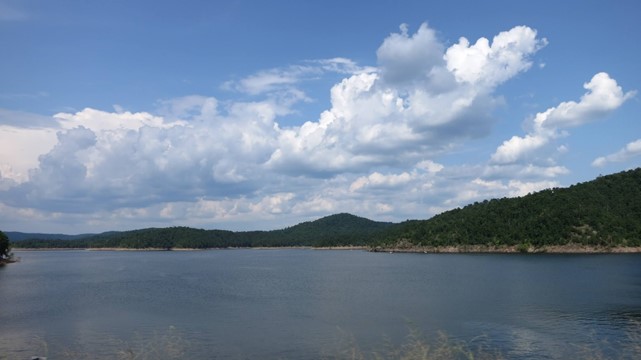
Having heard positive reviews for the Broken Bow area in the past, we figured there must be options for outdoor activities, or secluded areas outside of town which might be more appealing. We took a quick tour through Beavers Bend State Park, admiring the lake and checking out access points for future boating expeditions. Crowded but very scenic as this is the southern edge of the Ouachita Mountains, specifically the “Ridge and Valley Belt” where the mudflats of north Texas turn into picturesque hills and ancient, well-worn mountains. Nice place. Maybe this is the Broken Bow people speak of.
Broken Bow Lake is as expected, well-populated with ski and fishing boats, but based on the map and short drive, has plenty of secluded spots where paddling or just floating would be enjoyable. We’ll look to get back some day:
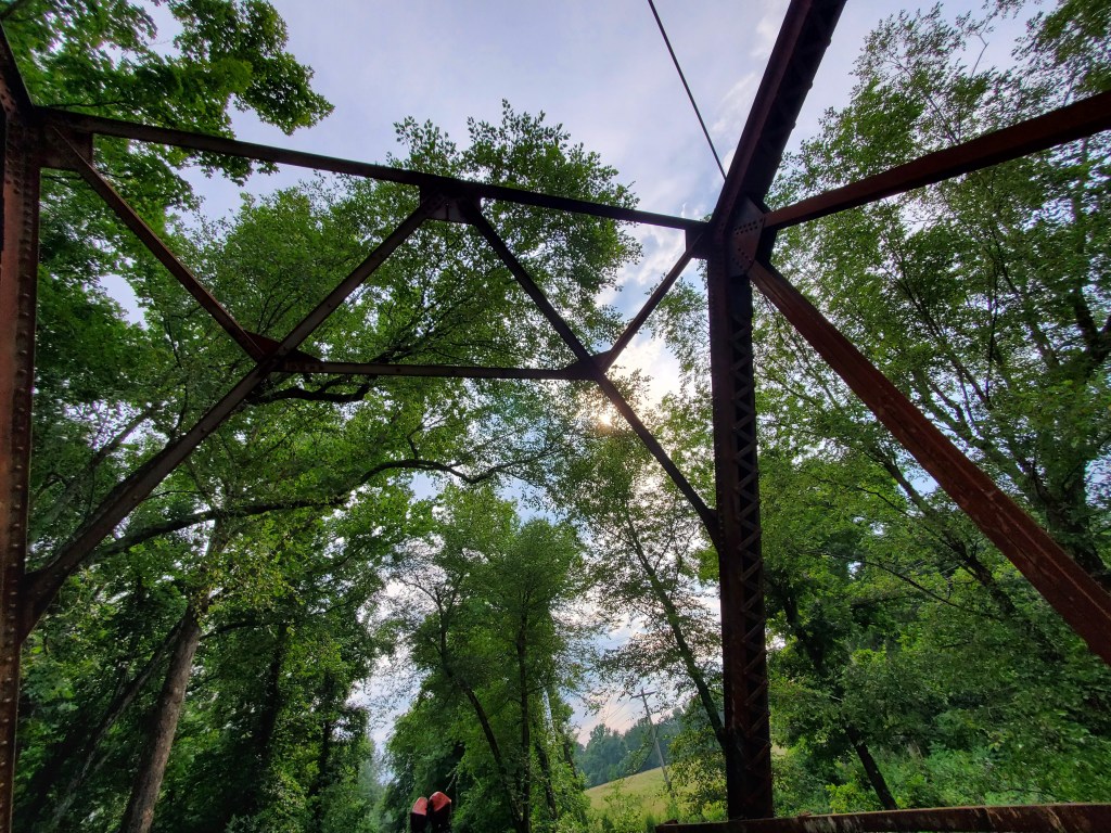
Further north, we worked our way down a side road and found this hidden bridge, which crosses over the Big Eagle Creek.

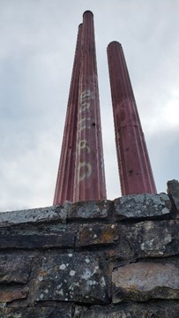
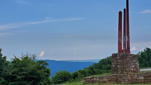
Climbing across the western end of the Ouachitas, somewhere before Big Cedar, we spotted a weird monument on the side of the road and pulled over. It appears to be the state’s attempt at honoring the legislators who fought to conserve the natural beauty of Oklahoma. Now, the enormous metal and concrete sticks (?!?) have been covered with graffiti and the ground around the monument appears to be a dumping ground for people unfamiliar with modern trash receptacles.

You’ll note that it’s now slipping into evening, and we’re still in Oklahoma …
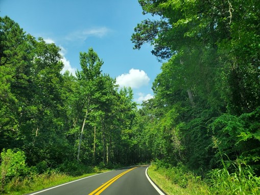
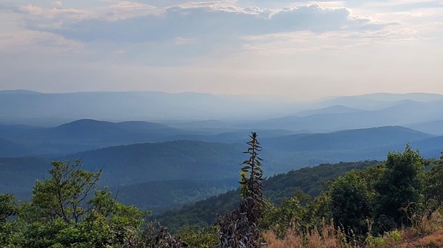
Since we were in the area, we figured we would take the Talimena Scenic Byway, a road through the western edge of the Ouachita National Forest.
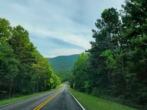
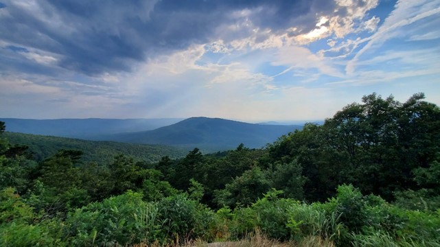
A gorgeous trip along an ancient moutain ridge, this road is well worth the time it takes to drive. Winding through a large forest area with significant elevation changes and beautiful views, there are trailheads, turnouts, and other features all along the highway. We stopped a few times to check them out, and reminded ourselves of the yearly bicycle ride that runs up and down this – a future trip. Impending darkness and hunger caused us to skip the last few scenic points, and we made our way down to Mena for dinner.
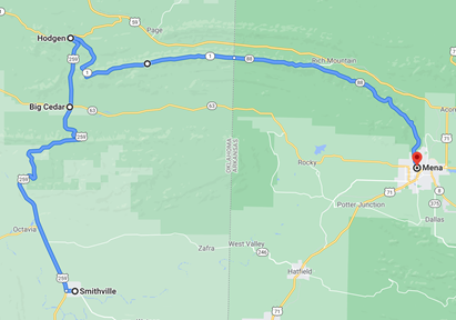
The detour that significantly extended the trip:
In Mena, there’s a little place called The Ouachitas, a local spot on the south end of downtown which not only offers coffee and food, but a full bar including local beers. We were sad about continued avoidance of bars in general, but we did decide on pizza, salad and coffee. All were excellent, with the house espresso being well-made, the pizza crust crispy and thin, and a flavorful moderate sized salad. Music was at a reasonable volume (as in almost inaudible), the place had the right amount of crowd – almost none. Perfect atmosphere after a lot of crowded roads and noisy people.
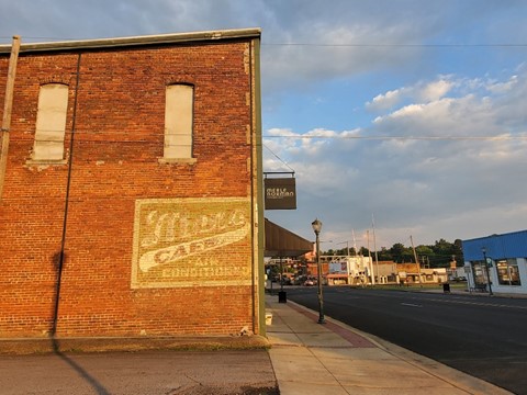
Steps had to be acquired so we squeezed in a quick walk, capturing some of the aging buildings in downtown. Daylight was limited and we still had a long way to go – somehow it was 7pm, after an 11am departure from home. Our usual moseying pace, the scenic byway, and several curiosity stops had considerably extended this trip.
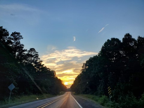
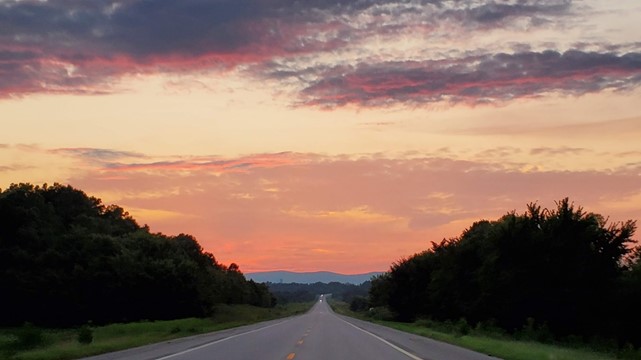
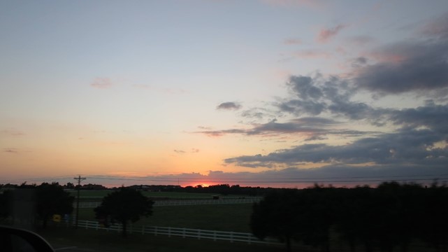
We headed north, driving through and taking note of Acorn, capturing some photos of abandoned buildings in Waldron and then speeding towards Russellville. The sun went down not far from Waldron, leaving us driving in hilly, windy, dark countryside and regretting the earlier pacing. We managed to capture the sunset before we turned east, and then had to keep eyes open for loose dogs, deer, and giant bugs committing suicide on the windshield.
After required random stops for gas and steps, the final stretch past Russellville was a strenuous couple of hours of windy mountain roads in the dark. This is not an area where you hit highway speeds – the climb up into the Ozarks has a whole lot of hairpin turns, stupid deer, and fog, to add to the challenges. We’ve done this before, the first time in 2011 when there were multiple stops for alcohol along the way, which at times begged the question of whether it was time to get a motel. The exhaustion this time was just hours on the road instead of booze-induced haze.
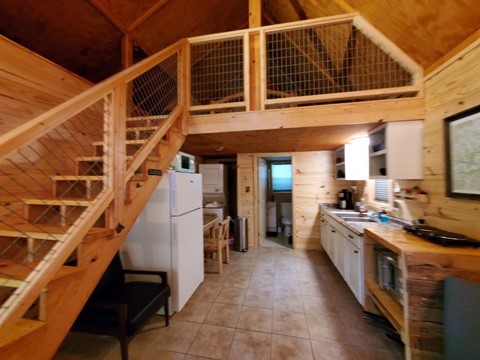
A little past midnight we finally found the road that our cabin was attached to. Unfortunately, the signage for said cabin was non-obvious, so there was a bit of a challenge involving slowly driving up and down the road in the forest in the dark, peering through the trees and looking for house numbers. Eventually we found our place hiding on a circular drive with markings at one end, a secluded spot surrounded by large trees. Once inside, a small kitchen/living area, with a sleeping loft, which at this point in the evening was the best thing we’d seen in our whole lives. Doing the math – we managed to turn 7.5 hours into a 14 hour odyssey.
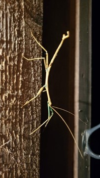
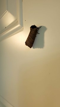
As always in Arkansas in the summer, insects (flying, crawling, buzzing, biting, eating each other) were everywhere. The best example this trip was the walking stick staring at us from the door frame as we dragged our bags inside. We bid him goodnight and turned in.
Thursday 2021 07 08
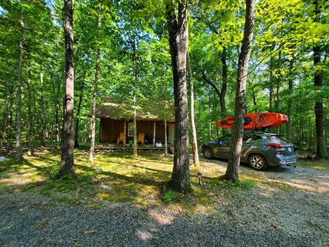
Abandoning the concept of an early morning run, we still made it out of bed before too late. The cabin was a little more visible in the morning, with a nice (bug-covered) porch, and near silence outside despite only being a mile or so from the busiest road in the area:
On Thursday, it was time for the best part of the trip – floating the river and unplugging for a few hours. We packed our things for a half-day float and headed down to Gilbert. The Buffalo River Outfitters in town have been our go-to since the first year – situated in the original general store and with the original mail slots from the post office right inside the front door, it’s run by friendly people and has all the things you forgot you needed for the river conveniently on the shelf (at <cough>convenient</cough> prices, but …). Our prior trips had involved renting boats and then sorting out parking, unloading, packing ourselves into either a van, a bus, or some mongrel blend of the two, followed by clinging to whatever handholds were available while a questionably legal young adult hauled ass up the hill and over towards Tyler Bend, all while conversing with whomever was closest to the front of the bus. Exciting, but a bit frantic.
This year, since we brought our own boats, the shuttling process was easy. A friendly 17-year-old employee, Dylan, hopped in the car to accompany us to the drop off point – Tyler Bend campground – then drove the vehicle back to Gilbert so it would be there when we were done. While the driver of our own vehicle may have worried both Dylan and his passenger, the ride was smooth, air-conditioned, and relaxed. So convenient. Why have we been renting all these years?
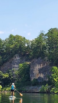
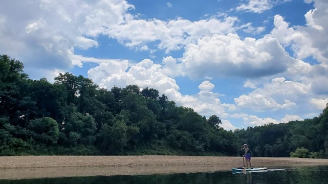
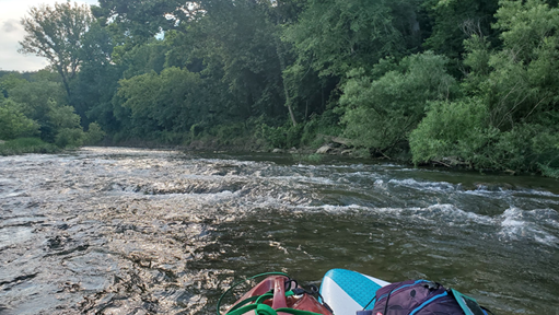
We’ve used a mix of two-person canoes, and one and two-person kayaks in the past, depending on the mix of kids, adults, and who brought a friend with them. These were all fun, and gave us experience when it came time to buy gear. We started with two single-person kayaks, but one of our parties is demonstrably coordinated enough to handle a stand-up paddleboard. Having braved the Llano River and Lake Alan Henry (including West Texas wind and chop), the calm of the Buffalo seemed like an easy ride.
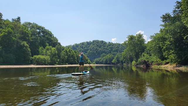
Acquired about a year ago, it has seen plenty of time in the water – the navigator is fairly skilled in keeping the board right side up. It’s an inflatable, so pumping it up to the required 15 psi, when it’s 90 degrees and 85% humidity, (or when it’s 60 degrees and dry for that matter) isn’t much fun, but once it’s on the water it’s solid and reliable. Inflated and with both vessels loaded up with shoes, life jackets, water bottles, phones in waterproof bags, hats, and miscellaneous towels and snacks, we hopped into the river. One paddleboard, one kayak.

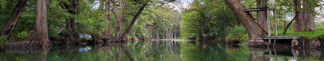
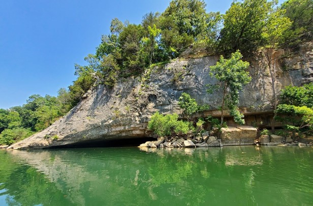
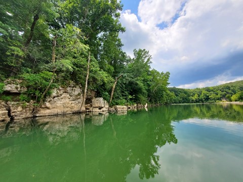
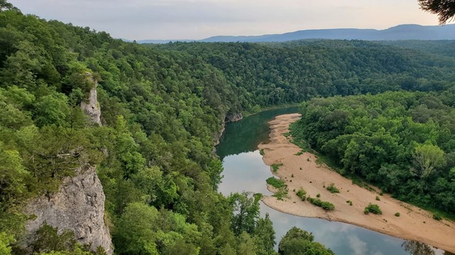
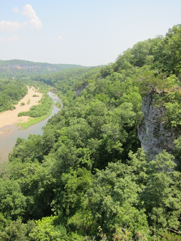
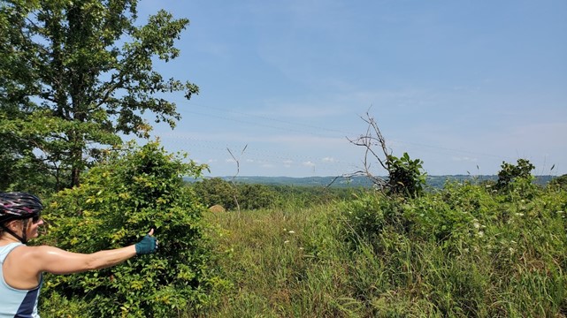
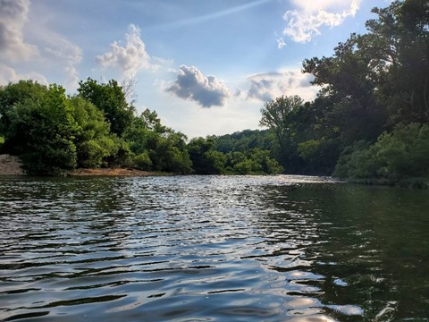
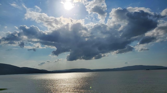
Over the years and depending on how early or late in the season we manage to make it to the river, the water level varies, so the banks and trees and sandbars and rapids are always a little different. The majesty of the riverside scenery is always the same – it’s a beautiful place. We go home every year with hundreds of pictures, mostly of the same spots along the river.
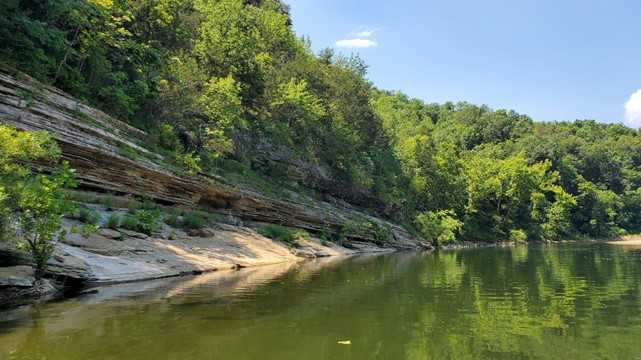
When the kids are with us, we can spend hours floating, diving, and relaxing at this spot. The bank to the left side of the picture doesn’t look like much from this angle, but the lowest jump-off is 8-10 feet off the water surface. If you’re young and agile enough to pull yourself up on those cliffs, there’s a heart stopping jump available – you can count 2 seconds of air time on the way down, followed by a thunderous slap of feet (or sometimes a face) at the end. Perfect for teenaged boys, but we’ve seen veteran adults come off the top of it as well – we suspect long-time residents who grew up at this swimming hole.
The water level was lower than usual this year after a dry summer, but we only ran into a few drag or portage spots. A couple of minor Class .5 rapids (that’s not really a thing …) where the water sped up through some channels were a fun diversion, but most of the river was calm, cool, and clear. The paddleboard turned out to be a good choice. Currents were manageable with a change of position – lowering body or sitting down – and fatigue from standing wasn’t too much of an issue. Can probably blame all those hours of squats and rowing at Orange Theory for excess fitness.
Watching the underwater wildlife is almost as interesting as the cliffs towering over the river – everything from schools of tiny minnows to fat carp and bass slumming along the river shallows, and plenty of bugs and other river denizens to look for. Some of the best times in the trip are taking a break from paddling to jump in the river for a sometimes chilly swim, grabbing something to eat and just unplugging for a bit.
We had brief flashbacks to our first trip in 2011, when one of our party was required to drag or push the unstable canoe over the shallow parts (water was even lower then), stepping on round (and square, and jagged) rocks that were in no way comfortable to walk on, all while slightly (to more than slightly) inebriated – we were in the habit of traveling with a cooler of booze at all times. The porting was a lot less painful ten years later, and we enjoyed the trip completely clear-headed. Surprisingly (or maybe expectedly), it was just as fun, and nowhere near as exhausting as six or eight hours of canoeing with vodka-infused blood in the body.

There weren’t any cliff jumpers this year, or really many other people on the river at all, most likely the result of low water, a mid-week trip, and COVID hangover for most travelers. Along the way, we noticed some things that had changed – one example is a rope swing with some unprofessionally tied knots, sticks, and other grip points in it, hanging from a conveniently located riverside tree – this (and we think the tree it was attached to) had disappeared after a couple of years of flooding finally washed out that part of the bank.
Our more adventurous companions in prior years had tested out the super slippery and messy clay bank, followed by scrambling up the tree to fling themselves into the river. No one that brave in the crew this year, but the missing tree reminded us of the year we watched a teenage jumper snap a finger while swinging out over the river, coming up with some colorful commentary on the pain as he surfaced. Maybe it’s better the tree is gone – fewer emergency room visits …
End of the line finally arrived, too soon as always. The landing at Gilbert is a nice stable spit of settled river stone and compacted sand, but there’s always somebody who manages to get their not-quite-ready-for-river-bottoms vehicle stuck navigating to the water. Fortunately, we were not that person this year – the all-wheel drive Seltos performed admirably, saving us having to drag the 11-foot kayak and deflated paddleboard more than a few feet out of the water.

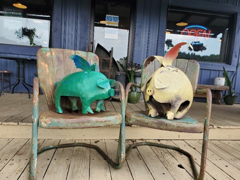
After the float, having burned approximately 1 million calories, we headed up to Big Spring Trading Company for barbeque and whatever else we could find on the menu. This tradition started with our first trip, and like everything else on that expedition, was a complete accident. Looking for food on a late evening in central Arkansas, this place was the only thing open, and was remembered as the “best thing we ever ate”. The restaurant is not only still open but appears to be doing very well, despite what had to have been a very very slow year with COVID and travel restrictions shutting down the tourist traffic that is a significant part of their business. We were greeted by a couple of metal pigs hanging out on the porch.
Some remodeling has done good things for the interior, making it a bit easier to get in the door and seated, but still a rustic family style place that combines a general store feel with home-cooking. The food was delicious, as usual. We’re never really sure if that’s an effect of extreme river-induced hunger, or just that the food is that good. In any case, we ate all of it – barbeque (can recommend the Muriel Star sandwich), potato salad, and home-made desserts. An additional bonus was found in the cooler while we waited to sit down – Curious Elixirs. As completely random as finding this place the first time, the chances of crafted non-alcoholic cocktails in bottles from California landing in a tiny roadside smokehouse in Arkansas seemed infinitesimally small. Trying one, having a second with the meal, and enjoying both, we surprised the owner of the trading post by collecting the remaining half case she had in the cooler. Having cut off booze in January of 2020, we’ve looked for options that didn’t suck, and the motto of “shaken, not slurred” combined with inventive recipes was a nice discovery.
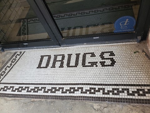
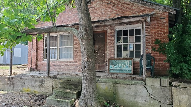
All this consumption of course created post-meal exhaustion, and we fought through that as we headed back to the cabin to clean up. It was the perfect time for a nap, but exploration called and we didn’t want to waste any daylight. We unfortunately also had an issue with some poison ivy from earlier in the week which needed attention. Changing clothes and packing up some road stuff, we headed to the nearest town, Marshall, to pick up a prescription for the quickly spreading rash (Tel-A-Doc online is miraculous when you’re 450 miles from home). We were lucky to find a local pharmacy still open late on Thursday afternoon, and more than willing to accommodate a last minute request for medication. Their tile entryway was appropriately labeled.
Amusingly, this is not just the local pharmacy, but also apparently the town armory (judging by the wall-length case full of guns for sale) and the local hardware store. The people were nice, but you do have to wonder exactly how much armed combat is expected in a tiny village in the center of the Ozarks. Maybe we missed something.
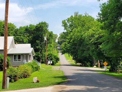
We wandered through Marshall a bit, reminded that it’s an ordinary rural Arkansas town. A local restaurant serves burgers – good ones – even though they are made from steers with only one front and back leg …

The only grocery in Marshall is Harps Food Store, which we’ve visited at some point on every trip. We grabbed some supplies for the cabin, with the intention of making breakfast in the morning easier, taking in the usual interesting crowd. Food and medication acquired, we headed over to Snowball, again having visions of 2011 as we drove over the long, winding, hilly road up there.
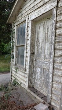
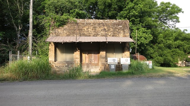
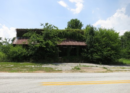
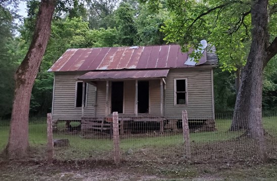
As noted earlier, Snowball was the location of our cabin on the first trip here ten years ago. This selection fit right in with the complete lack of planning – at the time, we had just picked a cabin off of a random vacation rental site. Snowball is no longer a functioning town, although a local chamber of commerce appears to be keeping up with the facilities. The main building in town is the old store (it’s actually called the Old Snowball House) and an abandoned gas station sits across the street. They haven’t changed much over the years, other than increased overgrowth of plants, slowly burying them in humid Arkansas greenery.

There’s still an old school bus buried in the overgrowth – we spotted and photographed this during our very first trip.

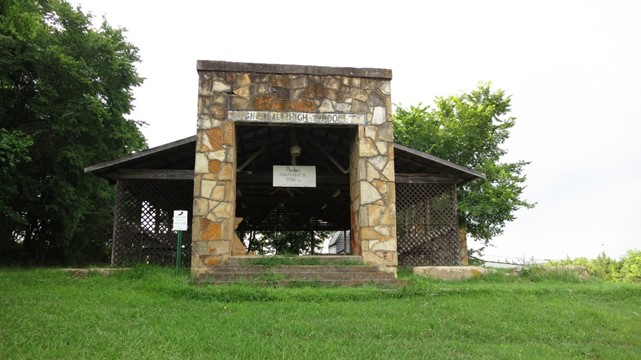
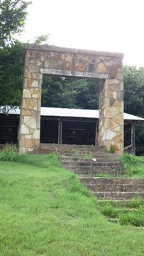
We explored the tiny ghost town, including parts we hadn’t seen the first time. Snowball High School was constructed in 1938 and closed in the 1970s due to declining enrollment. At that point, students in the area were transported to Marshall for education needs and the high school stood abandoned in the middle of town. Online research indicates it was demolished at some point in the early 2000s, but the entryway was preserved and transformed into a pavilion.
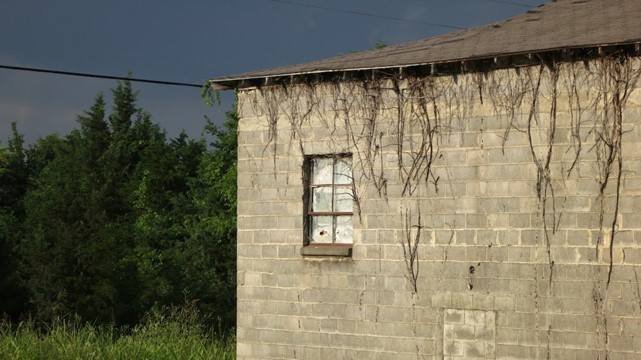
The gymnasium, next door, still stands. It was built a few years after the school opened and closed at the same time. It was used as an event center through the 80’s but stands empty today. From the outside, it appears to be a fairly normal building. We weren’t able to see anything inside as the windows were either covered or up too high, but according the abandoned Arkansas website, the interior is in bad shape, with warped floorboards and dusty bleachers.
After touring the decay of the town, we headed off to find the river. Google said we could get there, and we always trust Google <cough /> …
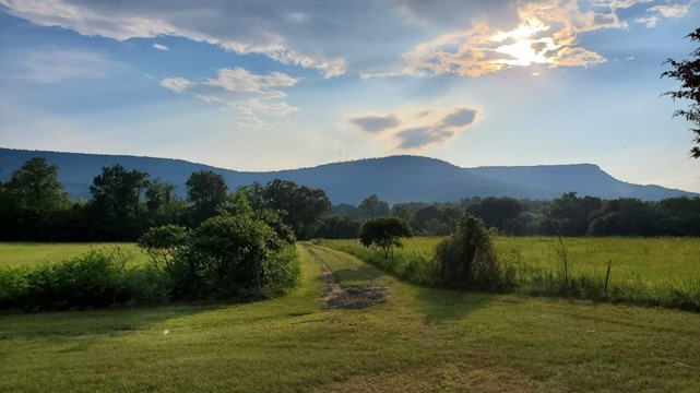
The river valley and ancient hills in the area surrounding Snowball are beautiful in the early evening hours.
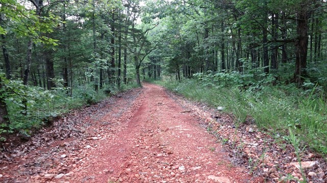
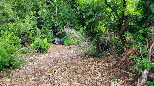
After a short visit to an aging and fading cemetery, we turned north. Roads in rural Arkansas range from smoothly paved and well-maintained highways to rumble-track farm-to-market, to unpaved but graded, to “we call that’n a rud ’round here”. Finding the river required trekking over all of the above and ended up on the latter. No problem. We’d removed the boats and bikes during the break at the cabin, and the new Kia Seltos seemed up for the challenge.
It took some searching, but we found the exact spot along the river where we first saw the Buffalo and had taken photos ten years ago.
2021:
2011:
The goal of all this off-roading was attempting to drive from Snowball to Tyler Bend via backroads. We made it about two-thirds of the way when we were rudely interrupted by a large mud puddle. Confidence in the Kia Seltos and its all-wheel drive was balanced against the knowledge that 6-inch ground clearance and questionably deep and rocky mudholes are not necessarily a match made in heaven when the goal is to not require towing assistance.
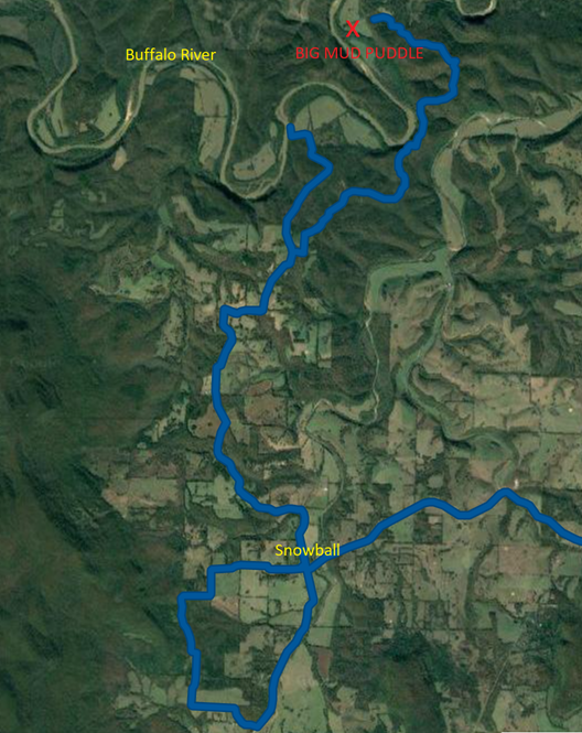
Not wanting to spend the evening waiting for a tow truck, we turned around and went back. All the way back to Snowball.
There were some stops along the way – a partial walk down a bug-infested trail in an attempt to reach the river was halted after we realized it would be a 2-mile trek, one way.
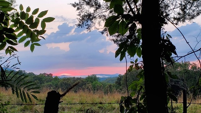
Watching the sun sink towards the hills, we looked for a right turn that would get us down to the water. Finding another rud, we went from two lanes to rocks, to what could be politely called axle-breaking ruts … after a bumpy ride down a steep hill, we were able to perch the car on a semi-dry spot, walk over a field of rocks, and we finally found the river.

The bugs were thick, and we couldn’t find the bottle of bug spray we had purchased before the leaving Texas. Squeezing precious drops from the almost empty bottle found under the seats, we combined that protection with fist-fighting the creatures off exposed skin. It wasn’t ideal. After a short walk, we were covered with unsightly spots, and hoping the greenery around us didn’t include more poison ivy.
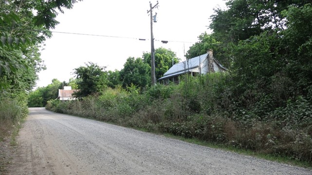
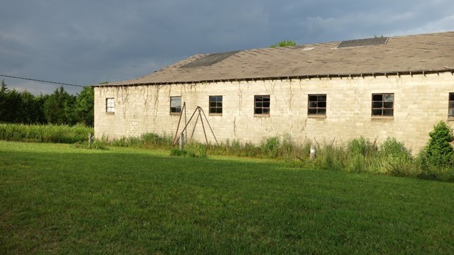
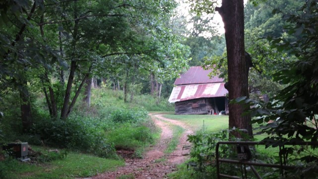
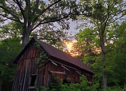
Mission accomplished – we spotted the river, got to the bank, did some off-roading in the new vehicle, and found our original 2011 lodging. While we weren’t able to make the full drive along the river back to the 2021 cabin, being forced to turn around allowed us to find the old cabin on the way back, barely visible through the trees. The neighboring barn, still sporting its flimsy roof has not yet fallen down. We wondered how many years it has left.
We drove back through Snowball to the 2021 cabin in the dark, watching the fireflies light up along the way. It was a nice way to end a long day.
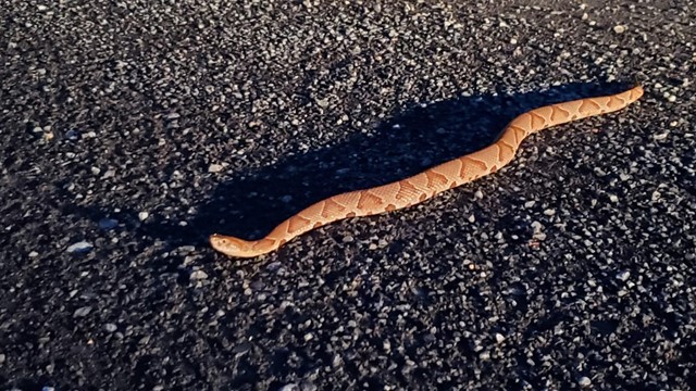
Well, almost. A quarter mile from the cabin, we spotted something slithering across the road. Curious, we pulled the car over and got out to investigate. Having never seen one of these outside a herpetarium, one of our party did recognize something you don’t necessarily want to pet, or accidentally step on in the leaf litter on a hike. Just a little copperhead, trying to find its way in the dark. A cautious scattering of a little gravel its direction encouraged it to get off the road, and went on our way.
Friday 2021 07 09
This morning’s objective was to arise before the sun and capture amazing photos. However, when the alarm went off, we determined those objectives had been overly ambitious. The sun would rise again tomorrow and that would be the perfect day for amazing photos. We did eventually emerge from the comfortable bed in the small, hot loft and made a quick breakfast while loading bikes on the car. This morning we had planned two different bike ride options:
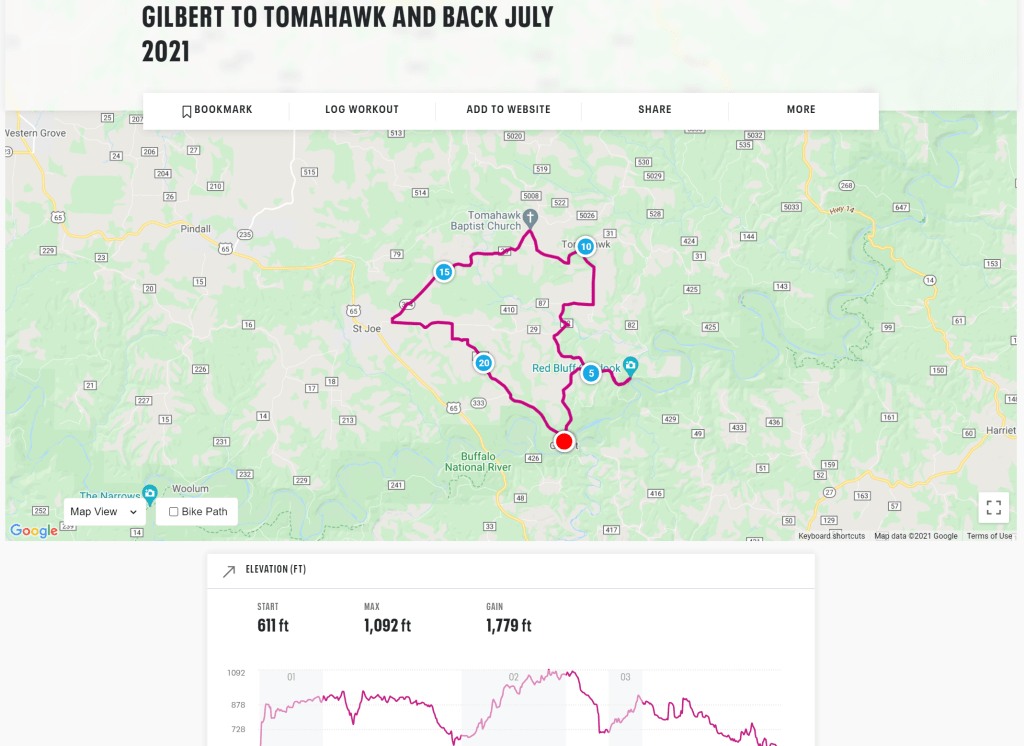
1. Long – 22 mile ride from Gilbert to Tomahawk and back
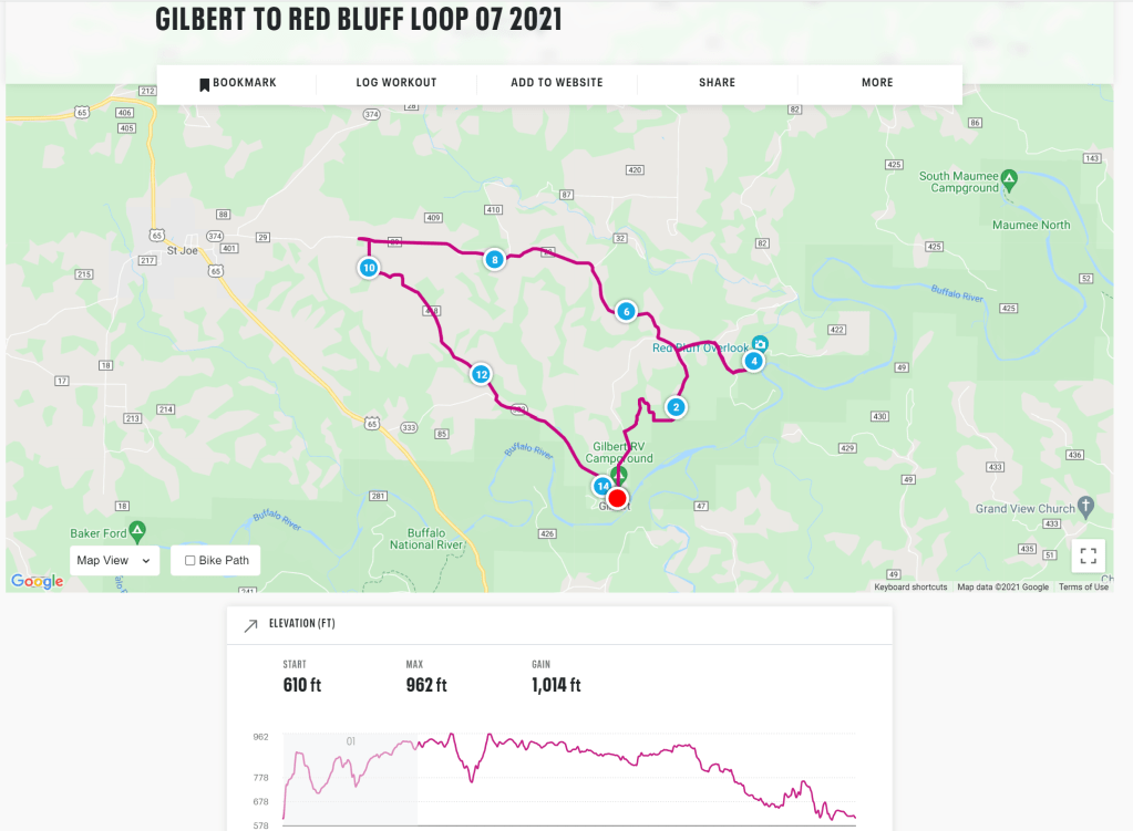
2. Short – A 12 mile loop from Gilbert, almost to St Joe and back
Stepping outside and immediately dripping non-evaporating sweat in the Arkansas jungle air, we chose option two. Twelve miles seemed reasonable and would result in less complications from heat exhaustion. We stopped at the Gilbert store for bug spray, and thanked the owners, who allowed us to park in their lot at no charge. Ten years of canoe tripping here gets you some perks.
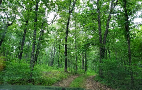
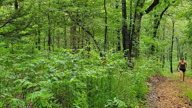
Gilbert is down in the river valley, at a very low elevation, so any exit requires significant climbing. In a car or rattly canoe delivery van, that’s stomping on the accelerator. On a bicycle, that’s leg power. You’ll note that both of the routes start with a stiff climb, meaning within five minutes of starting the ride, our jerseys were saturated and we were well in to zone 4 in the land of effort. Once we cleared that first hill, navigating our way down the dirt roads of Arkansas was a scenic and fun change of pace.
According to Google maps, there is supposed to be a scenic overlook not far from our start point. We headed that way. About ten minutes of riding later, we pulled up to the point Google had easily directed us to. The map says “scenic overlook” which indicates views of the river from a high point, with a clearing in the trees would be available. This was not the case. We peeked through the heavily wooded spot, attempting to find any shot of the river. No luck. We parked the bikes and headed down a path in the area, wondering if the location wasn’t exact. More of the same: heavily wooded blocked views. And bugs. So many bugs. Fortunately, we were sufficiently covered as we had purchased the new full bottle that morning.
We walked back to our bikes and encountered an SUV pulling into the area. Not completely unusual, but it is a very secluded area, so we wondered if a property owner in the area was annoyed with our presence. A couple hopped out of the car, a woman with an expensive camera around her neck, which she held carefully. She was obviously eager to capture the views. Her husband, however had already realized what we had. He smiled in our direction. “Following Google Maps, as well, eh?” A common problem, evidently. We pointed them in the direction of the wooded path but warned them there wasn’t too much of a view that way either. The female partner appeared determined to capture something, and they headed down the trail. We wished them luck as hopped back on our bikes and rode west.
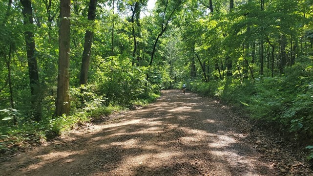
It was a nice ride and the perfect distance. We had partially paved roads in some areas, which is a nice break from rocky dirt. We stopped at a church for a break and enjoyed the quiet Arkansas countryside.
Ride review: one thumbs up.
We hadn’t seen a car in miles. Turning south back toward Gilbert on a shaded rough gravel road, we were greeted by not one, but three cars in a row. Apparently, there are other humans in this area. We passed a large property sitting on a corner of the road, and fought off two irritated dogs who kept up with us for a quarter of mile before exhaustion took over and they padded back to their home, where the owner called out from the driveway. It sounded like “Killer, come here!” but that had to be imagined. Dogs are always a small threat while on rides, not that they will attack, but could cause a fall or worse just by creating chaos. We left Killer and his owner and rode back to Gilbert, finishing up with one last climb and a speedy coast down the long hill to the river. It’s been a routine for the last few trips up here – conquering the Gilbert hill on a bike. Well worth the work.
The hill:
Conquering that hill:

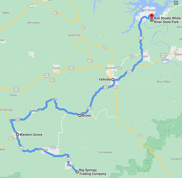
Sweating, we loaded bikes and put ourselves in the car for a quick stop back at the cabin. Again, we refrained from napping. There was still daylight and we were hungry. A quick change of clothes, and two boats on the car, we headed back toward Big Spring for more barbeque. We couldn’t resist another trip. We were guaranteed good food, and it was on the way to our next destination, so why not? Service was quick despite more crowds today, and we were able to fill our bellies before heading out for another paddle expedition. We didn’t have an exact location in mind but intended to explore the area around Bull Shoals Lake, stopping at a few ghost towns along the way.
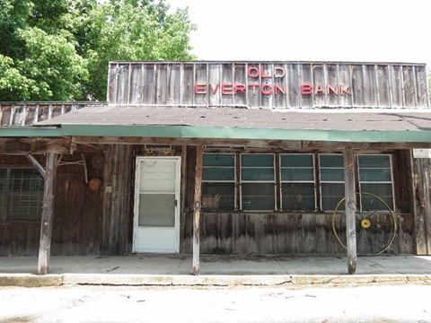
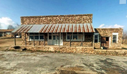
In Everton, there was an old bank and a store whose owners appeared to be fans of the Last Supper.
In Eros, we found this old general store which is quickly becoming overtaken by weeds. A google search didn’t pull up much information except it was built in the early 1900s and has had several owners over the years. Thanks, Google for describing every building that ever existed. Google street maps was a little more helpful. Here’s what this place looked like in 2008. Thirteen years of nature doing its thing.
2021:
2008:
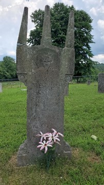
Bruno evidently has an old school building left, although we weren’t able to visit since it’s positioned on someone’s property. We were able to take a quick trip through the cemetery where we found this creepy grave with three horns. We wondered what this former citizen of Bruno had done to deserve eternity under the creepiest gravestone ever.

In Yellville, we found some coffee at a little remodeled cabin on the side of a main road, where we were greeted by an exhausted employee who served us coffee and filled us in on her extraordinarily long day. The coffee was good, so evidently her stress did not affect her coffee brewing ability.
On our way into Yellville, we noticed a creek running under the bridge going into town. There were a few locals fishing from the bank, and it looked like a nice peaceful place to paddle. We stored the location in Google, but kept moving north to Bull Shoals to try for a better spot. We found ourselves wandering through a generic resort town, something similar to Ruidoso in New Mexico, a cheap lake location without much character. At Bull Shoals White River State Park, we scouted out the water access points. This location is directly beneath the dam, so the river is flowing fast, maybe 7 or 8 miles per hour, way too fast for our open water skills. Given an absence of other kayakers and not wanting to to end up floating to Missouri, we opted out of this location.
We turned around and went back through Bull Shoals, and over to another drop point, Jimmy’s Creek Access, which offered calm waters instead of white water rapids. Jimmy’s was a nice little place, and we might have dropped in there, if we hadn’t already seen the spot in Yellville. Lakes can be a peaceful paddle location but can also get rough when the wind picks up, or loud with motorboat traffic. In the battle of creek vs lake, the creek won.
We drove back to Yellville and unloaded. We happened to arrive at the same time as some talkative locals. One bank fisher shared a long story about an ill-fated trip to the Buffalo River recently in which his canoe collided with a tree, resulting in loss of all his equipment, which happened to include a few loaded guns. We were a little confused about the necessity of this particular item on a river trip, but we nodded politely while dragging boats into the water. “I named the tree Obama,” he declared. “Because it stole my gun.” As if that part needed explanation. Still processing this random information from the local Yellvillian, we paddled upstream. A tree named Obama. Creative, at least.
The Yellvillian has also advised that the creek wasn’t quite the peaceful paddle we expected. There was a bit of a current which is difficult to see from the bank, and we evidently had a bit less than a mile before we’d be hoisting the boats over a waterfall. No problem – we would just need to work a little harder. Muscles straining, we paddled fast and moved little. We finally made it about a half mile up the creek, stopping to drag boats at a few shallow spots. There was finally a point at which we felt going further would be useless, as we would be doing more dragging and upstream paddling than floating.
The hard part:
So we turned around and enjoyed the easy float back to our starting point. It was peaceful, though, more than the lake would have been.
The easy part:
We stopped to dry off at the local park, watching the families with kids playing in the splash park and waiting in line at the snow cone stand. Such a typical scene from a small town summer evening, like something right out of the Sandlot.
Tired and hungry from paddling, we researched food options. It seemed silly to consume more barbecue, but it was either that or pizza, and pizza just didn’t sound good. So we headed over to Blacksheep BBQ, evidently a popular place with the locals. After running the front porch gauntlet past a very enthusiastic if questionably in-tune guitarist / singer, we ran into some fellow boaters from the creek (not the ones missing their guns and hating the Obama-tree). We found a place and squeezed ourselves in to wait for food. Squeezed feels like the right term here because we couldn’t help noticing we were probably the smallest humans of any age in the restaurant by far. Full plates of food were quickly being inhaled around us as we waited for our meal. Inhalation (but maybe not all the pounds) was justified – we enjoyed a delicious meal and even determined, while feeling disloyal, the potato salad here was better than Big Spring …
We couldn’t stay in Yellville forever, so after dinner, we picked a new route back to the cabin. This would take us around the other side of river toward the cabin, with a goal of finding a spot to watch the sunset. Checking Google while heading south on 14 we realized we weren’t too far from one of the several thousand places marked “to visit”. Given this recent obsession with ghost towns, I’m not sure how I didn’t realize we were so close to Rush Historic District until we were a few miles away. Without a fixed schedule, of course, we impulsively took this detour. In addition to knocking out a ghost town, we could check out the river access at Rush Landing for future boat launches. Turning left, we watched the sun quickly dropping while we wandered down the dirt trail toward Rush. We made it down to the river, avoiding emergency vehicles which appeared to be preparing for a water rescue, although we never could determine if there was actually an emergency. At the river, we stopped to chat with a park ranger, who was casually eating a snack outside his truck; he greeted us and commented on the weather. Maybe there wasn’t a person in danger, we thought, but then passed an ambulance and another park ranger with a rescue boat headed down to the river area.
The ambulance rushing past the Kia on route to…. meet the park ranger munching on Cheetos?
We checked the news later, but nothing popped up. Campers in the nearby campground did not seem to be concerned with anything specific.

After scouting out the landing area (not a bad place, but might be difficult to get boats down due to very narrow and rocky roads) we headed back up the ghost town. The sun was still in the sky – barely. We thought we could take a quick detour then watch the sun drop as we came back up out of the valley.
See if you can read this without glasses:

Rush is a neat place; more intact than most of the organic ghost towns we visit. Buildings are mostly standing, preserved by a local historical society. We obeyed the instructions not to get too close to the preserved spots and wandered around in the quickly fading light. Settled in the late 1800s after zinc ore was discovered in the area, the town quickly gained interest and a growing population, requiring more buildings and houses. It was a short-lived boom with the town starting to decline in the mid-1900s, and the buildings left to decompose. A fascinating story for evening reading about the Hicks family, who owned the main hotel in Rush. Now, only the walls and stairs are left.
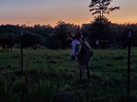
Before the compulsive reading started we had to make our way back to the top of the hill. We had spent more time in Rush than anticipated – of course – and heading back up, we found the sun behind the trees instead of showing the last light over the field with cows. We seem to be doomed to miss sunsets due to sidetracking …
Our consolation was this calm and cool donkey who didn’t seem to care at all if the sun was up or down.
The evening drive:
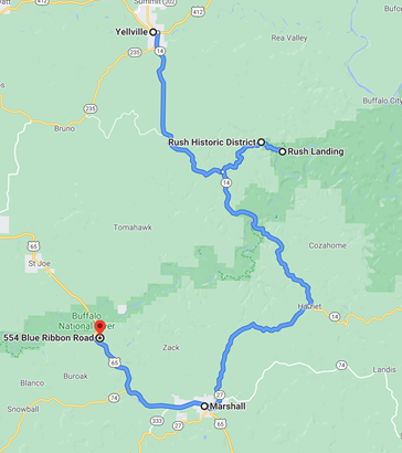
We headed south toward Marshall, through Harriet (not a town anymore, there’s only a store left) and made it home to the cabin, and found it completely dark, surrounded by fireflies. The bugs in Arkansas are normally a pain, either in your face and hair, smacking on the windshield and making a mess, or biting constantly. Fireflies are a nice exception, making a compensating case for their cohorts.
Friday 2021 07 10
This was the day we would wake up for the sunrise, we decided the night before. At about 6 am, we glanced out the tiny loft window and could only see clouds. What was the point of a cloudy sunrise? We slept in. When we did finally wake up and make breakfast, we opted to eat on the front porch. Evidently all the bugs in Arkansas had the same idea.
The breakfast bugs:

After Café Insect, we headed out for a walk down the cabin road, enjoying the morning quiet and more insects. And more bugs. All over the place. One of our party focused on the mosquitoes, but we did spot a few less annoying creatures – a fat millipede was one example:

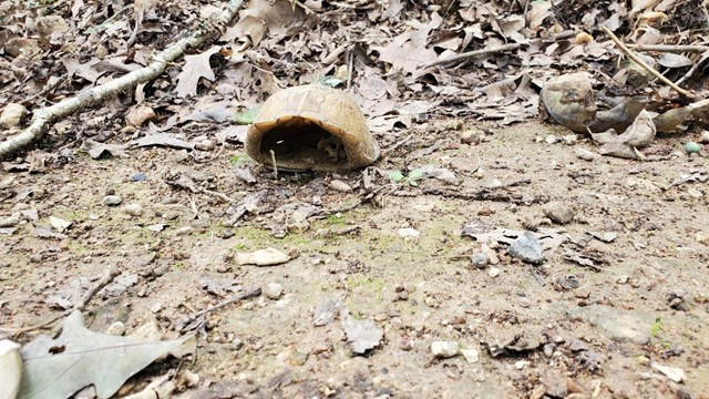
This ex-turtle left his shell conveniently by the roadside – all other parts appeared to have been dispatched to parts unknown:
Admiring the properties nearby (maybe it wouldn’t be so much trouble to own a place here) we managed a one-and-a-half-mile walk. Humidified and relaxed, it was time to leave.
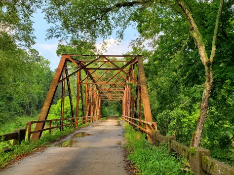
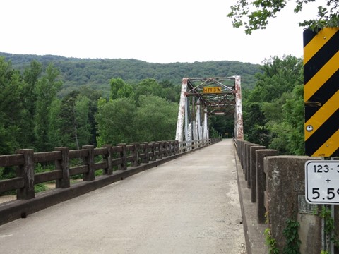
We had decided the trip home would be just that – a trip home. No more wandering through every state park, over every bridge, stopping in every .. single .. town. The goal was not to spend 15 hours in the car again. This took restraint – there are so many places to see. We did avoid a direct route, driving through the mountains to retrace our path from 2011, capturing photos of this historic bridge which hasn’t changed at all in ten years:

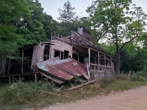
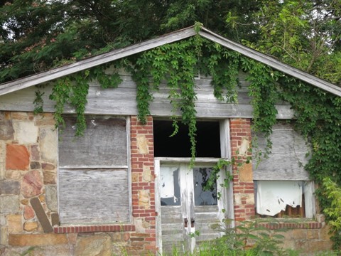
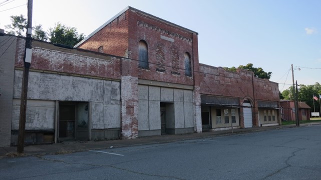
… and an abandoned building in Hagarville, which has changed a bit:

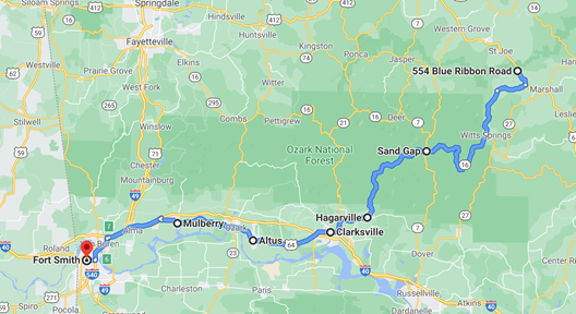
Lunch in Clarksville at the Wrecked Canoe, a restaurant / gas station with better-than-expected food, despite the miscommunication on the order. We ended up with an extra salad, but more greens are never a bad thing. After coffee at Piney Bay Coffee Company, we followed the Arkansas River through small towns (stopping only once in Altus) and marked river access points on the map as we sped by.
Altus:
We found more coffee in Fort Smith at a funky refurbished auto repair garage in an older part of town, coincidentally called … Fort Smith Coffee Co. Good beverages and interesting art on the walls – booked for future travels. After an accidental detour on the way out of Fort Smith we quickly got back on track and crossed the border into Oklahoma.
The first half:
The second:
We took the scenic road through Oklahoma (at least more scenic), passing through Poteau, Talihina and Yanush. It was a preferable route to I-40, which would have been a little faster. As always, we prefer scenic over expedient. We stayed on isolated two lane roads, passing lakes and farmhouses and long stretches of land.
A future boating location – Sardis Lake:
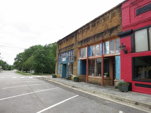
Atoka was the end of our attempts to capture scenery, as we were approaching the “we need to get home sooner” phase of our long trips. A typically depressed Oklahoma small-town downtown tucked away off the US 75 main thoroughfare, although there were signs that some re-investment might be pending.
Already behind schedule, we had to get back on the highway and head home. Dinner on the road turned out to be complicated even thought we conceded to food from a national chain. Chick-Fil-A in Denison was a fail due to a closed dining room and a drive thru which didn’t look accommodating for kayaks on top of vehicles. Brain locked on chicken sandwiches, we attempted to be modern and efficient, ordered our food online from a phone, with scheduled a pick up in Gainesville, only 30 minutes away. We headed that way while the sun went down.
The dining room in Gainesville was open, but the service was questionable. Despite ordering over 30 minutes ahead, the employee appeared confused as to why we were there. They finally figured it out, without so much as an explanation or apology, and handed over a sack of lukewarm chicken sandwiches and fries. Felt unusual for Chick-Fil-A, the place where employees always end sentences with “my pleasure”. While the dining room allowed indoor seating, the less-than-friendly staff seemed to be discouraging customers with a frosty 54 degrees on the dining room thermostat. With shaking, freezing hands we managed to lift nuggets and sandwiches into our mouths.
On that down note, we rolled onto our least-favorite freeway – I-35, bless its overcrowded speed demons and never-ceasing jams – and logged the last few miles home.
All told, a very successful solo trip and one that we’ll probably replicate – we’ll give the adult children the location and dates and times, and if they show up, great! If not, we know what to do …

2 thoughts on “Ten Years Gone – Solo to the Buffalo”