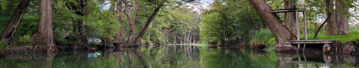

We’ve spent a lot of time in Northern New Mexico – Taos, Santa Fe, Red River, Las Vegas, Cimmaron, Clayton, and everywhere in-between. While it’s beautiful there, we’ve always been curious about the mountains further south, so we arranged an extended weekend for exploration. The plan was to do the usual Colorado trip, then head south to explore the area around the Lincoln National Forest. It was time to break in one of the new cars as well and with a kid and relatively responsibility-free weekend, it didn’t seem right for the new Hyundai Kona to sit at home.
Friday 2021 06 04
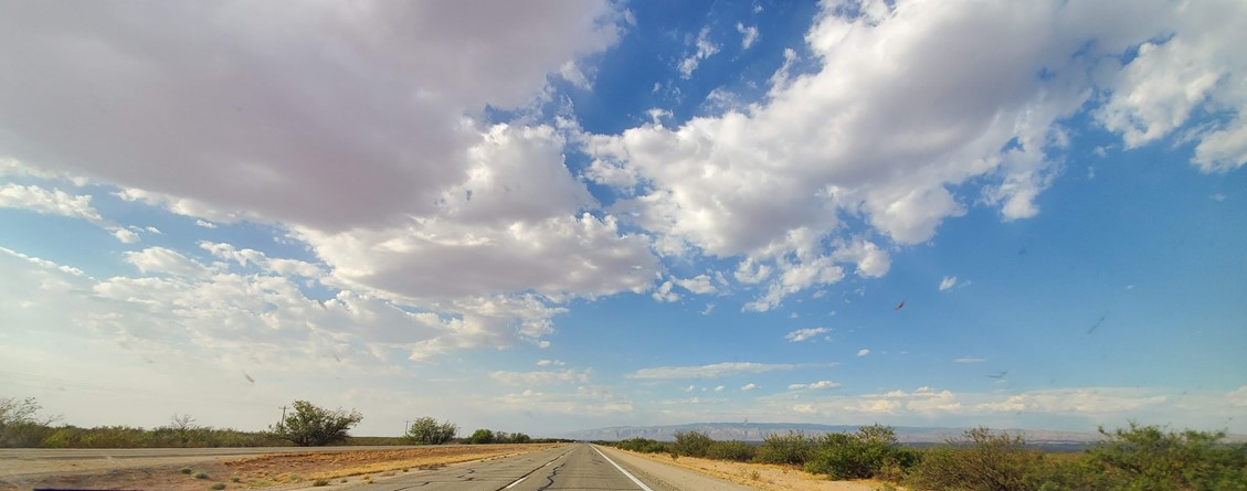
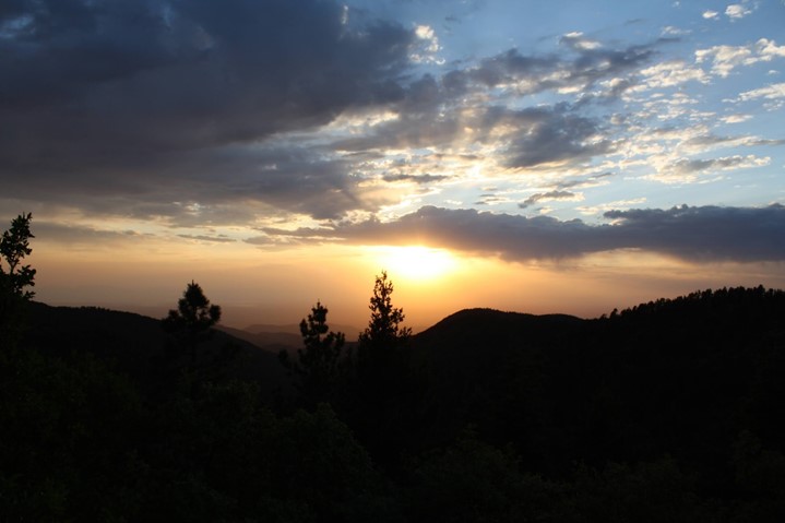
Amarillo is the usual stopping point on the way to Colorado. Only 5 hours from home, it makes for an easy Friday afternoon drive. We’ve collectively traveled this road hundreds of times, but there’s always another backroad – so many trips in the past were rushing up north and flying back south on a tight schedule. Of course, stopping for photos and exploration along the way we found ourselves behind schedule; the sun was already disappearing as we were headed out of Wichita Falls:

A few more detours, visits to the restroom temple of Pak-A-Sak, and it was late when we got to the hotel in Amarillo. Downtown Amarillo is not Deep Ellum, but it tries hard to make up for that with avoidance of sleep and thundering bar music. The Marriott sitting on Polk looks over the busiest section of downtown, with Tejano clubs, LGTBQ bars, and bored cops watching the variably legal crowds wandering around, but way too many hours spent in planes and hotels for work means that we have our pick of rooms in the hotel. High enough up the building, and exhausted, we knew we weren’t in Kansas but that didn’t stop sleep.
Saturday 2021 06 05
Early morning in Amarillo’s downtown is the polar opposite of Friday night – you can hear a pin drop there’s so little going on. Leaving the hotel, we determined we needed a few items before heading out – coffee, gas and food in whatever order they could be had. Coffee was complicated as the Polk-street Palace Coffee was closed (lack of custom might have been the cause for that …), so we headed west to the cross-town Palace location. Packed as usual for a Saturday morning, we decided the wait would be worth it. Always excellent coffee (the Honey Badger Latte is the bomb) and a small breakfast (less exciting) led to a short walk in the Panhandle wind eating a slightly dry bagel.
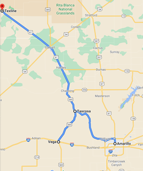
Food, walk, coffee acquired. Believing we had accomplished all things (you’re probably noticing an item missing from that list …), we headed northwest out of Amarillo, enjoying the scenery on the way out. The northwest route out is always a nice drive – hilly, winding roads, a whole lot of sky, desert vegetation and buttes, although the 85 mph traffic can be a bit sketchy. We were almost to Tascosa (read: the middle of nowhere) when we happened to glance down at the gas gauge and remembered the missing item from the morning to-do list – gas. The car was blithely sailing west down 1061, but showing 22 miles of happy driving left on the dashboard gauge. 22 miles in this part of Texas will not get travelers to anywhere other than a dusty highway shoulder. We examined the map in a low-key state of worry and decided Vega, approximately 20 miles away, was the best bet. Slowing the Kona down to 50 mph, we turned south on Highway 385 towards Vega. The math wasn’t looking pretty – 20 miles to go and 18 miles of gas left. Turning off the AC and wishing for a tail-wind on a morning already in the mid-80s, every hill was one too far.
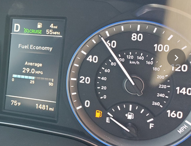
The road to Vega was straight, but rolling, and as the Kona traveled up each rise, we kept waiting for the yellow light to go red. We got down to 1 mile left in the tank as we floated on fumes into the first station at a deserted intersection in Vega. We both let out a deep breath, relieved that we avoided the potential stranding on the side of the road in a remote location.
The town of Vega is not exactly thriving, so we felt good about contributing our gas money to their economy – given a completely empty gas tank, it was the biggest contribution we could make.
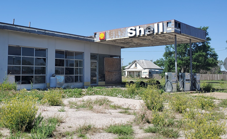
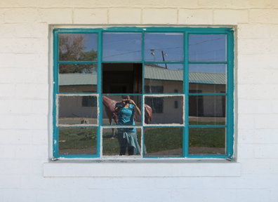
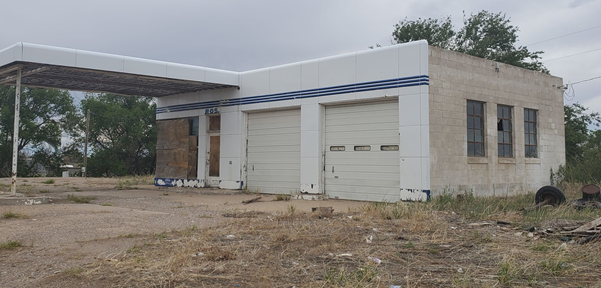
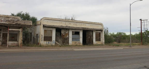
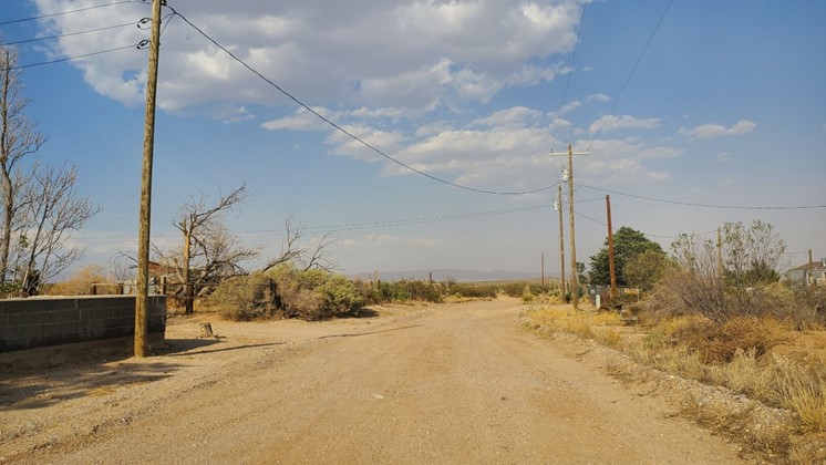
After the much needed refuel, we swung the Kona around north and returned to our planned route. There were a few photo stops on the way to the New Mexico border capturing the slow deterioration of the small Panhandle towns and satisfying one traveler’s recent obsession with abandoned places.
Channing: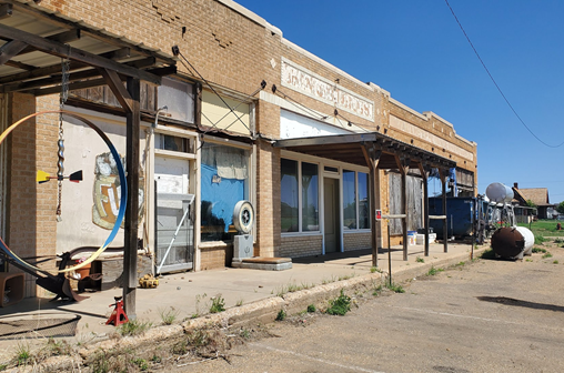
Perico:
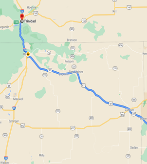
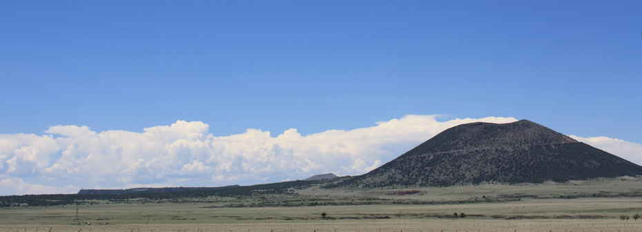
The rest of the Amarillo to Trinidad jaunt, we kept a close eye on Kona fuel levels and enjoyed the increasingly wide-open country and dramatic volcanic remnants that cover this quadrant of New Mexico.
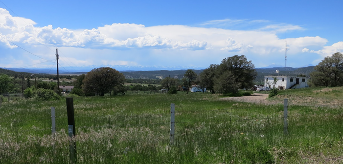
Arrival in Trinidad, CO, is always a relief – high altitude and a chance to get out of the car for a bit. The town has always been one of the lower-rent districts in Colorado, but it’s got a scruffy charm and no shortage of interesting scenery. This time, we were greeted with a food festival smack in the middle of downtown, hosted as a fundraiser by and for the local firefighters, replete with live music, crowds of bikers (of the Harley persuasion), and various Trinidad-ians. Sadly, Colorado was experiencing a rare heat wave – there’s not a lot of air between the sun and the ground at elevation.
Our initial target for food and beverage was evidently fully occupied providing support for the festival, leaving us debating food choices and sweating. Giant piles of grilled meat and heavy-looking BBQ surrounded by fried onions and coleslaw looked like a nap-inducing meal. We determined smoking hot food might be more delicious on a cooler day, so we took a chance on a hole-in-the-wall cafe called AlMack’s Kitchen for salads and sandwiches and large cookies. While not part of the fundraiser, local cold food in a rehabilitated downtown office building seemed more weather appropriate. Friendly if slightly loopy service, observation of random bathroom access antics by the elderly patrons, and very tasty food led us to save Almack’s for future visits.
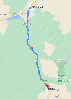
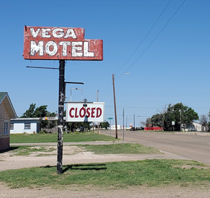
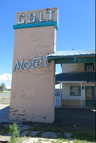
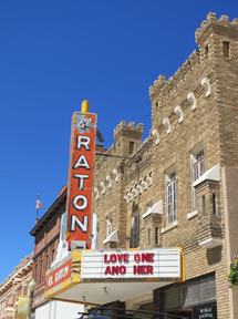
After our short visit to Colorado, we headed south, hoping the weather would cool off – by the time we got to Raton, we were out of the heat. In the interest of capturing more American decrepitude, we took the scenic route through Raton. After scoping out an abandoned and partially inhabited motel, it was time to head south again.
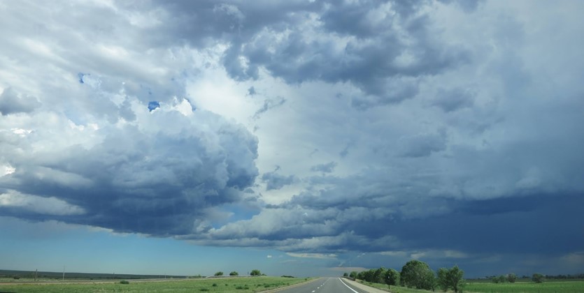
One of the beauties of the high desert near the mountains is the sudden appearance of gully-washing storms. As we headed out of Raton, we enjoyed the sharp temperature drop and dramatic views of some mild storms crossing I-25 – big, rolling clouds and dark skies, zips of lightning and rain curtains washing across the prairies. The smell of high-desert rain is intoxicating.
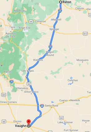
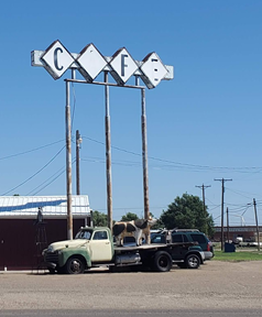
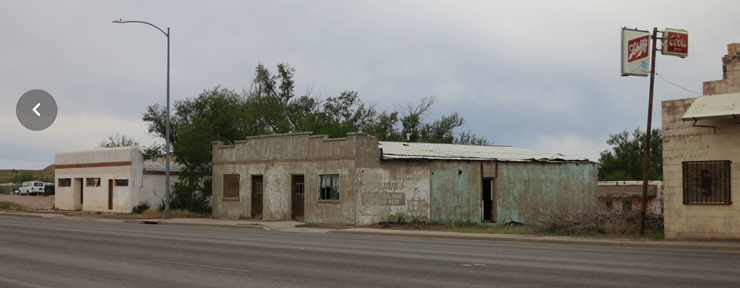
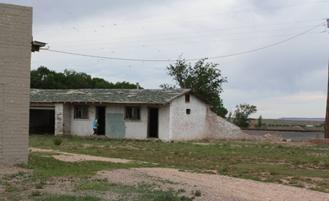
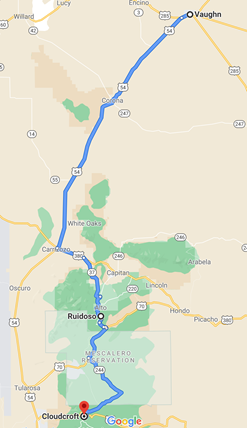
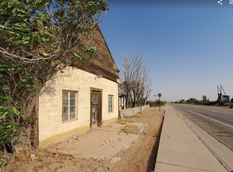
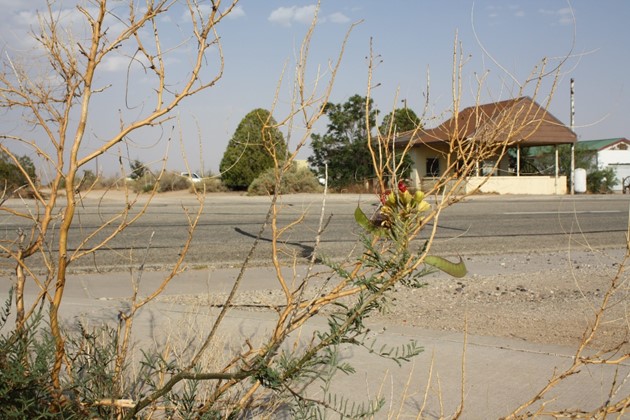
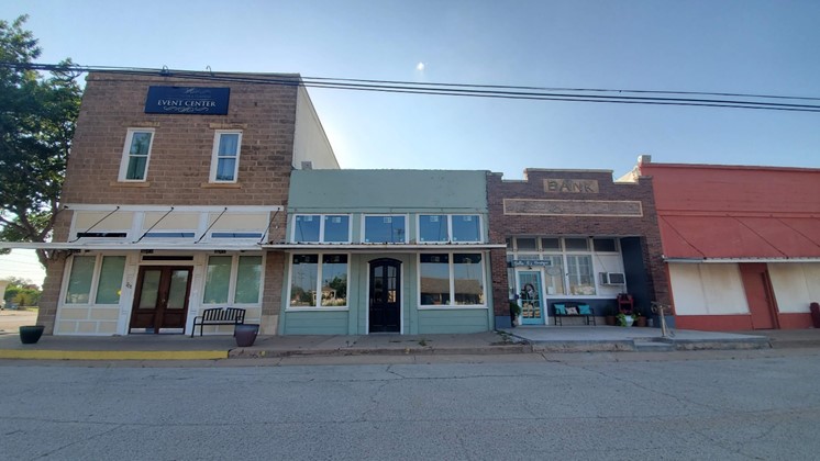
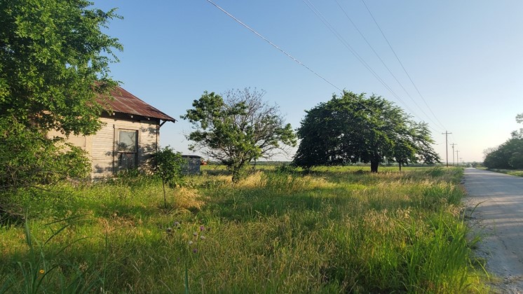
South of I-40, you’re into eastern central New Mexico, where not much has been happening for quite a while. Our route led us through Vaughn – a good place for a stop in terms of location, although not exactly bustling, as it has evidently been for decades. Originally a watering spot for cattle, it later thrived as an intersection between busy railroads. Now, it’s a stopping point for weary travelers who somehow find themselves on these lonely highways in eastern New Mexico. Vaughn still has some residents, and several operating businesses, but one wouldn’t know that by driving the main throughway, full of abandoned motels, restaurants and storefronts. Obviously, we had to explore the crumbling buildings and stores.
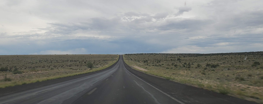
Time check – our hopes for a dramatic New Mexico sunset were dashed by solid cloud cover all the way over the western horizon. Pedal down, we looked for other signs of life as we headed south but this leg is mainly scrubby bushes, rocks, and rolling desert gullies – a very nice block of southern New Mexico scenery and a quiet drive south.
Having saved several properties on Zillow in Carrizozo, we hoped to check out downtown, but dark, late, and tired, we settled for gas and some canned coffee in lieu of tourism and any sort of dinner food – there may have been grumbling about Clif Bars or hyper-dehydrated chicken strips as choices …
Next stop: Ruidoso, and faint hopes for late night food. Last visit either of us had to Ruidoso was as a toddler being towed along by grandparents to the horse racing tracks – was not at the top of the list of places we wanted to see. The area is probably nicer in the daylight, but regardless we still had a 30-minute walk to accomplish (there’s a story to tell about being a slave to Fitbit step requirements to help pay for American healthcare industry costs ..)
We parked the car in an unassuming Starbucks parking lot and took off on foot down the main drag. Given a Saturday night in what appears to be the Las Vegas of south central New Mexico, police presence was heavy. We watched some unruly bar attendees carry on a conversation with the authorities and then found a quiet trail near a creek to complete the walk, dodging cigarette smoke and lines of moderately intoxicated pedestrians outside the bars.
Steps accomplished, we headed back to the Kona. As we reached the crosswalk near the car, we noticed the police involved in the other incident had now migrated to our parking lot. Standing right next to the Kona, no less. Hurrying over and asking what was going on, we found they were curious about this Kona with an open driver side door. “Open?” Surely we closed the door when we got out. While sorting out proof of ownership with obviously confused cops, we rewound our brains 30 minutes back in time. No dice – neither one of us could remember forgetting closing up the vehicle.
Amazingly enough, nothing was missing or out of order, despite a wide-open door at almost midnight on a crowded street on this Saturday evening. Pure dumb luck is the phrase that came to mind, along with a serious sense of relief. Mostly that nothing had been stolen, and that our days of excessively consuming alcohol are over – had this incident happened two years ago, we likely would have ended up in the Ruidoso jail on public intoxication charges. 100% sober, we blamed the carelessness on exhaustion, having been driving since sunrise in another time zone. Thanking the understandably confused and suspicious police officers, we got in the car and tried to sort out the shortest route to Cloudcroft. Having started the day trying to run out of gas, nearing the end by leaving laptops, wallets, and other valuables sitting in a brand new unattended vehicle with the door standing open near a busy street, after having a couple of quarts of really strong tap water, we wondered, “What next?”
That was answered as we rolled south out of Ruidoso in the middle of the night, in the middle of the New Mexico arboreal forest – big-ass ELK. Standing in the middle of the road, lurking in the trees, bolting across the skinny two-lane roads, combined with fog, fatigue, and stress, we tried to take it easy for the last miles of a long day.
It was after midnight when we pulled into the Airbnb location, a tiny cabin right off the main street running through Cloudcroft. We found our street easily, and assumed our cabin was the middle of three in a row in this spot. It made sense, the one to the left was #103, and to the right, #107. Ours was #105, according to the Airbnb app and apparently helpful directions and photos. Piling suitcases on the porch, we tried the provided code on the lock in the dark. Multiple times. While we were attempting to gain access, the residents or guests of #107 around the corner were loudly carrying on a conversation while slamming beers, smoking cigarettes, and watching their cats prowl around (reminder, after midnight).
After trying and failing to open the door and getting increasingly cranky we debated contacting the Airbnb owner in the middle of the night to correct the situation. While debating we happened to wander around the other side of cabin #103 with the phone flashlights on to the side driveway and … lo and behold, there was #105 in not-so-plain sight. Thankful that we hadn’t been trying to break into the wrong cabin in Texas (where we most likely would have been blown off the porch by a trigger-happy traveler envisioning burglars randomly attempting to steal their shoes) we finally found and entered the right cabin. Triple-checking the Kona doors (see earlier vehicle security issues), we unpacked and rolled into a very uncomfortable sofa bed medieval torture device for some much-needed sleep.
Sunday (1AM and still awake) 2021 06 06
The tiny cabin didn’t have room for extras, like, um, towels – we shared one – or a real bed. The sofa pull-out, while visually functional, was actually a 1610-era rack from the Spanish Inquisition masquerading as a sleeping surface. We can sleep just about anywhere (and have), but metal bars in all the wrong places dug into our ribs during the night, with a mattress in name only providing no relief. Little to no sleep acquired, we crawled off the rack with limbs aching and limped our way out into the town. After a miserable night, the gorgeously refreshing air and huge trees outside at nearly 8000 feet of elevation were a beautiful sight.
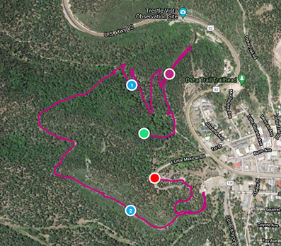
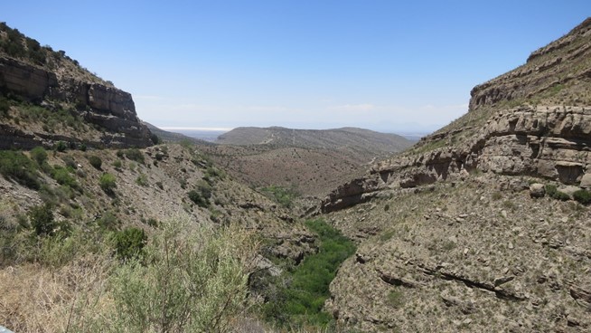
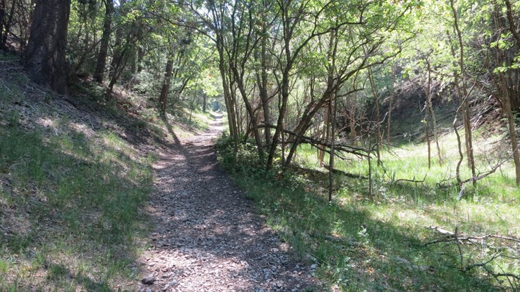
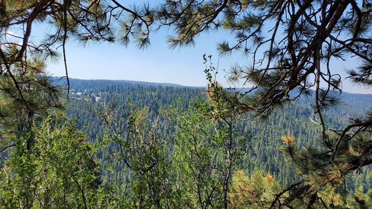
Downtown Cloudcroft is about the same size as my apartment bathroom, but we were able to find a great coffee spot: Black Bear. Crammed into the end of the main street strip of buildings, and making great drinks, it was a nice intro to the town. Burritos at Burro Street across the road were more of an “eh” food – adequate substance to fuel hikers, but not worth going back for. Time for health insurance funding and exercise – Cloudcroft is in the middle of a national forest, with hiking, biking, off-roading, and logging trails everywhere. We found a trail a mile or so away from the little cabin, perched on the edge of town and leading to one of many places marked for exploration – the Trestle Recreation Area – and started walking. Clearing the edge of the national forest grounds, we passed a sign, a gate, and a rebuilt chunk of railroad bridge, followed by a porch-bound salesman trying to attract donations to support the trail maintenance and recreational group who keep the rail bridge and a convenient Airbnb in business. Looking at a driveway that is reputed to have beaten all-wheel drive pickups and sedans with equal prowess, we politely moved on. While the hike was pleasant, both parties admitted that the remaining 1/4 mile of the old Mexican trestle railway bridge was not the most impressive thing we’d seen lately. Someone constructed a few wooden beams in a canyon strong enough to support a train – who can’t do that <cough />? Instead of a straight out and back, we decided to check out the other trails in the area, racking up about 2.5 miles, with views that are hard to discern from an aerial Google Maps photo. The edges of the White Sands National Monument and some far off peaks were visible down the valley to the west, but with the sun climbing and high, dry forest air baking us, we were glad to see the end of the trail.
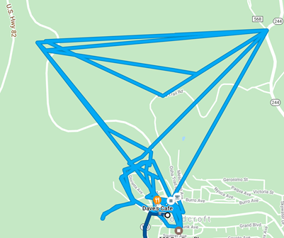
Mexican Trestle Railway Hike, as tracked on MapMyRun:
It’s interesting, but …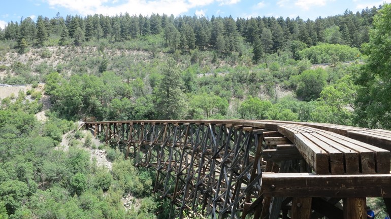
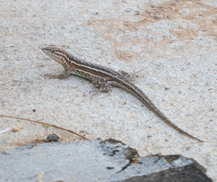
We were able to add to the Bestiary! photo collection with this moderately hostile (but non-poisonous) fellow: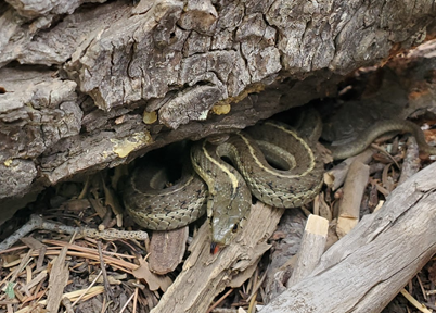
This ant was large and most probably not a petting candidate:
Deer in the area are properly paranoid, but still willing to stare at the random humans in their woods:
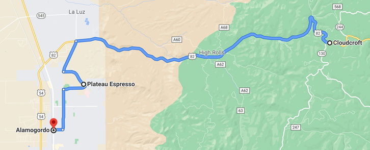
Hiking in the mountains is a lot of work, but we had a lot of road to cover so we deferred lunch and began working our way towards Alamogordo. “Google”, we asked, “what is there to eat on the way to Alamogordo?” Google responded in her polite voice, “bupkes”. The scenery on the descent from Cloudcroft is impressive, but it’s not edible. Stuck in the flow of traffic, we started looking for options in Alamogordo, forgetting that we were deep in the poorer parts of south central New Mexico. A promising looking coffee shop advertising espresso and sandwiches popped up at the edge of town in what looked like a newer area – right up our alley. Ignoring hunger pangs and stopping on the way a few times to capture some of the scenery (but failing to grab the dust devil which hovered over the city as we drove in), we arrived at Plateau Espresso, on the very west side of Alamogordo. Sitting on a hill at the base of the plateau we’d just rolled off of, the cafe appeared to be new to operations of any sort. Normally we prefer quiet restaurants; these old and cranky travelers have low tolerance for loud music and verbose patrons. However, in Plateau, they could have used some background noise to help distract from sandwiches that were politely average, and coffee that kinda leaned towards drinkable. Employees blasted the blender and the cavernous and empty dining area echoed around us while we ate. Not marked for a return visit …
Bodies fueled to some extent, it was time to head to our next destination, the sand dunes. Attempting to be efficient with our time, a quick stop at Walmart was on the agenda, as an air mattress was critical if we expected to sleep after what was looking like another extended day. Frankly, a bed of rusty nails or some splintery plywood would have been an upgrade from the most uncomfortable sofa bed that has ever existed, but we were able to pick up what turned out to be a ridiculously over-sized air mattress. More on that later.
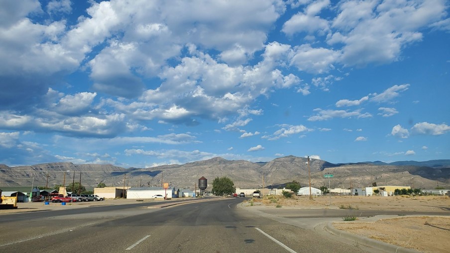
Walmart visit finished, we took time for a quick tour through Alamogordo – being attached for decades to various military ventures, the town has a blend of typical military personnel transience and dirt-poor New Mexico desert town. Some interesting abandoned and rusting manufacturing and a struggling downtown gave us a couple of photo opportunities.
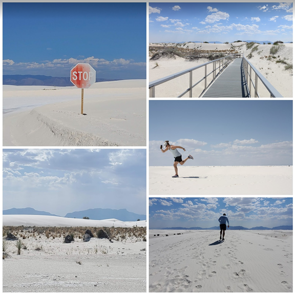
Then – White Sands National Park, a few miles west. Driving in, first impressions are of a set of coastal dunes having been dropped in the middle of the desert, but further into the dunes the feeling of being on another planet takes over. A friend termed it “otherworldly” after a recent visit, and it is. Miles and miles of brilliantly white sand, exotic plants, and ragged volcanic mountains as an eerie backdrop. Even watching kids toboggan down the dunes on their sleds while parents tiptoed across the baking hot sands couldn’t really detract from the beauty here. Photos can’t capture it properly – definitely recommended if you’re able to see it in person.
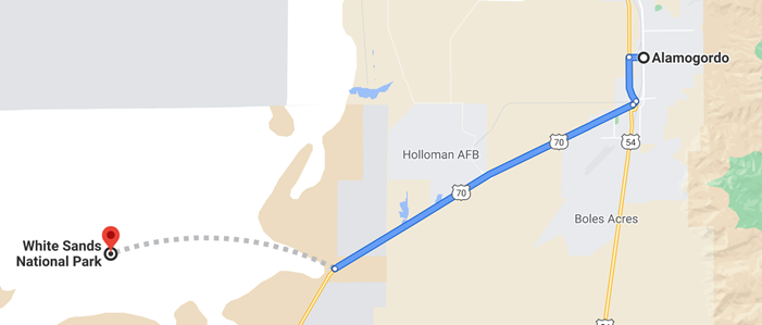
After White Sands, we turned west again but had to debate on the next destination. One of us wanted to push on to the Organ Mountains, just east of Las Cruces, followed by a southward loop and up the hills to Cloudcroft. Unfortunately, the extended visit to White Sands put us late enough in the day that we’d miss sunset from the mountains, another agenda item. Pedal to the metal and looking at maps, we discussed, drove, debated, drove, and then turned around – the Organ Mountains would have to wait …
Google shows a lot of roads these days, but significantly lacks clarity on which ones are public, private, or just plain closed. Given that, we decided to try for Orogrande, and then ramble across 506 to the south edge of the mountains around Cloudcroft. Ideally, we’d hit sunset just as we arrived at the top of the range.
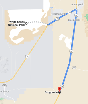
54 south out of Alamogordo is one of those stereotypical ruler-straight desert highways, and other than mountains in the distance, there’s not a lot to see. Pavement, desert, the occasional railroad track, and miles and miles of desert. Orogrande was as expected – basically a ghost town, with a few shuttered buildings and dilapidated trailer homes. We hopped out for some photos and were surrounded by an eerie silence, broken by the desert wind and the occasional passing car headed north from the Mexican border. Information online seems to indicate there are still human residents of Orogrande, but we didn’t see any evidence of that.

After acquiring photographic evidence that Orogrande exists, we headed toward Cloudcroft. Aside from reminders of the increasingly militarized southern edge of our country in the form of yet another Border Patrol checkpoint, we were back to the plan. Google said to go all the way around through Alamogordo to get to Cloudcroft, but we spotted road #506 that seemed like a scenic shortcut across to the southern edge of Lincoln National Forest. This was a great plan on the phone, saving us multiple miles of driving. Unfortunately the polite Google voice didn’t inform us that CR 506 (like many other roads in this area) crosses the US government’s live firing ranges and is therefore considered slightly hazardous for Hyundai Konas and their operators. With our shortcut blocked by the need to blow cactus and coyotes to hell, we were met at the entrance to 506 with a CLOSED sign.
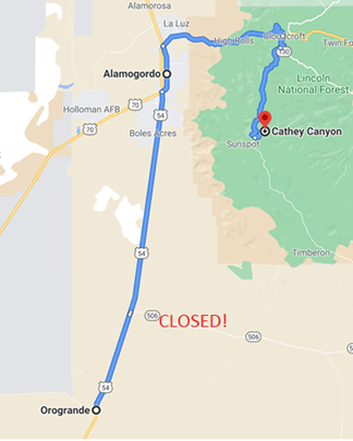
Alternate routes in the area are scarce, so this inconvenient closure meant a long, straight, boring, straight, flat, straight … drive back to Alamogordo. The Kona seemed to be enjoying the climb back up to Cloudcroft, but we were hungry and realized (or thought) we had just enough time before sunset to stop for food. Conveniently, the Wild Game Bistro in High Rolls was at least partially open for burgers and salad. Watching a typical budget mountain tourist crowd, we enjoyed some food and forested views on a quiet patio.
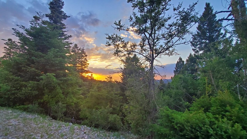
After food, we decided to head for Sunspot, the place where I would expect to acquire cancer, but we won’t know because we never made it there. On the winding mountain roads with no passing zones, we got stuck behind a tractor pulling a horse, which put us behind schedule for sunset. Catching a glimpse of what looked like a gorgeous sunset, we compromised and pulled into Cathey’s Point. Not quite prepared, we got an average view of the skyline and we grabbed some less than desirable photos.
Having failed at the sunset task, we wound up discovering that the observatory we’d hoped to visit was locked up and would have been unavailable even if we’d arrived before sunset. Fitbit steps still had to be acquired, so after the sun went behind the trees, we found a logging road and decided to explore new territory in the dwindling light. Making it to the top of the hill in the dark, fighting off bugs and wondering what would happen if we encountered a mountain lion or some other creature, we enjoyed the significantly cooler temperatures at least. We passed a few remote campsites, some likely hikers working their way down the hundreds of miles of trails that loop around the Lincoln National Forest, but some who might have been more permanent residents. We considered adding that to the bucket list, but then remembered our attempt to sleep on an uncomfortable sofa and realized we might not survive multiple nights sleeping on the ground.
As usual, we arrived back at the cabin later than planned, but at least we knew where it was this time. Unpacking the air mattress, we realized that stuffing a 24-inch tall queen-sized air mattress into a cabin barely big enough to support a brutally uncomfortable hide-a-bed was going to be a challenge – we powered through and slept well enough to justify the minor expense.
Monday 2021 06 07
After a more comfortable night’s sleep, we gave up on our planned pre-sunrise arising – we figured this was okay, as we’ve seen a few sunrises in our time together, so missing one wouldn’t kill us. However, a bear might. Revisiting Black Bear for coffee, it was time to get some running or hiking in. We decided on the Osha Trail to get some outdoor time before spending the day in the car. Given less than optimal planning, timing the hike was complicated, as one of us had to make squeeze in a work phone call. Heading into the woods on a beautiful trail around the hills north of Cloudcroft, after 20 minutes, the work-committed party had to double-back and find a place for work interruptions to commence.
While strolling back to the car for the call, forgetting the surroundings being part of a big national forest, the returning party was flabbergasted to turn a corner and find himself staring at what looked like a tree-sized black bear about 100 yards down the trail. Brain misfiring, stupid human stood and tried to remember what to do when facing a bear big enough to snack on him. Fortunately, the bear was as surprised as the human and lumbered off into the woods the opposite direction.
While this was great for the first human, a little spatial orientation and thought made him realize that the second human was looping around a trail that might well intersect with a now spooked and fleeing black bear of hugeness. Notifying the second human that no, no joke, there’s a big-ass bear in the woods here, was accomplished, and a more focused walk to the car started.
At this point, halfway through solo hike, headphones on in this isolated part of the woods, second human being notified of a bear sighting was not welcome news. Heart pounding for the final 2 miles, the hike was accomplished without destruction of body parts by a resident of the Cloudcroft bear community.
We failed to log our hike on MapMyRun for the morning, and recreating the route in their app failed as the Osha trails are not plottable on the app. Google, which failed to provide bear alerts on their map (they probably blame Waze), says the hike went something like this:
After baking in a running car for annoyingly timed customer call, first human and second human reconnected, checked for bears, and determined the morning’s excitement dictated lunch. Dave’s Cafe advertised breakfast and brunch, but only opened late morning for lunch. Given the choice of waiting a half hour for inside seating or dining al fresco on the patio, we picked the outdoors. Service was New Mexico speed but apologetic, and the pub food from Dave’s was perfect for the day – a pastrami melt and The Alex (vegetarian sandwich loaded with fresh veggies). Crowd watching on Main Street Cloudcroft was a bonus. No vacation meal is complete without dessert, so we stopped at KennaBelle’s famous bakery for something with enough icing on it to evict your pancreas from your body. Delicious.
Having tanked up on gas, sugar, and fat, we said good-bye to Cloudcroft and headed southwest through the forest. Instead of taking the boring two-lane and predictable roads towards, Texas, it was time to see if we could get lost. There’s no way we would skip a town named “Weed”, so Google was aimed there, pointed along the least traveled roads we could see on the map.
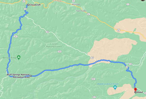
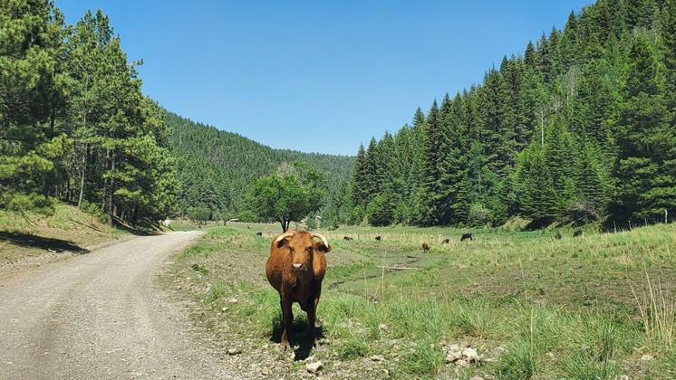
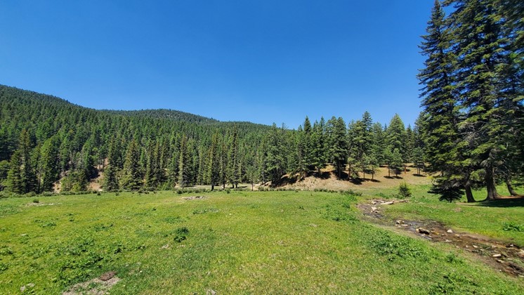
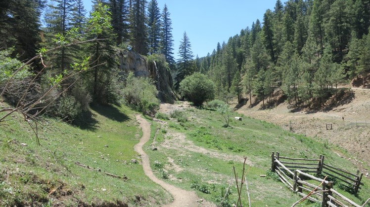
Avoiding direct routes as usual, we aimed for the Bluff Springs National Recreation area, and exiting the main road, headed down the river valley. While the road to Weed wasn’t paved, the new all wheel drive Kona was more than capable of handling a moderately rough ranch road. We bounced our way through the National Forest, winding up at a pull-out with a trail and falls fed by the eponymous Bluff Springs. Crystal clear water from the springs was unfortunately occupied by human feet during our visit, but the cattle grazing nearby and the beauty and isolation of the valley were a nice break.
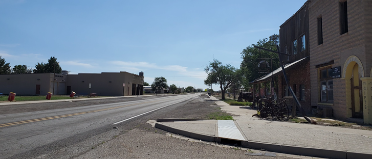
Next stop: Weed. Beyond the name, we had no particular reason to stop, but managed to get a picture of the “POP 20” sign and say hello to the residents of the cemetery, wondering about the life of Weed citizen “Dumpy”.
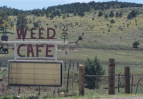

The famous Weed Café was not open, and it appeared to have been closed for quite some time. We guessed these small mountain towns and their businesses are not doing well during the time of COVID, especially here in NM where masking and travel restrictions were much tighter than other states.
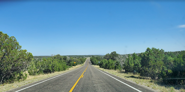
After Weed, we headed out of the forest on 24, enjoying a beautiful, isolated drive and bonus – paved roads! Eventually we had to exit the highlands and get ready for the Permian Basin, but at least for a while we still had hills and terrain to watch.
Artesia claims Kith + Kin as a coffee stop. The holy spirit referenced heavily on the walls may have been soul-inspiring, but the coffee and service on a Tuesday afternoon was not. Hot, flat, and still, the town was good for a 300-step walk on the Fitbit and a rapid exit. One item of interest was a number of large orchards in town, a strong contrast to the relatively treeless plains around Artesia – not however enough to mark for a return visit.
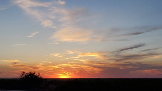
Carlsbad was next, where a search for “gastropub” led us to dinner at the Yellow Brix Restaurant. Now this was inspiring. A surprisingly excellent menu, with several healthy options, and great environment in an old remodeled home. Crowd-watching in southern New Mexico was fun, and the meal was a nice change of pace. Bellies full, we stopped for one last walk, then headed west out of Carlsbad toward Hobbs, watching for sunset in the rearview mirror. Stopping at one of many abandoned buildings along the highway, we managed to grab photographic evidence through the petrochemical haze that appears to be blanketing this part of the country now.
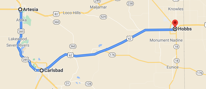
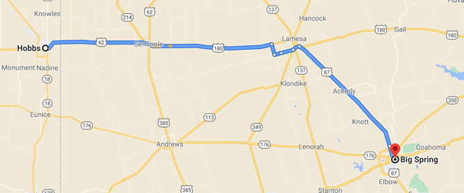
There’s not much between Hobbs and Big Spring to inspire in the daylight, much less at night. The remainder of the evening was spent in the car, speeding through small Texas towns, stopping at Allsup’s or other small gas stations for breaks and caffeine, and finally arrived at our destination for the night – a rental in Big Spring in a questionable neighborhood.
Tuesday 2021 06 08
Having stayed at another rental managed by the same people in Big Spring during a prior trip, we had moderate hopes for the location. Morning exploration of the property showed that this one was not quite ready for prime time, despite a humungous dining room table and an amazingly comfortable bed. A morning trip to H.E.B. was required to acquire coffee, a coffee *maker*, soap, shampoo, and other random items which are typically basic equipment at Airbnbs. Testing our ability to work from a random living room, we made it through the day, then packed up, left the house, washed the Kona and grabbed coffee on the way out of Big Spring.
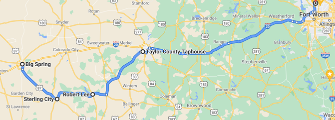
Taking southerly routes to avoid I-20 as long as possible, navigating a detour through Sterling City and Robert Lee, we finally had to turn north to Abilene for dinner.
Visiting our old favorite, the Taylor County Taphouse, we filled up, caffeinated, and then stuck to the highway, sadly, as we made our way home.
All-in-all, a fun bit of exploration through a really beautiful area of New Mexico that we’re going to re-visit.
