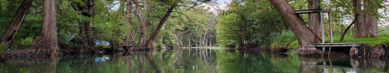

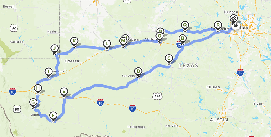
The summer of 2020 was a chaotic time. The pandemic was still in full force, coming back with another wave after declining in cases for a month or so. Business were open to varying degrees, with varying restrictions, tending on the more lenient side in our part of the country. We had settled into a comfortable routine of working from home, cooking from home, exercising from home, entertaining adult and teenage children at home … the list goes on. July was the perfect time for a break from all that. Yes, travel would still present challenges, given the lack of available dining opportunities, but it was also an excellent time for exploring the world on a socially distanced agenda, which is our preference anyway.
Thursday 2020 07 02
Children otherwise occupied over the Fourth of July, we found a dog sitter and headed out of town. We left on Thursday afternoon, with a quick stop at a new local spot, Native Coffee + Kitchen, where we found ourselves in the middle of an intense Texas thunderstorm. It was a nice way to start the trip.
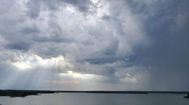
Headed out over Lake Worth, there were some nice post-storm clouds.
The first stop was Cisco, where we hopped out to stretch our legs and explore the town. Turns out this tiny little town is full of history, with the famous Santa Claus bank robbery being one of the highlights …
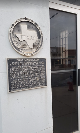
This is a fascinating tale of a poorly planned bank heist, led by an ex-con dressed as Santa Claus along with his three not-so-bright accomplices. They managed to acquire the loot they desired from the bank’s vault, but the escape was a little more complicated. Local authorities arrived on the scene quickly and immediately engaged the bandits in a shootout despite a crowded lobby being involved. Santa and his friends grabbed two children as hostages (who had innocently followed him inside, hoping for a conversation with the big man) and escaped into the back alley where their getaway car was waiting.
Four robbers were involved in the intricate planning of this event, yet none of them remembered to fill the car with fuel, which impaired their ability to execute an escape. When the car sputtered to a stop a few miles down the road, they did what any sane burglars would do. They flagged down the next car that drove by and ordered the 14 year old driver (remember – west Texas, 1927) to relinquish his vehicle. In the chaos of transferring hostages and kicking the young driver out of the car, the neglected to take the keys. The young driver had wisely fled, but with the car keys in his pocket.
Unable to start the new vehicle, they were forced to abandon that one as well, along with one of their injured accomplices and – oops – the bag of money. After hiding out, abandoning their child hostages and stealing one more car, the three were finally captured after a manhunt (the largest one that had ever occurred in Texas) starving, injured and not any wealthier. The saga ends with three burglars in jail, one deceased, two dead officers and 200 bullet holes in the bank. The children survived to tell the tale and were likely traumatized by the mere thought of Santa Claus for the rest of their lives. History is fun.
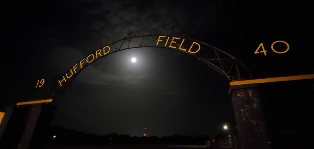
On the way out of Cisco, we listened to the Casefile podcast episode covering the robbery, so we could get the full story as told by an Australian podcaster. While immersing ourselves in the criminal history of Cisco, we took the scenic route (avoiding I-20) south toward San Angelo as the sun went down. We stopped for a quick break in Coleman, town of a thousand dogs and a cool football stadium. The field spans four city blocks and is surrounded by a rock wall, mostly still intact despite being constructed in 1940.
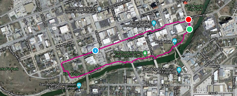
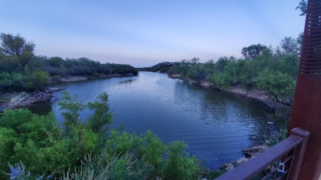
After Coleman, we headed to San Angelo, the town of a million ram statues. We completed our evening with a late night walk down the river, not because we wanted to walk in San Angelo in the dark, but to accomplish daily Fitbit step requirements (leading to an earnings of $1 for 3000 steps …). During our walk, we couldn’t shake the feeling the rams were watching us at every turn.
This one made us think of Shrek. Hearing Donkey’s voice: “Why, of course you’re a girl ram. You’re just reeking of feminine beauty.”

We walked just enough to quiet the Fitbit, then headed to our hotel for the night.
Friday 2020 07 03
In the morning, we dressed in bike attire (more on the why of that in a second) and headed to the back exit of the hotel, which detours around the pool. While there was not a lifeguard on duty, there was this feline, keeping watch over the guests while cleaning itself.

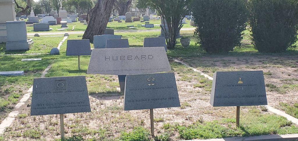
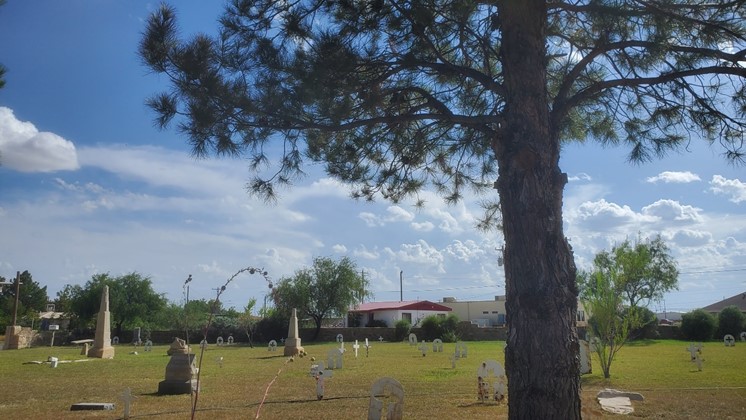
We snuck out of the gate under while Smelly Cat bathed and headed over to Discount Tire for some car maintenance. We had a minor repair on the to-do list for a week or so, but we just hadn’t gotten around to taking care of it. This minor inconvenience gave us the opportunity to ride our bikes around San Angelo (hence bike attire …), accomplishing exercise while exploring the city. Our route took us through the cemetery, where a family of extraterrestrials have found a final resting place together.
We wandered through the San Angelo State campus, encountering many rams along the way (yes, more of those) – statues, flags, memorials. The ram is held in high regard here. Officially, the mascot is a purebred Rambouillet ram named Dominic, a name the student body voted on back in 1964. Dominic is now a fixture at ASU activities. After the campus of the Rams tour, we headed downtown, looking for coffee and food.
We stopped at Stango’s, a little retro cafe right in the middle of downtown. While we sat down with coffee, our eyes were drawn to this appeal to the citizens of San Angelo:

Evidently lockdowns were causing some distress in the area. This was interesting, as most of the world was significantly more restrictive than Texas (not a surprise). After all, here we were, enjoying coffee, inside a business with other customers. Other than the requirement to wear a mask when walking in the door, there’s not a lot of other freedom blocking restrictions going on. Most places were open. Some were serving food. Evidently this was not enough freedom for the masses.
Finishing our caffeinated coffee, we opted to ride around a little more before food. The menu at Stango’s looked good, but they were dealing with shortages, so it was limited. Maybe this was the problem for Mr-Open-the-States – he can’t consume all the food. Unfortunately, Stango’s did not survive the pandemic. They shut down a year after we were there.
We followed a trail along the river, and into another part of town where we found a small grill that advertised full breakfast. Again, masks were required but the place was open and crowded. We ordered a breakfast full of grease prepared by the Chinese owner, served by disinterested teenagers, and listening to a very loud conversation between a woman and the person she needed money from at a table down the way. It wasn’t poisonous, but we didn’t mark “Bobo’s Kitchen” for a return trip.
Full of grease, we wandered back toward the hotel, through some very storm damaged neighborhoods in central San Angelo. There must have been a hailstorm recently; it appeared to have taken out several roofs and trees in the area.
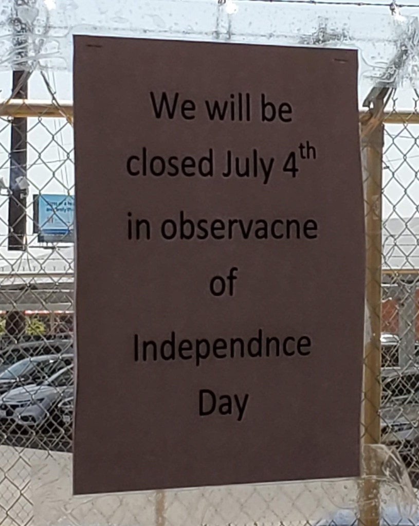
Not a bad ride, but it was getting warm by the time we were ready to pick up the car. We stopped to retrieve the vehicle, taking note of the sign near the entrance. Or is it entracne?
Time to head south. We were happy to get in the car, rest our legs and enjoy some air conditioning while we drove southwest toward the mountains. Again, the scenic route.

The next town along this route was Fort Stockton, and we decided it might be a good place to stop for lunch. We found some food at a local diner – a non-mask wearing, religious establishment called B’s diner and ordered greasy grilled sandwiches to go. We ate outside on the steps of courthouse, as indoor dining was prohibited in these parts. At 90+ degrees Fahrenheit, the dry-ish West Texas air was still fresh enough to support an ocean of mosquitoes.
After our outdoor lunch, we took a quick tour through town and came across the oldest house in Fort Stockton. The house is the only remainder of the first Fort Stockton, founded in 1859. With thatched roof and adobe walls, it seems to want to disappear under the brutal Texas sun but is currently not allowed to so do as the historical society is continuing to preserve the property.

After the oldest house, we found this tiny cemetery buried in the middle of a residential area. Tiny and old evidently (but not as old as the house), as its name is … Old Cemetery. The Old Fort Cemetery was a burial ground for soldiers stationed at Fort Stockton as well as a few civilians who grew up in the area. Life here was difficult; none of thepeople under the headstones had made it past forty years of age. Notable deceased include a convicted murderer and a corrupt local sheriff. We considered getting out to wander, but it was really hot and the sprinklers were on. Not that the water wouldn’t have been a welcome refresher, but we thought tourists playing in sprinklers in the historic, old cemetery might be discouraged. Especially tourists over the age of 40. It seemed disrespectful. So we continued down the road.
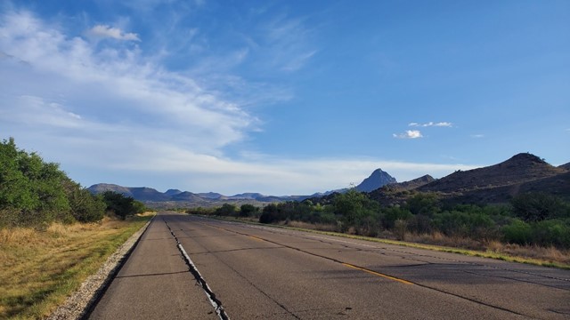
The road to Marathon is a pleasant drive. You can see for miles, but it’s not like the nothing miles you see in the Panhandle. The landscape is fascinating. It starts out flat, and slowly transitions to a more mountainous view as you get closer to Marathon. With minimal traffic on this two-lane road, it’s wide open vistas and a huge bowl of blue sky.


One interesting item in the area is the fact that the highway south goes through the middle of a huge impact crater from about 100 million years ago – signage talks about the Sierra Madera Astrobleme. At 8 miles wide, it’s not noticeably a crater unless you look closely – still impressive, especially the rebound mountain sticking out of the middle of it.
In Marathon, we stopped at The French Company Grocer, which appears to be a popular spot for tourists. We picked up some groceries, since indoor dining was not guaranteed (COVID) and we weren’t sure what would be open once we arrived in Fort Davis. The Grocer is a cool little place – full of good groceries as well as necessities. Fresh drip coffee, espresso drinks, and a nice variety of sandwiches and pastries were available as well. Bookmarked for future trips.
Supplies acquired, we headed west toward Alpine, still enjoying the awesome scenery. Prior to it being torn down, we spotted the smallest Target store ever built. Once in Alpine, we stopped for a quick walk next to the coolest baseball stadium in Texas. This wasn’t just our opinion – it’s actually been called “the best little ballpark in Texas (or anywhere else)” by Sports Illustrated. Well taken care of and set against a backdrop of mountains, this is home to the Alpine Cowboys and the Sul Ross State University Lobos. It’s worth a stop, even for non-baseball fans.


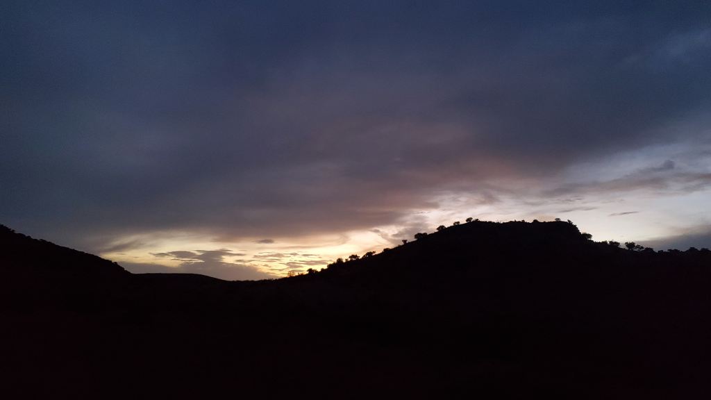
We watched some storms form to the west as we left Alpine.

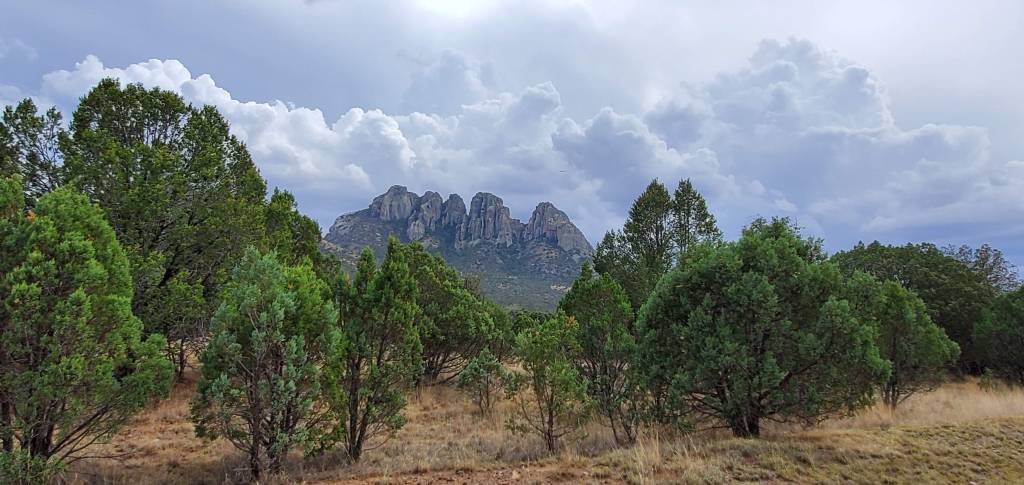
The terrain changes significantly (again) as you get closer to Fort Davis – the ascent is gradual, but we were working our way up from 2000 feet above sea level in San Angelo to nearly 5000 feet up at our destination. We stopped for multiple photos before the sun went down.

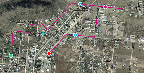
We found our accommodations in Fort Davis easily, a little guest house on a nice property in the middle of town. It was very quiet as the owners were not in the main house that weekend. Once unpacked and settled in, we headed out for a walk. The town is so small, a walk will get you anywhere you need to go. We found ourselves at the high school stadium, where it seemed like people were gathering. We followed the crowd in because it seemed like the right thing to do. Turns out, it was time for the Fort Davis 4th of July fireworks event. Our long day of driving had affected our brains, evidently as we had forgotten it was Independence Day weekend:.
What a perfect ending to the day. We happily watched the show from the uncrowded high school stadium with other locals and tourists and a random dog, then walked back to our guest house through the beautifully quiet night.
Saturday 2020 07 04
We woke up and went for a short run through the town. We opted for a very leisurely pace this morning, feeling sluggish after excessive driving. We cut the run short in order to acquire some coffee at the Stone Village Market. Exercise – check. Caffeine – check. Weird locals – check.
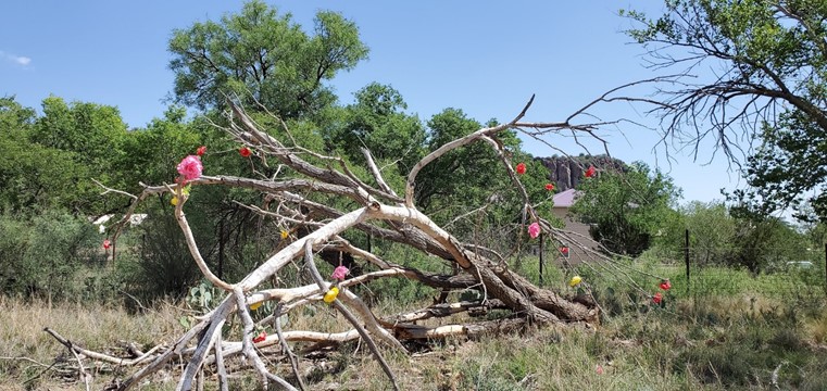
On the way back to the house, we came across a completely deceased tree that someone had taken the time to decorate with … crepe paper?
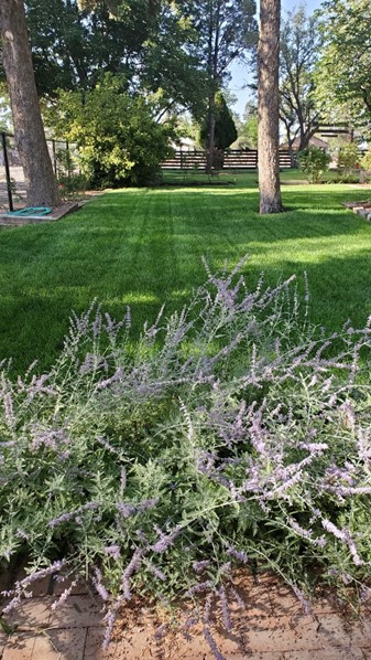
We headed back to the guest house for breakfast, using the eggs and sausage purchased from the French Grocer. This was our view from the patio while we ate. An expensive view, we thought, trying to calculate the gallons of water this color green requires in this part of Texas. Nice to look at, but maybe a little wasteful.
We also found a few lizards hanging out on the property. They looked miserable. The air was still and sticky this morning, and already the heat was overwhelming.

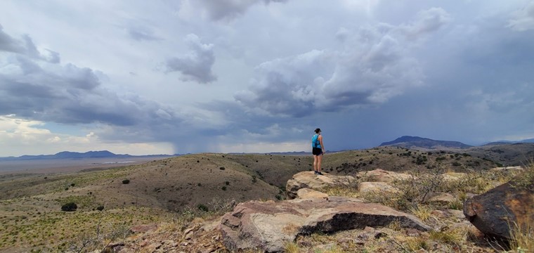
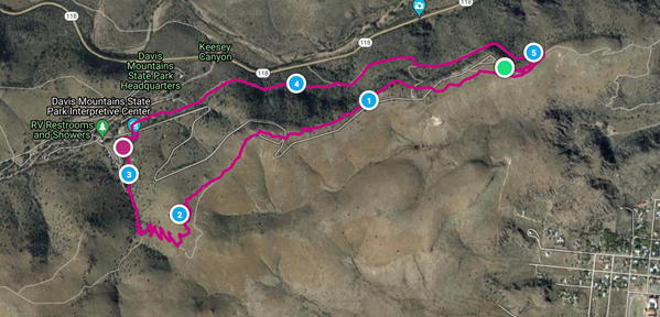
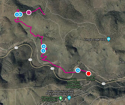
Breakfast was quick, as there were mountains to explore. We headed out to the Davis Mountains State Park, a quick 10-minute drive. After a complicated search for a parking spot, we took a quick look at the trail map and set out to explore.
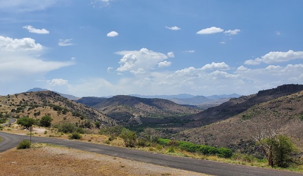
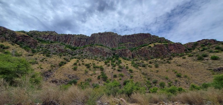
The plan wasn’t to hike five miles, but as is typical with our organizational skills, that’s what happened. We set out to walk a few miles, then walked a few more. The trails were challenging, but not impossible, and the scenery more than compensated for the effort.

We were lucky to receive some sporadic cloud cover, which provided some relief from the heat. We even watched a few rainstorms in the distance.

Despite the unexpected distance, we were very happy the views. The park near the entrance was crowded, but we only encountered a few other hikers on our way across the hills. Maybe they were looking for parking spots?

Five miles takes a lot longer when you’re hiking over rough terrain and up and down a few hundred feet of trails, than running on concrete. It was late in the afternoon when we finished.
Beautiful place. It’s a large park with almost 3,000 acres of land and miles and miles of trails. Even after our long hike, we still felt like there was more to see. We would need to return. We notified Google, who happily stores our want-to-go-back items.
Tired and hungry, we headed back to Fort Davis, where we found a place currently allowing indoor dining – the Fort Davis Drug Store. We put masks on and headed in for lunch composed of chicken salad sandwiches and coffee. Going north out of town, a quick stop for ice cream at Herbert’s Caboose at the end of town seemed like a good idea. It had been crowded every time we drove by, but we were able to get in and out without too much delay. That settled, we headed out for a drive, figuring we could cover more points of interest on wheels.
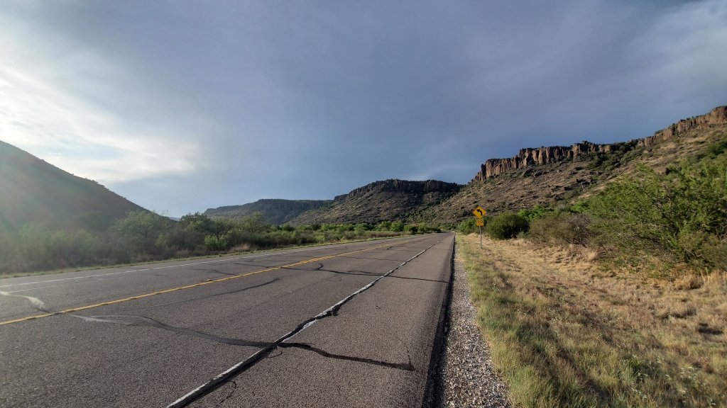
We opted for a scenic loop that goes west from Fort Davis, past the McDonald Observatory, then south on loop 66 which winds around the south end of the Davis Mountains, past the Point of Rocks Park, then back east toward Fort Davis.
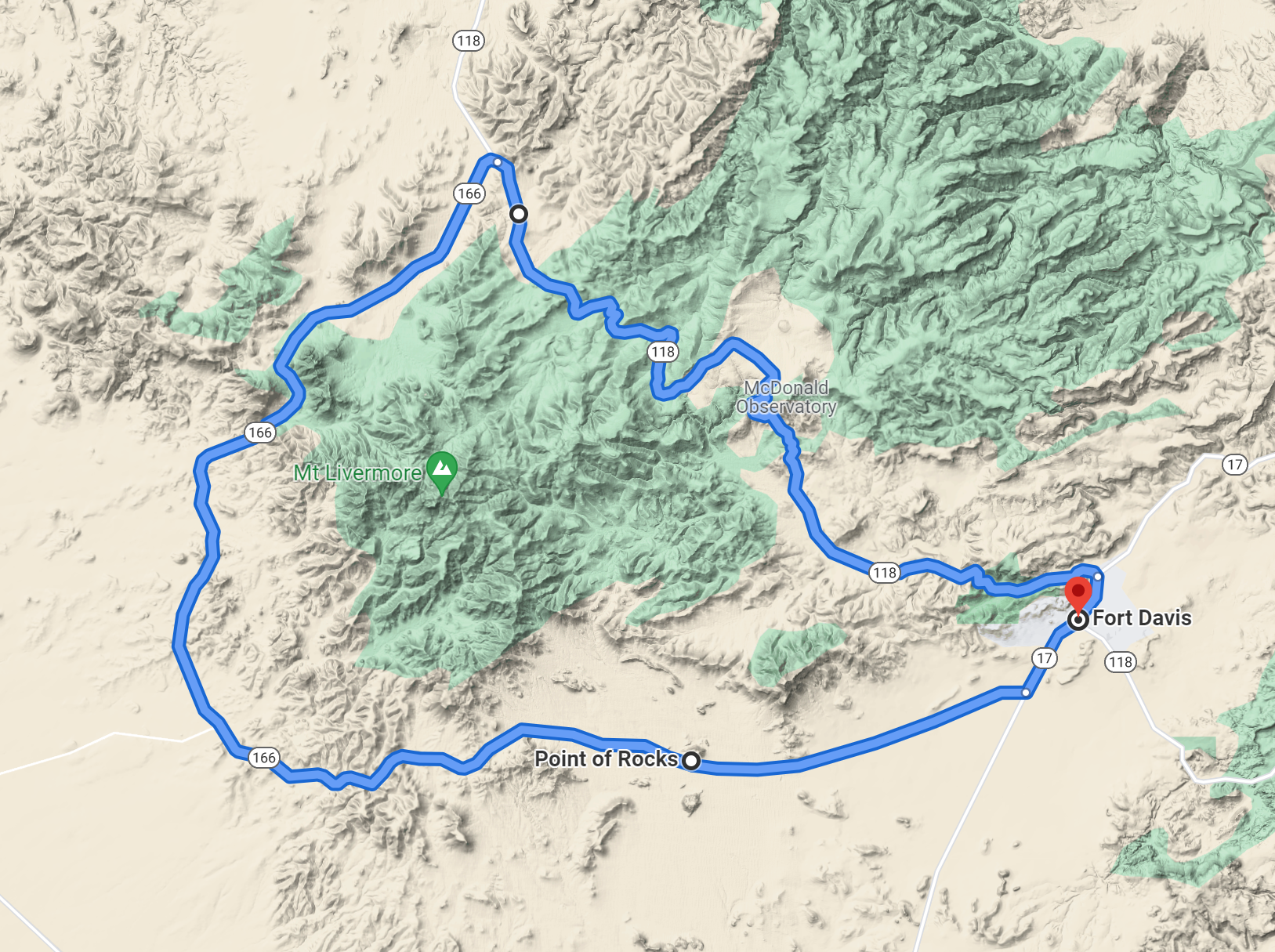
The driving was a nice change after the morning’s excessive physical activity. We drove, relaxed, enjoyed the view and occasionally stopped for pictures. A nice end to the afternoon.
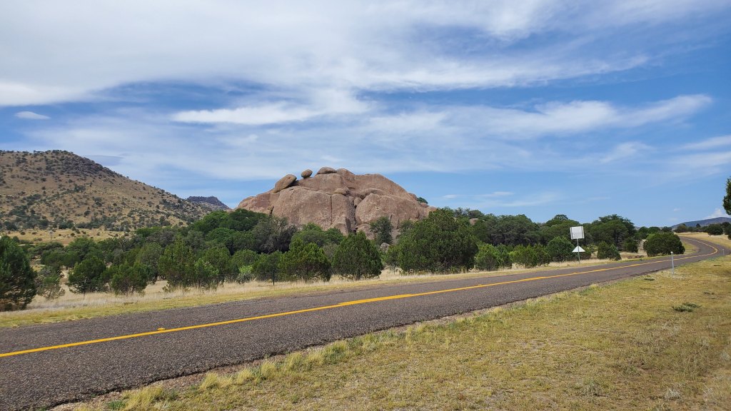
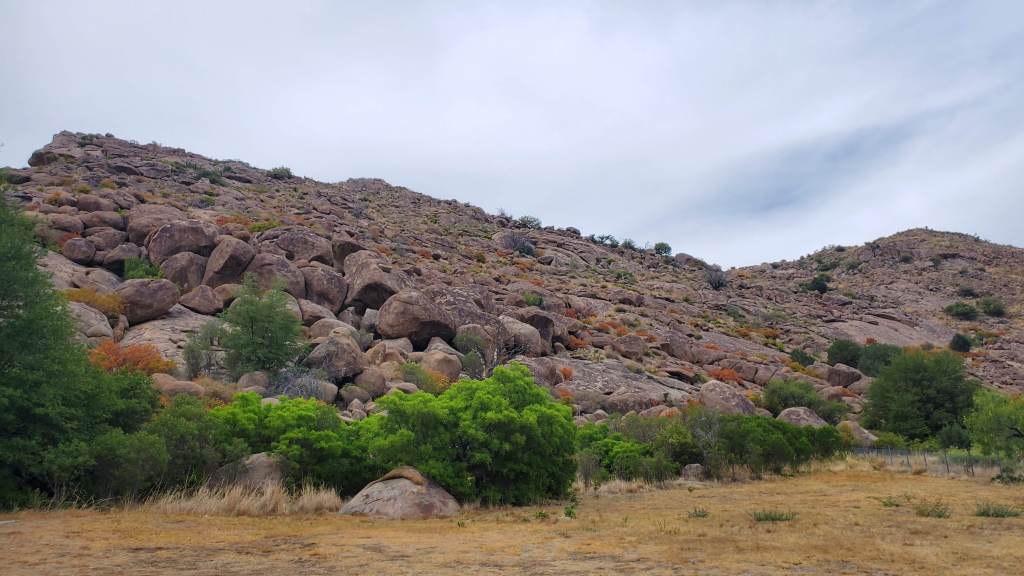
The drive takes you past several interesting rock formations, and around Mount Livermore (which has to have a better Native name) – at about 8500 feet of elevation, it’s an impressive outcropping for Texas. We stopped to walk at the Point of Rocks, a scenic spot marked on the route. It’s pretty much just a pile of rocks, but they are definitely more scenic than your average rock, and the photo below doesn’t really do justice to how big and fat those rocks are.
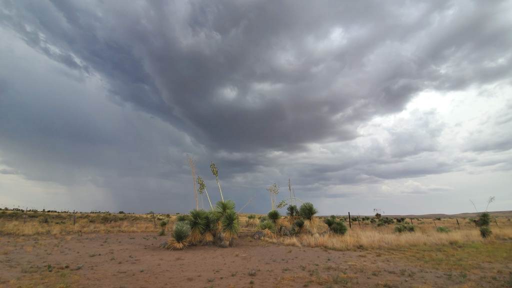
We’d been watching these storms to the south all day, hoping they might bring some rain, but they just sat there, dropping cool, refreshing rain a few miles south.
We stopped at the Pioneer Cemetery on the way back into Fort Davis, fighting off bugs and heat while we read about the sad life of an early settler named Delores. The historical marker reads:
Delores who on her wedding eve lighted a signal fire for her fiance later found scalped by Indians. She became mentally ill and (until her death 30 years later) burned fires on the mountain for her lost lover.
Poor, poor Delores.

Next, a quick nap at the guest house. We were exhausted, and about an hour of sleep was enough fuel for the evening’s activity: a drive to Marfa. The well-known Marfa lights were a “half” item on the agenda, not a requirement, but something we’d like to see at some point. We left as it was getting dark. About twenty minutes into the drive, we realized two things: a) it was very cloudy, and b) this meant the lights most likely would not be visible. A quick Google search revealed that the visitor center was closed due to COVID. Some things travelers should probably check on before getting in the car and heading to the destination …
Given we were halfway there and curious about Marfa, we rolled on. It was dark when we arrived, and everything closed. We couldn’t even get a cup of coffee. Settling for a short walk around the quiet square, we headed back to Fort Davis. Not the most exciting way to end the evening, but it wasn’t a complete failure. Technically, we saw Marfa.
Sunday 2020 07 05
We had a run on the schedule for Sunday morning. The goal was five miles. We put on running clothes and trail shoes and headed back to the Davis Mountains. Five miles is a decent effort on a flat road – much more challenging running up and down a mountain. We’d forgotten we were 4000 feet higher than our home terrain, which added thin air and less oxygen to the already challenging ascent over some very rough trails. One of us might have walked most of the way, changing the “run” to a “walk” on the MapMyRun.
Walk, run, or jog, the exercise was a good way to end our time in Fort Davis – panoramic views including a distant hint of the observatory buildings at McDonald 18 miles away.

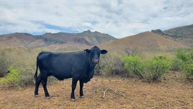
Exercise complete, and with the day progressing, it was time to start the trip home. Back at the guest house, we packed our things and headed north-ish. We didn’t get far before we decided on a detour. Yes, shocking. FM 1832 West looked like a nice, scenic drive so we went that way. The roads winds to the south, then back west, then dead ends in a scout camp, which appeared to be closed. COVID, most likely. We turned around and headed back the way we came. The (questionably) friendly black cow observed us, most likely making sure we were getting off the property so it could continue with the day’s activities – which appeared to eating mesquite bushes with a garnish of grass.
Back to 17 north to Balmorrhea. There’s a state park there which is on our bucket list, but we weren’t expecting it to be open this year – most state parks are closed or limited for COVID – and it wasn’t, but the closure was related to pool repairs, not illness. There’s a natural spring in the state park, which is rated one of the top swimming spots on Texas. Sadly we would not get to enjoy that spot on this trip.
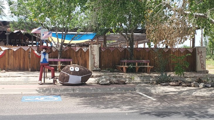
The spring water feeds through the town of Balmorrhea, winding from the state park through the middle of town. As we drove through, we watched all the locals splashing in the spring fed canal running parallel to the highway. It was probably the only thing to do on that miserably hot day, since any indoor activities would be restricted. We stopped for a walk, said hello to the masked potato, and headed on our way.
It’s not far from Balmorrhea to Pecos, a dusty spot in the road off of I-20. It was about lunch time, but the only place we could find serving food was a dimly lit bar called 2 Javelinas Draft House. There was food to be had, although we were the only customers there who were actually ordering food without alcohol. We took a break from the car and ate, jealous of the other patrons with their cold beverages and questionable food. Average food was still filling, giving us fuel for the next leg of our drive.
Barstow is just down the highway from Pecos. It’s a well-known ghost town that thrived during the early oil boom times but is now slowly crumbling into the west Texas dust. Evidently there just wasn’t enough water around here – who knew? We wandered around, trying to ignore the sun mercilessly beating down on our heads.


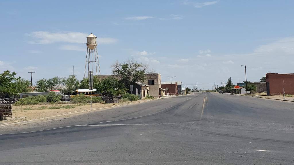
From Barstow, we turned north. Our final destination today was Big Spring, but we weren’t really in a hurry to get there. Being on the far edge of the state, we added the goal of driving out of state. New Mexico was right there, and we like New Mexico. The only town in the southeast corner is a little place called Jal. It appears to have been named after an entire herd of cattle which were branded with the initials “J A L”. It’s small and unassuming, population about 2,000 but it’s doing much better than Barstow.
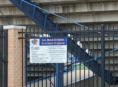
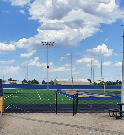
Having put our feet on the ground in New Mexico and getting a very warm walk around the football stadium, it was time to get back to Texas.

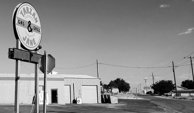
This route took us through Andrews, Tarzan and Lenorah, all small, quiet west Texas towns being kept alive under the broiling hydrocarbon stink of the fracking boom that is slowly lowering the Permian Basin into the earth. We wondered how many businesses in Tarzan take advantage of the Jane association. We found at least one:
We arrived in Big Spring before dark – barely – found our Airbnb, checked in, and then searched for food. Unfortunately, at this hour and in a small town, we were down to chain restaurants. After a failed attempt at McCallister’s (which smelled like raw sewage), we ended up at Wendy’s, and consumed chicken sandwiches and fries. Not healthy, but it was the best option available.
We had some time to explore Big Spring before the sun went down, and took a walk around the Historic Spring site. Big Spring overall appears to be struggling, with crumbling houses and shuttered businesses, but this is an unexpectedly nice little spot in the middle of town. The natural watering hole has kept humans alive for hundreds of years.

After the Spring, we noticed the skies turning dark and checked the radar. A nice sized storm was moving in. Most people would seek shelter, but we are not those people. We found a spot north of town to watch the lightning, figuring we’d be able to see anything dangerous coming in. It took about thirty minutes of lightning flashing across the sky for the rains to arrive – more correctly for a blasting wall of dust pushed in front of the squall line to arrive. Blinded by dust, we turned to navigate back to town, watching lightning strikes blow up transformers and other things.
The town, like most in this area of Texas, has minimal options for drainage – makes sense as it rains almost never out here. After two days of watching storms from a distance in Fort Davis, we finally got all of it in about a half hour. The streets flooded quickly, and our drive back to the Airbnb was a little scary, with a short blast of hail right as we parked at the house (thankfully partially under a tree). Slightly damp and frazzled, we made it, wading through ankle deep puddles to get to the front door.
Monday 2020 07 06
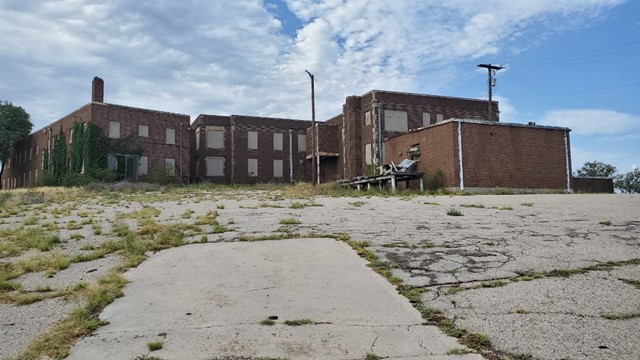
By the morning, the water had receded (where did it go?), and we figured it was a good time for a bike ride. Our bikes had been strapped to the back of the car since the first morning in San Angelo and they were looking sad. Pedaling from the house, we decided to aim for the state park in the middle of town. We rode by this old building on the way. An old hospital, according to the internet, and recently damaged by fire. Creepy.
Big Spring State Park is located on the top of a large hill erupting in the middle of the town. Perfect for a challenging ride, and with almost no traffic, we safely navigated to the top. The entire town and probably 50 or more miles of the surrounding country is visible from the park road across the butte – very nice.
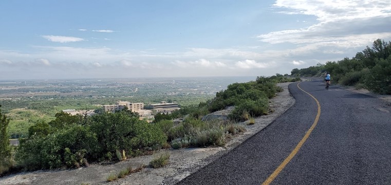
It’s not easy to get up there on a bike, but the view is worth the work. Bonus – we found a playground at the top. We hopped on the swings and pretended we were thirty-five years younger.
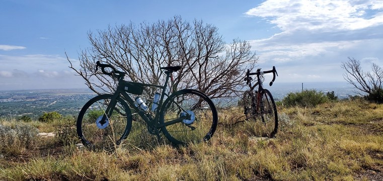

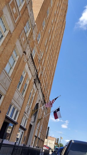
The ride down was much more fun with a high speed descent to the park exit. Exercise accomplished again, it was back to the house to pack up our things, followed by a search for breakfast. We found food at the Hotel Settles, which was surprisingly open for business. They were allowing a limited number in the restaurant, and we made the cut.
The Hotel Settles has an interesting back story. Originally established in the 1930s it was the tallest building between El Paso and Fort Worth. The hotel was sold during the Great Depression, and then went through several owners, who were unable to keep the hotel operating past 1982. It closed and stood empty for decades, falling apart slowly under the combined assault of heat, cold, wind, and pigeons. In 2006, it was purchased by a wealthy local resident, who has restored the property and returned it to it’s early ’30’s glory. We decided if we ever had a reason to come back, and COVID was no longer a thing, we’d like to stay.
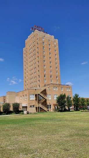
We left Hotel Settles and headed east toward home. Direct routes are so boring – rather than blasting across I-20, we tried for as many side roads as possible This let us travel around the south side of Lake Colorado City and then into the actual town from the south. The old Baker Hotel captured our attention, and we stopped to check it out. Once a fancy place, the building has obviously been in disrepair for a while. We imagined this is probably what Hotel Settles looked like before the restoration. Maybe the same will happen here.

The area around the Baker Hotel could use some restoration as well.


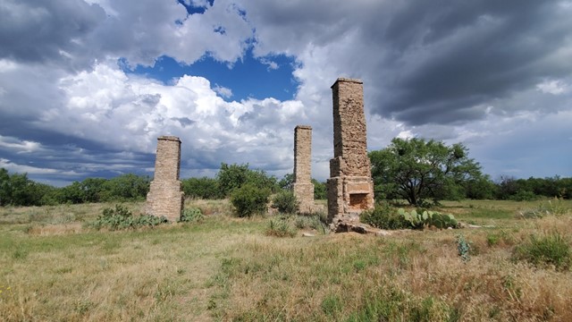
After exploring Colorado City, it was time for lunch. We headed to Abilene and found a Mexican food spot that didn’t care about COVID – evidently spicy salsa and fajitas were enough to fend off the plague. Fort Phantom Hill is north of Abilene if you take the long way home, which of course we did. This is the remains of an old army fort, originally built in the 1850s, and one of the best preserved historical sites of its type in Texas.

Finally nearing home, we drove towards a fat rainbow peeking out of a wall of rain – we took that as a good sign and enjoyed the quiet drive back home. West Texas would need some more visits …

