
Having been up and down the East Coast, over the Mississippi, and into the mountains, it was finally time to organize a joint trip to the West Coast. One of our party had been out several times around work trips and conferences, but schedules being what they are, a long weekend hadn’t worked out as of yet. VMworld 2014 turned out to be a perfect intersection – conference in downtown San Francisco wrapping up the Thursday before Labor Day weekend. Juggling VRBO and airline miles, a late late late night arrival into SFO and a winding drive up to the Point Reyes area looked like a great way to see some of California with slightly less people than Times Square on New Years …
2014 08 29 – The Wrong Trail
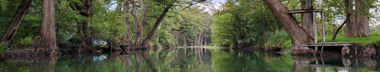
After a late night and late morning, we were off to explore Point Reyes National Seashore. The northern portion of California’s coast is one of the most dynamic and beautiful areas we’ve visited. After spending a week herding cats and going slowly insane in the urban depths of San Francisco, Inverness and the areas around Tomales Bay were better than a $0 happy hour at the vodka distillery.
Of course, any good multi-hour biking / hiking trip requires fuel. Rolling back to Point Reyes, we stopped into the Station House Café and grabbed a tasty bowl of mussels:
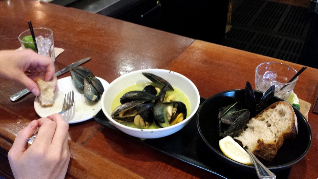
I’d never eaten a mussel before – will admit to having experienced a quick conversion to the shellfish way after years of equating mussels with muddy-snot-textured mollusks. Next to the mussels are a couple (or four) vodka tonics.
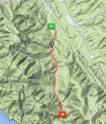
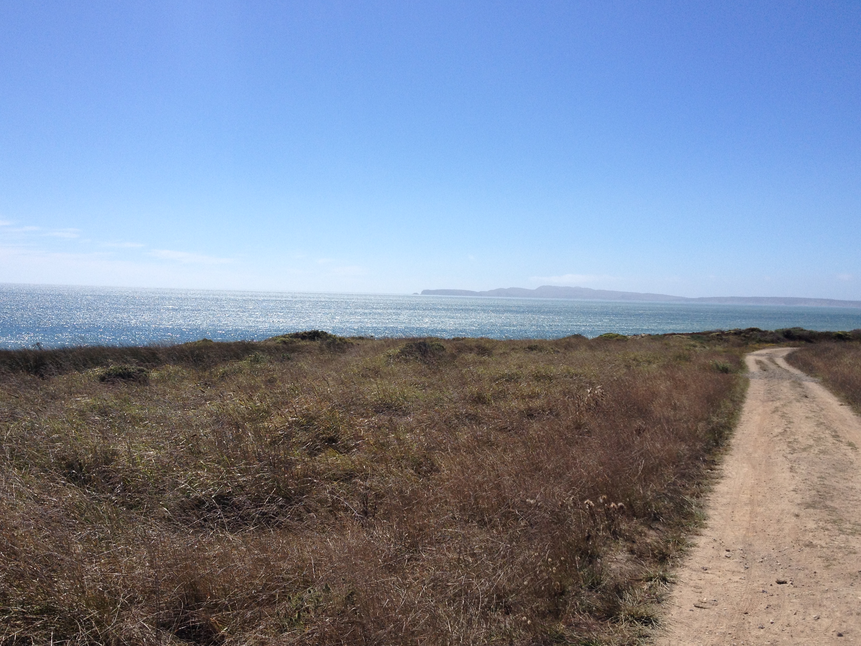
Advice from the local bike rental shop in Point Reyes led us down the hill a bit to the Bear Valley trailhead, equipped with two of the dirtiest mountain bikes I’ve ever handled. Trusting that the gear in hand would get us up and down the hills, we set off down the main trail, aiming for the beach and putting our feet in the ocean.
First challenge – forgetting bike shorts. Even 3 slow rolling miles on seats apparently made by an angry Frenchman convinced us to update our packing lists next time. Second challenge – angry equestrians who evidently need an hour notice to move their steeds to the right. We bicyclists are supposed to give them plenty of warning, up to and including getting off our steeds and walking around so as not to spook theirs. Would be nice to see courtesy extended the other way – nothing quite like inadvertently plowing through a pile of half-dried horse pucky in knobby tires to harsh your mellow. Maybe I can start lobbying for these signs:

All that said, after a nice moderate hill and a fast roll to the bike rack …
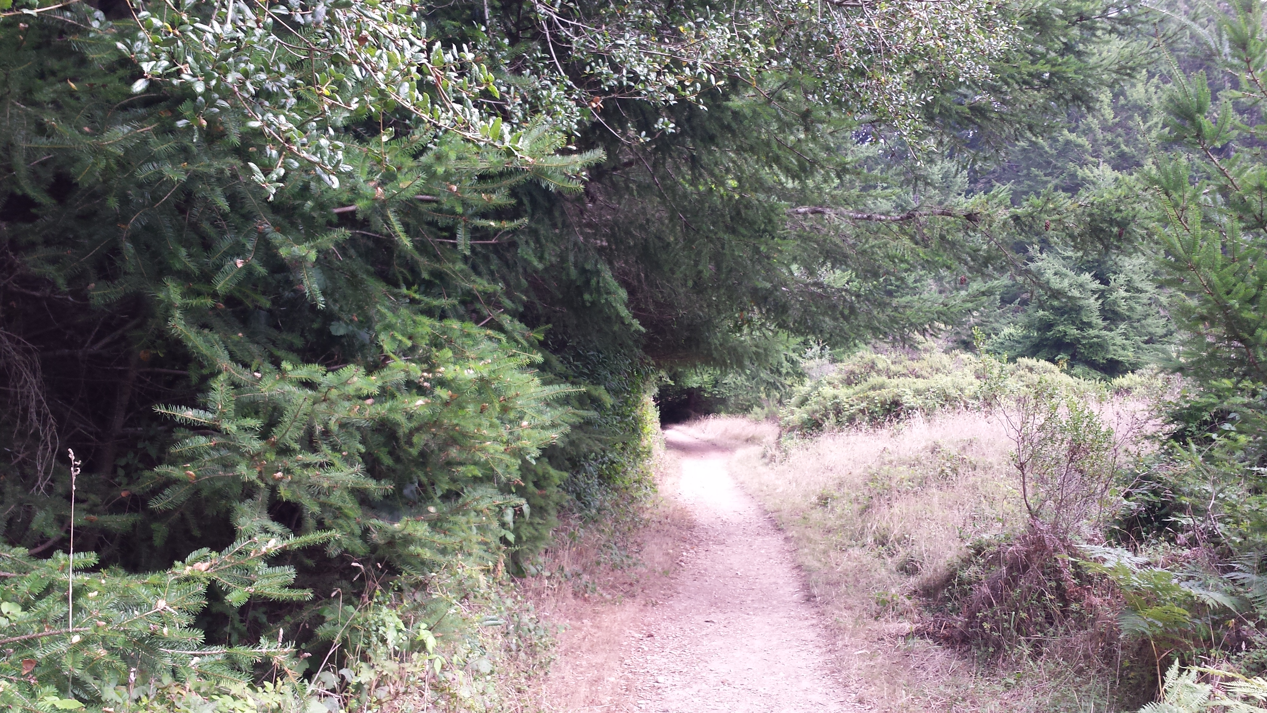
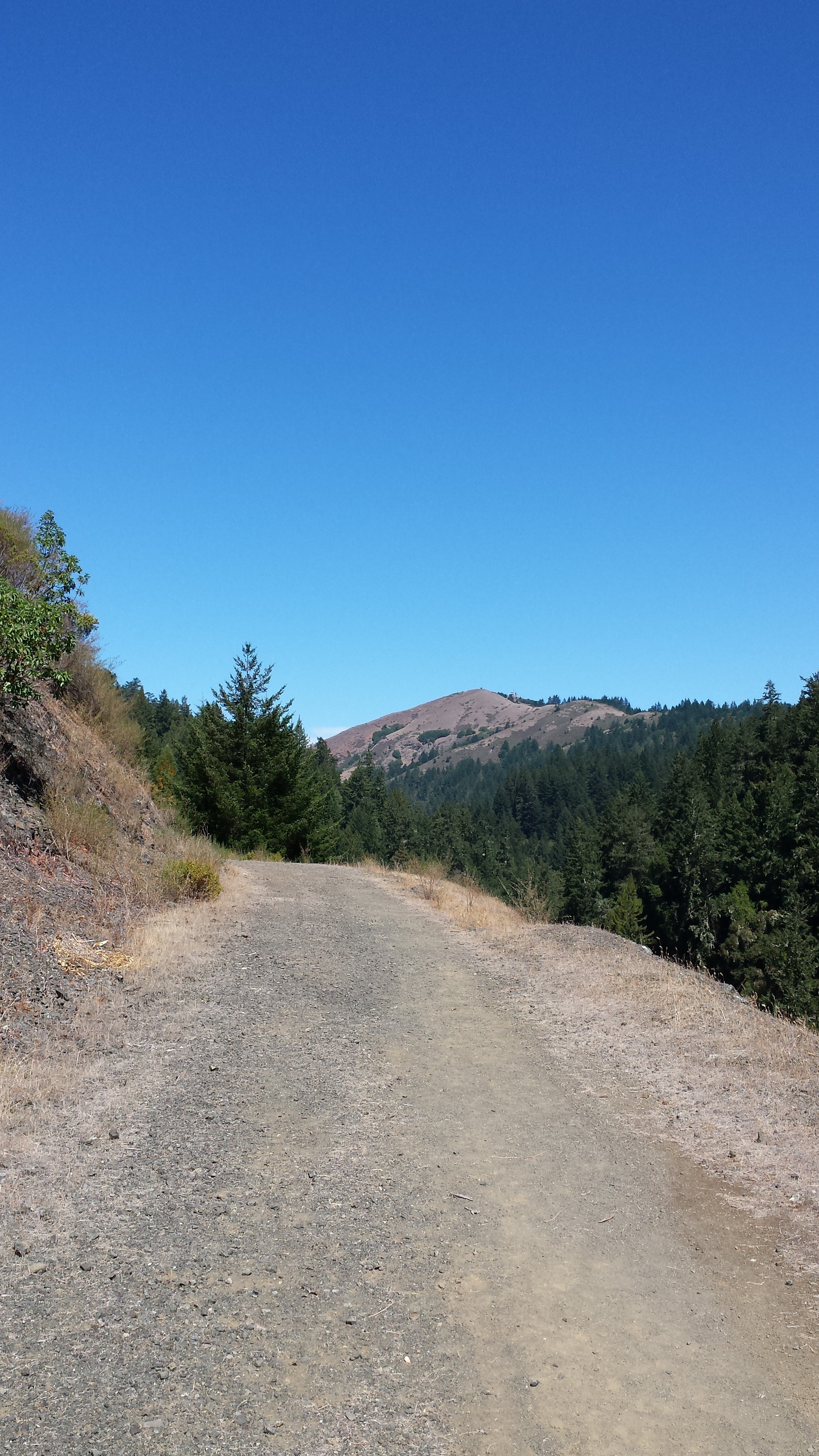
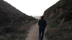
… we dismounted, unpacked, checked the map, and headed out. The wrong way. Deceptively easy trail looked like this:
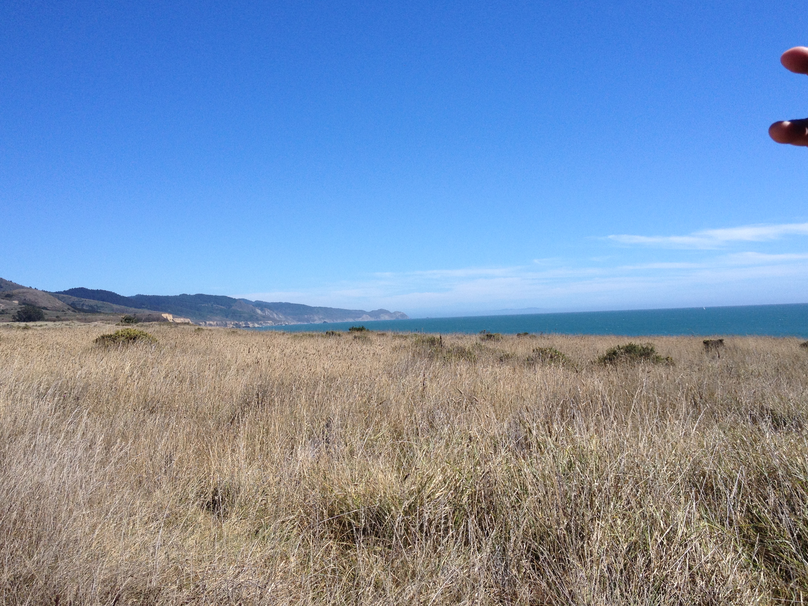
After making it up a 20% grade and around a few corners, a really nice view back down the valley:
Ahhhh – the ocean! Only a little bit further:
A horizontal mile and several hundred vertical feet later. Closer?
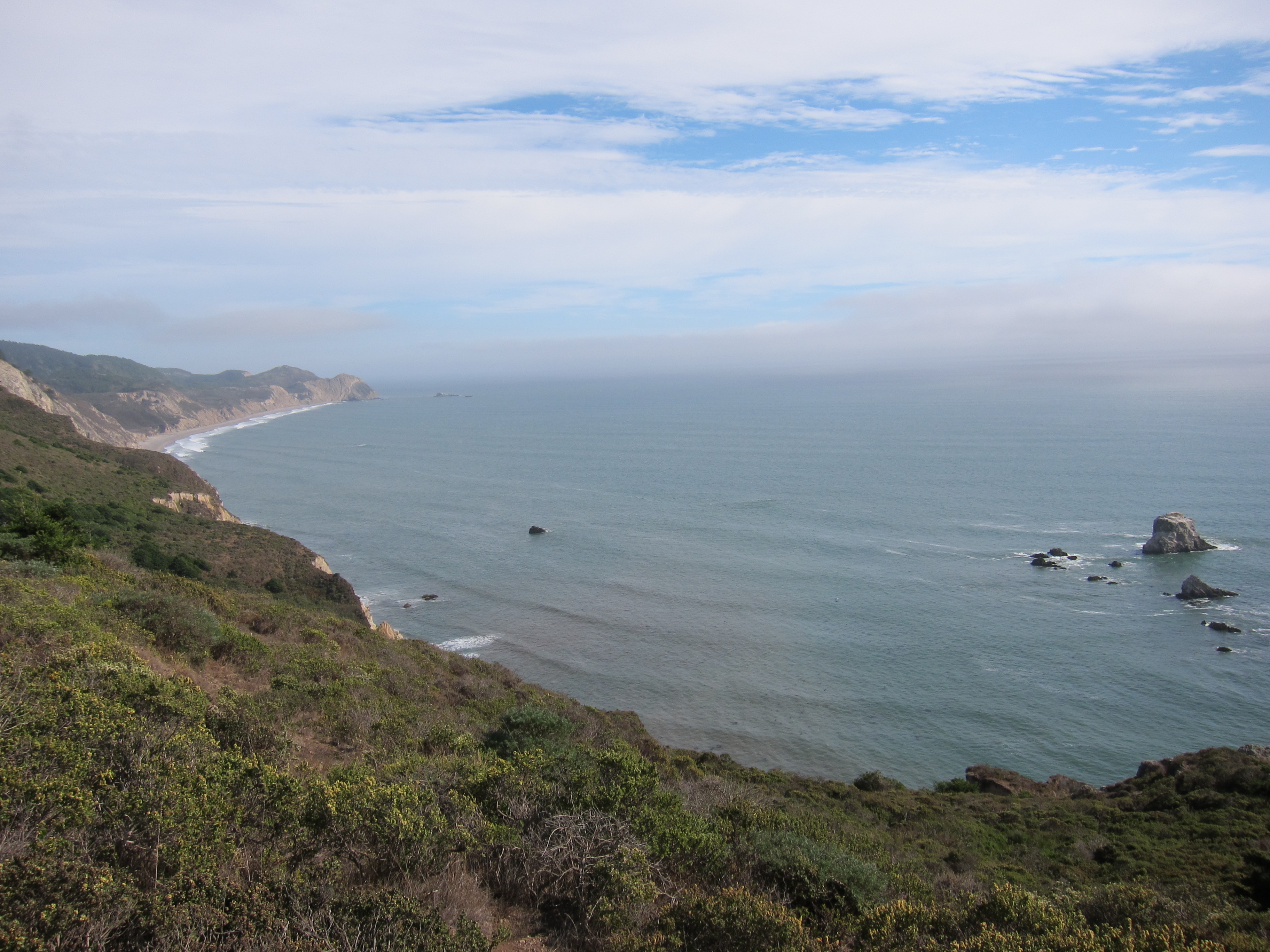
And we head back to the west, and southwest, and northeast, and … more coast!
2.5 miles of up and down grind later, we made it. Almost.

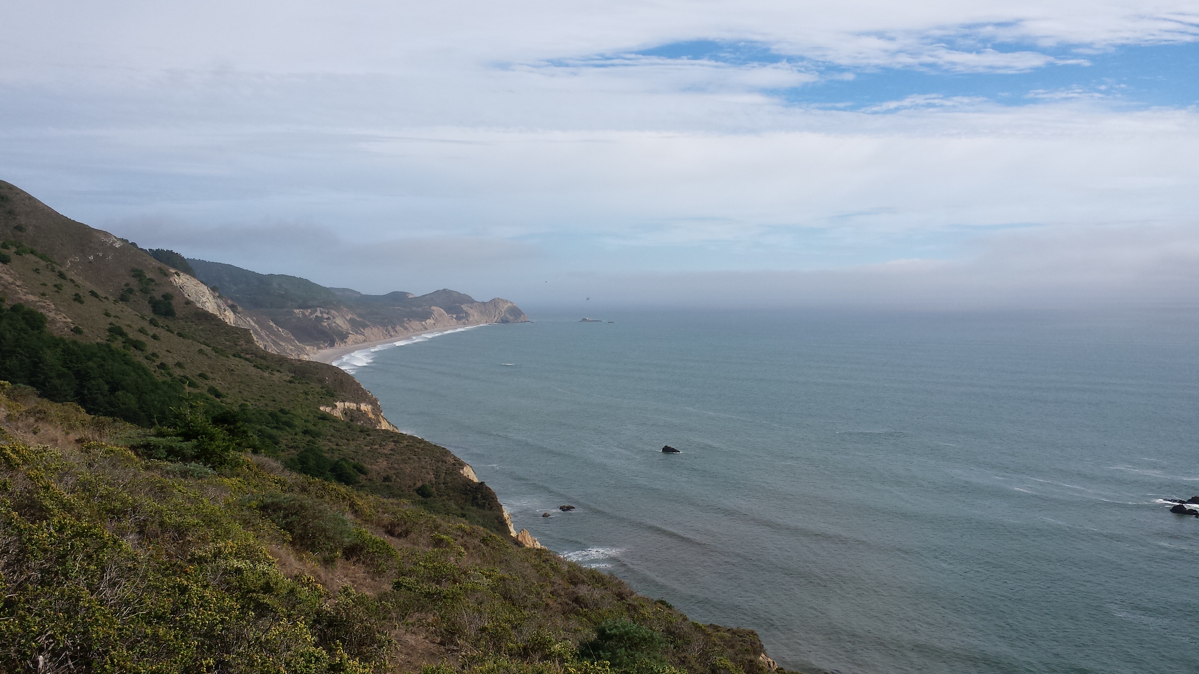
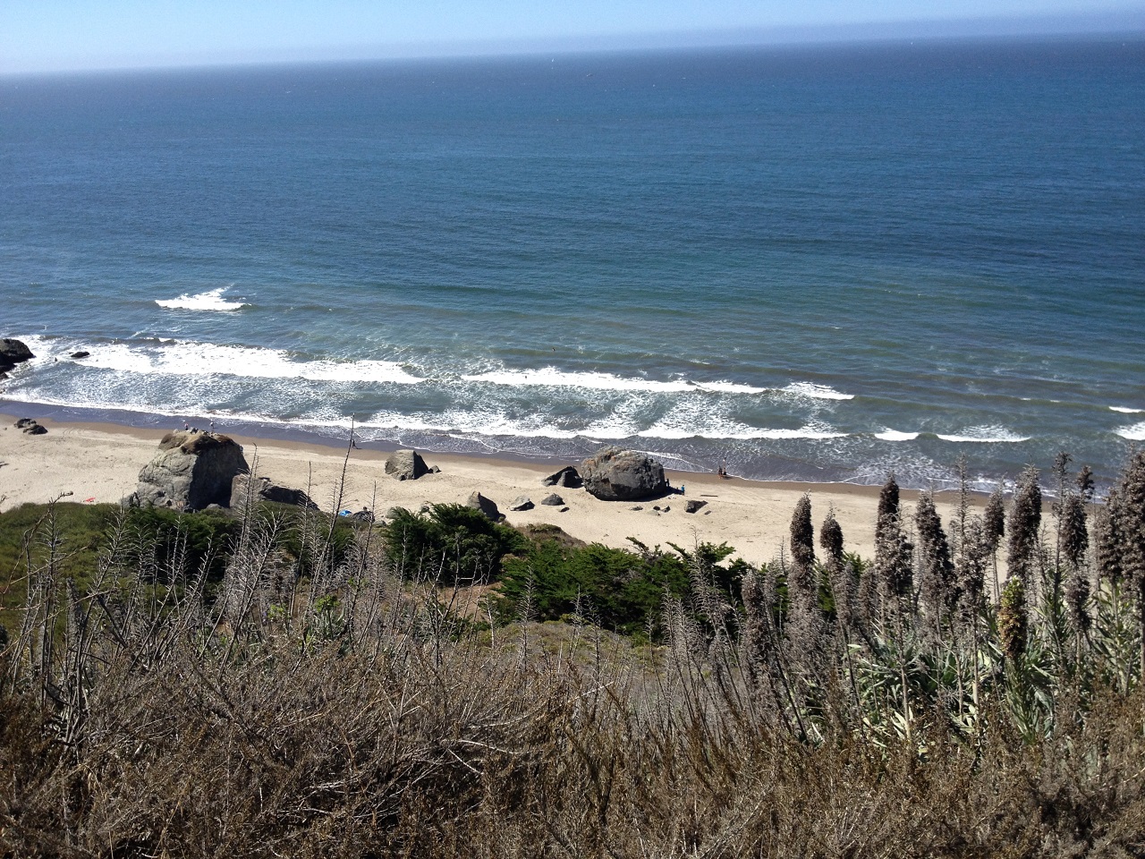
Looking southwest off the top of Arch Rock:
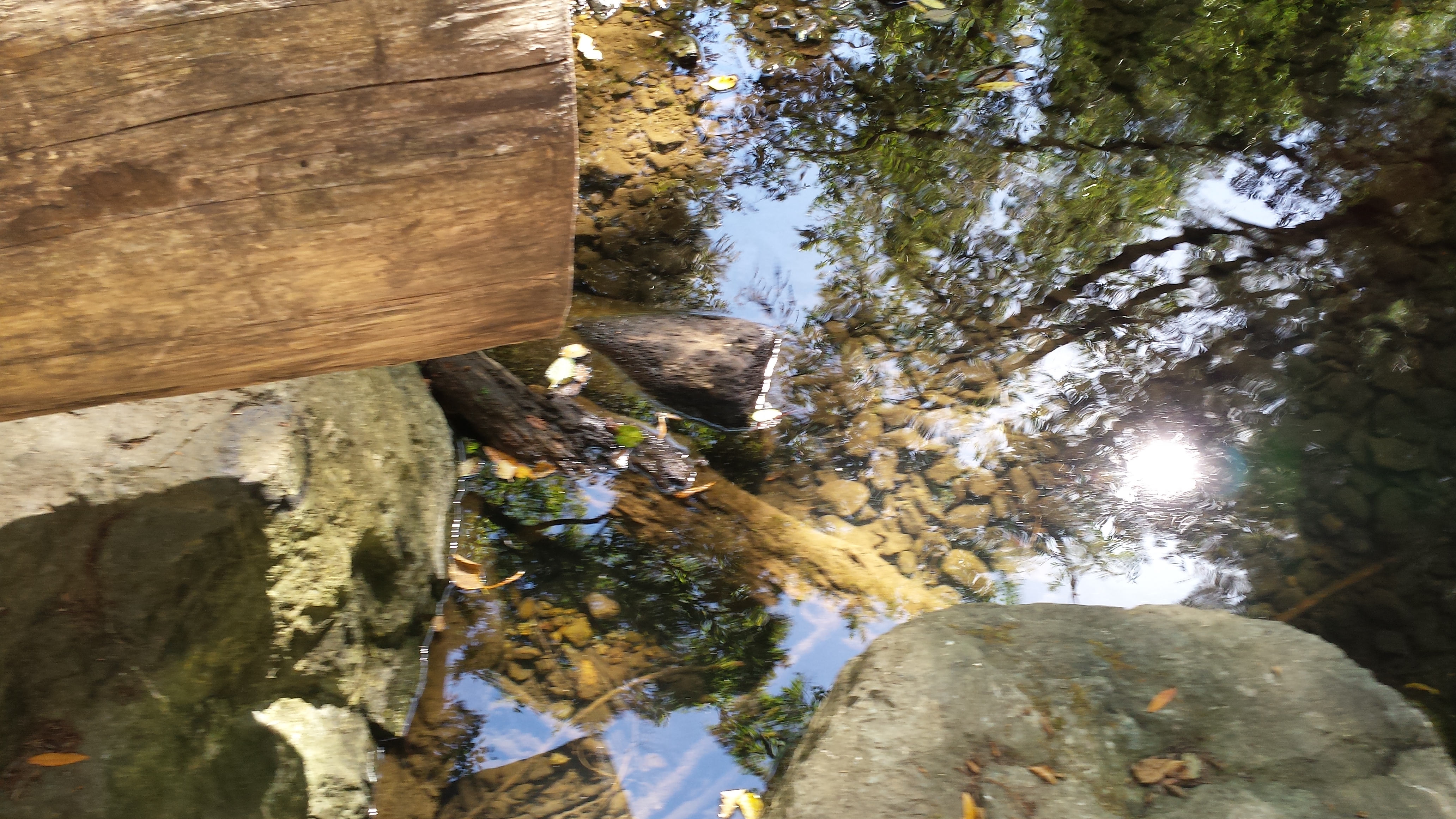
After some downhill mountain goat activity, dodging a small crowd of shoeless teens, and some very cold water, the appropriately named Arch Rock. The water coming through is a freshwater stream running out of the hills behind us:
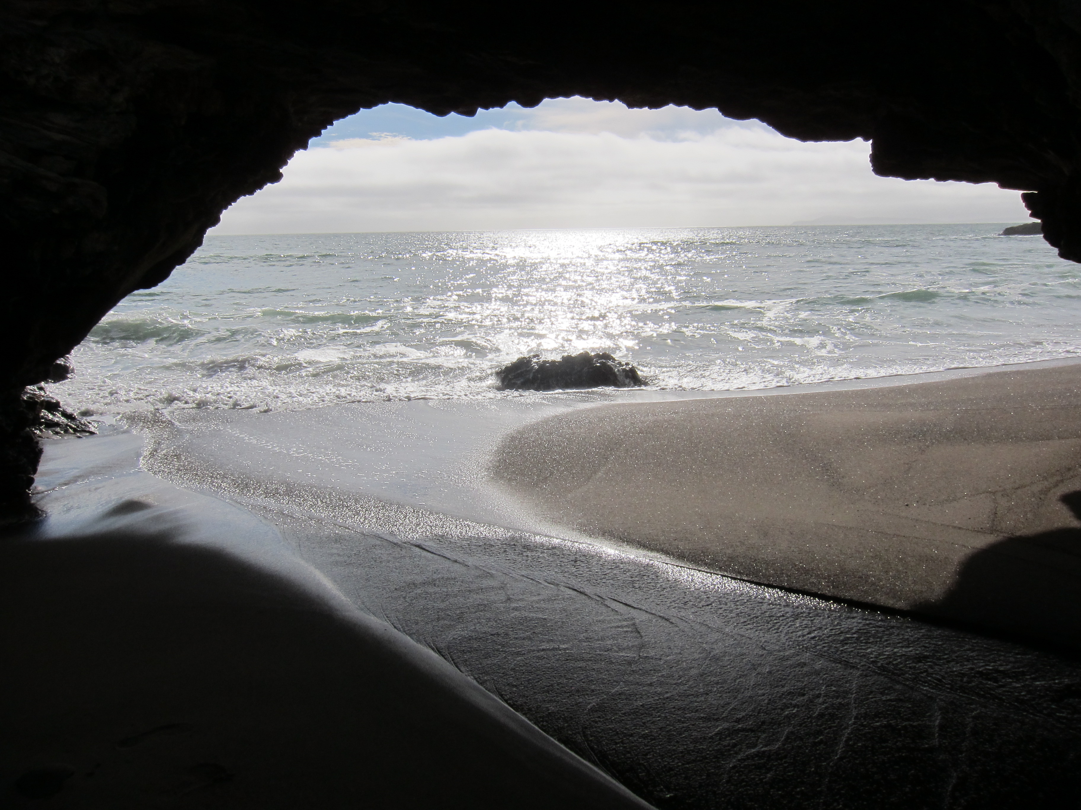
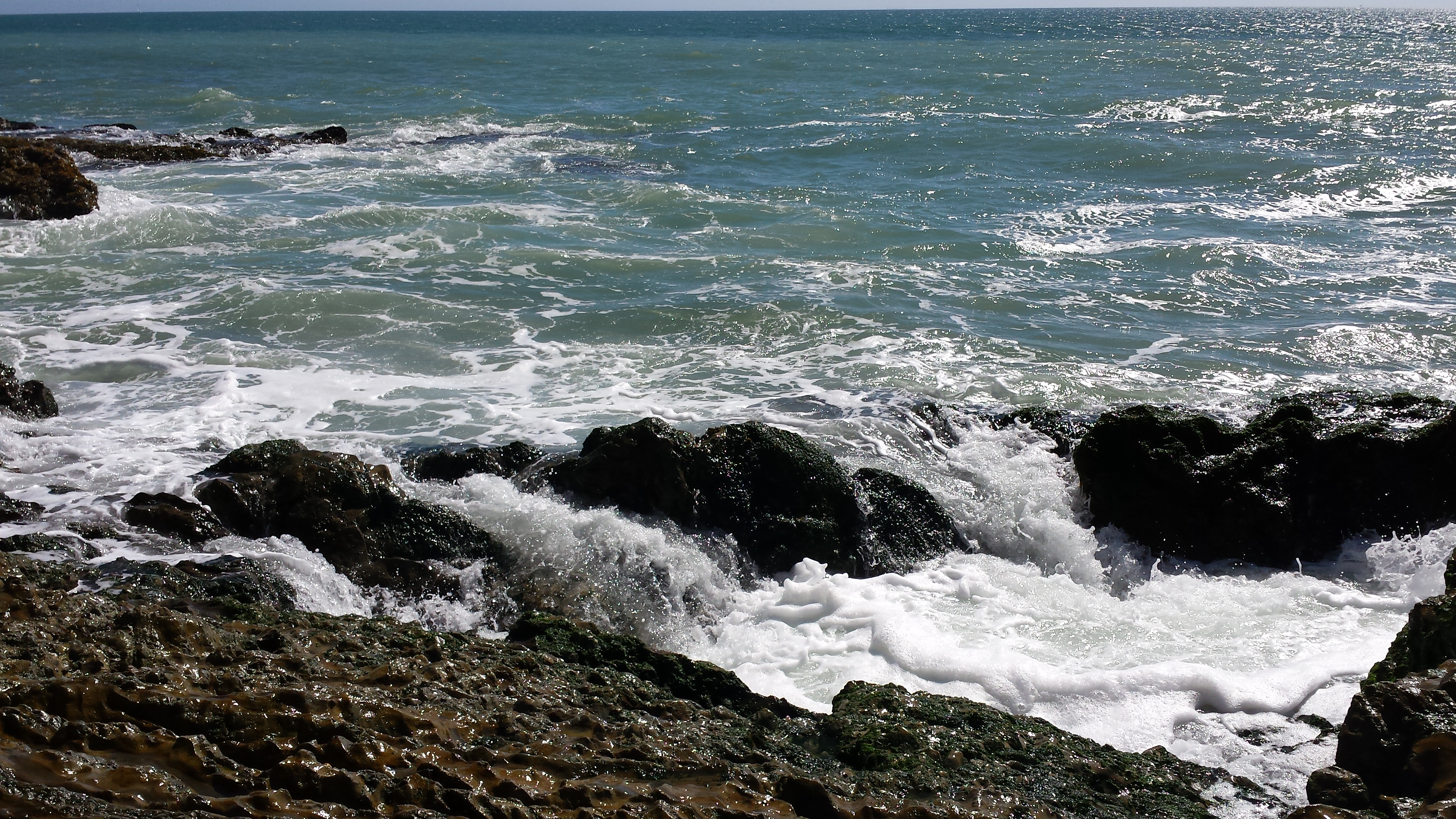
Chocolate sand and pounding surf – beautiful:

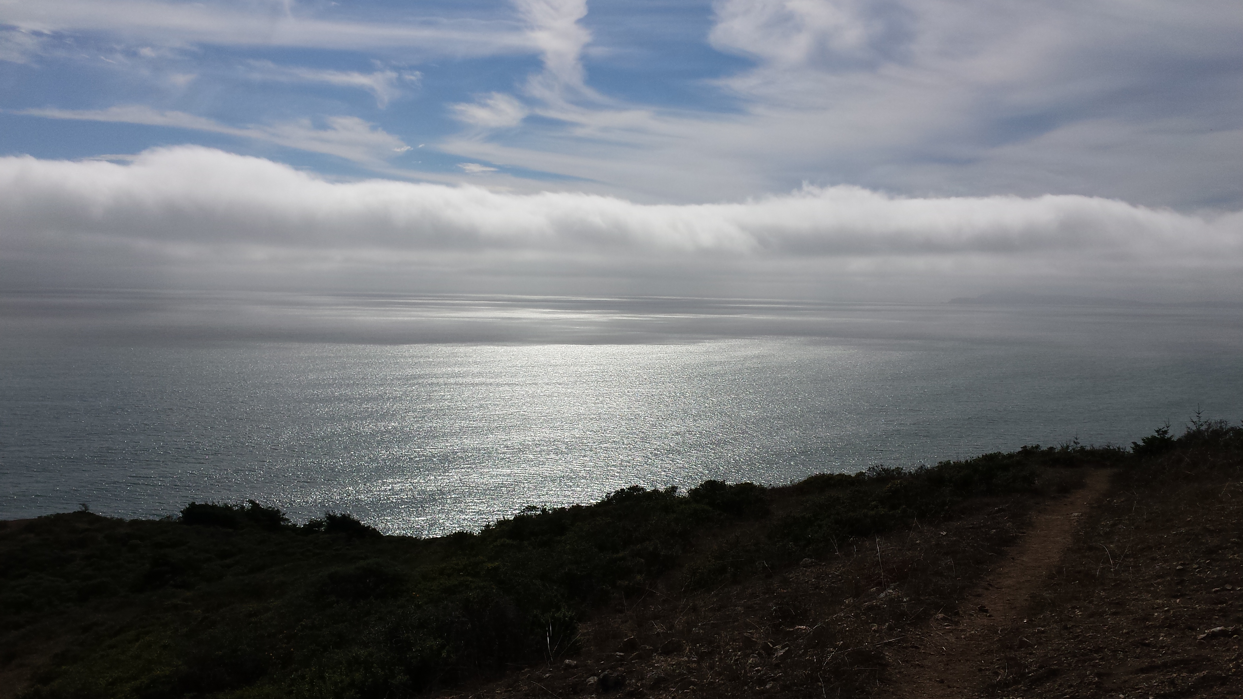
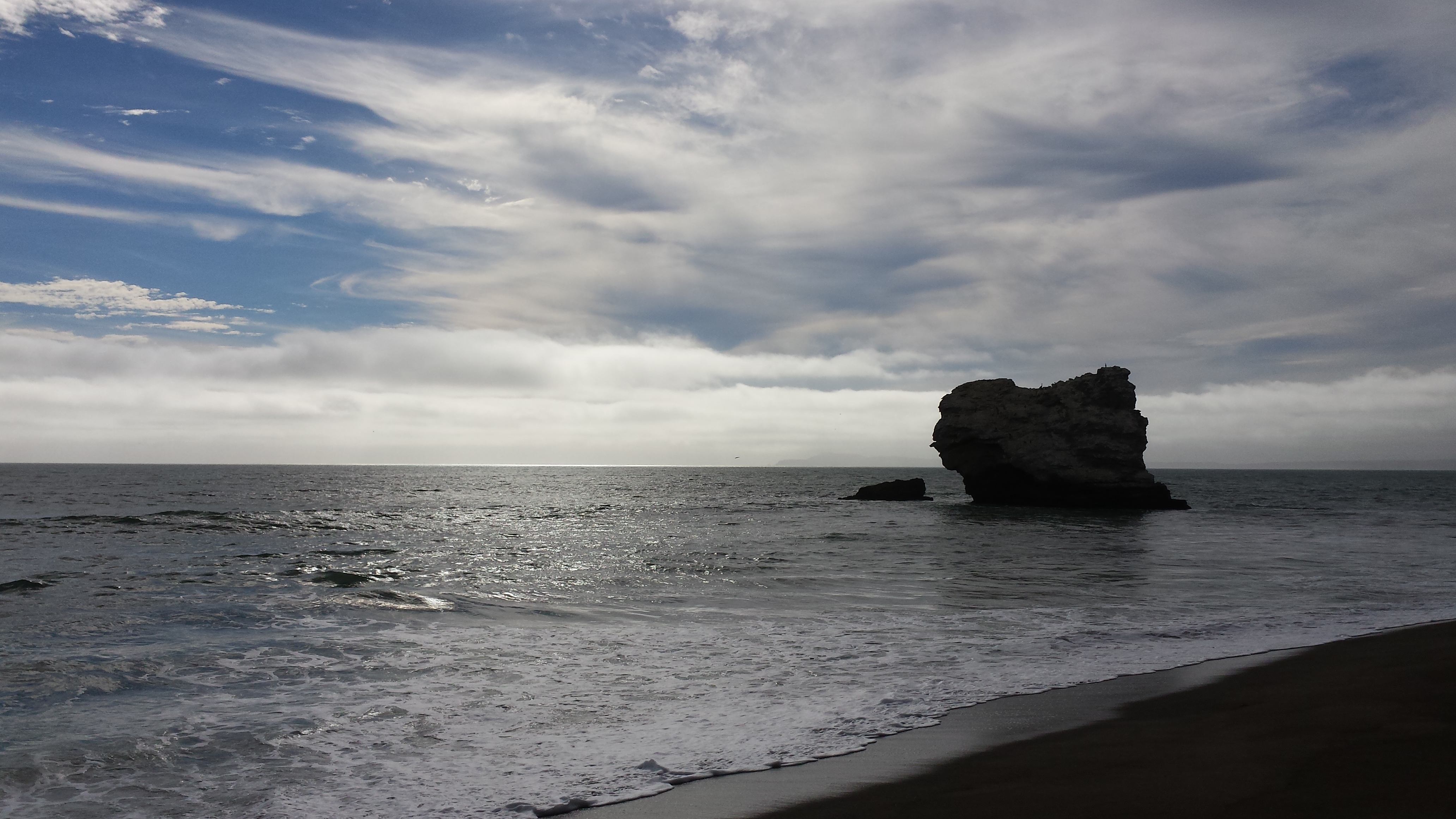
Pelicans roosting on the rock (trust me, they were there), and west-setting sunshine:
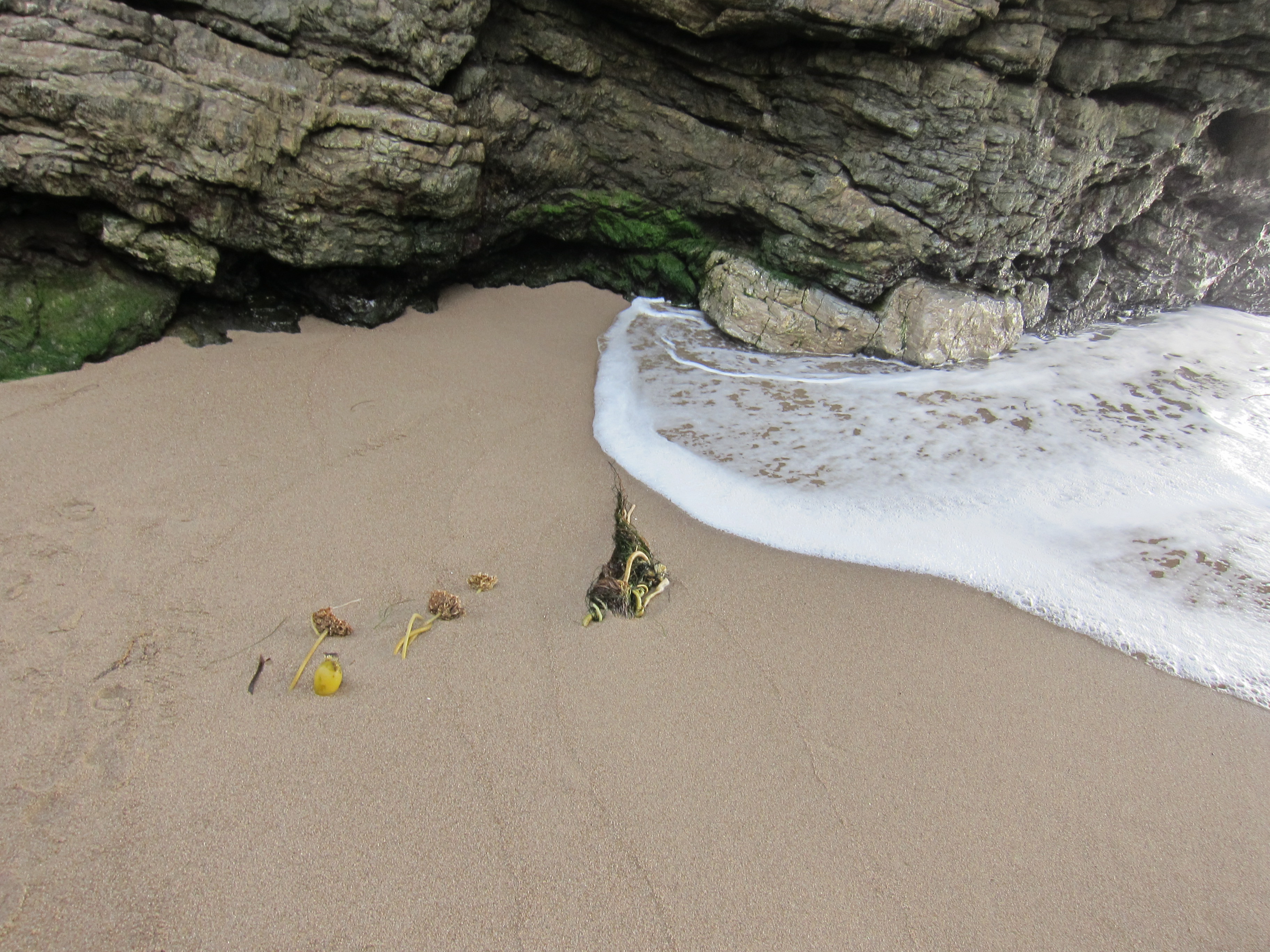
The ubiquitous kelp – where you can’t see it, you’ll still smell it:
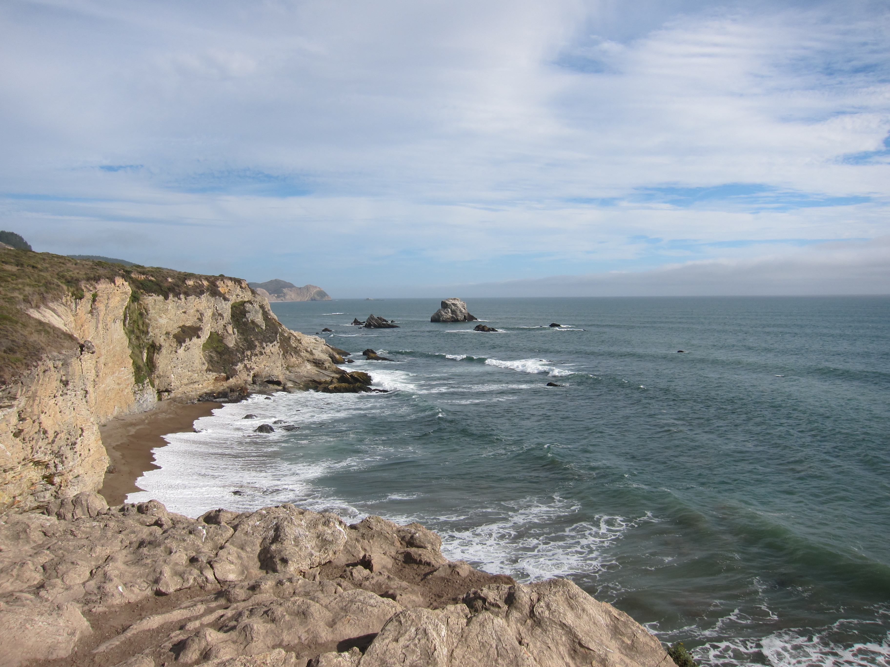
Looking back up the valley from the arch. Ready to head back up the hills:
As we headed back up the hill, a map check made us realize we’d looped off the direct Bear Valley to Arch Rock trail and taken the Glen Camp cutoff to the Coast Trail. Getting back to the bikes on the correct trail was a lot easier, and after some heavy pedaling, we cleared the mid-trail ridge and dodged manure piles on the downhill roll:
All-in-all well worth the effort, the extra mileage, and the amazing scenery.
2014 08 30 – Peaceful Noise
After a half-day recovery on Friday cut into our trail time, we decided to jump out of bed on Saturday at 8:30AM. I think we actually made that deadline. Consultation with our biking oracle at Point Reyes Outdoors led us to the Cross Marin trail on the other side of Highway 1, hoping to see 1) some big, old trees and 2) fewer people. It was immediately obvious that goal #2 was a lost cause. I think most of Marin County was bicycling (or waiting behind bicyclists) between Point Reyes and San Francisco on Sir Francis Drake Highway. After circling a bit, we found a well-populated road shoulder and collected the gear. Levi’s bike hits the road … with an almost flat tire. No problem, two different compact pumps attached to the rentals! Oh, these tires have Presta valves and it appears these pumps only have Schrader adapters. After a few attempts to make the twain meet, we have a completely flat tire and no way beyond some very painful blowing to roll out. Fortunately, the bicycling army referenced above were in full regalia – the very first peloton who stopped by had a Presta pump and were kind enough to share. And we are on our way down the Cross Marin trail:
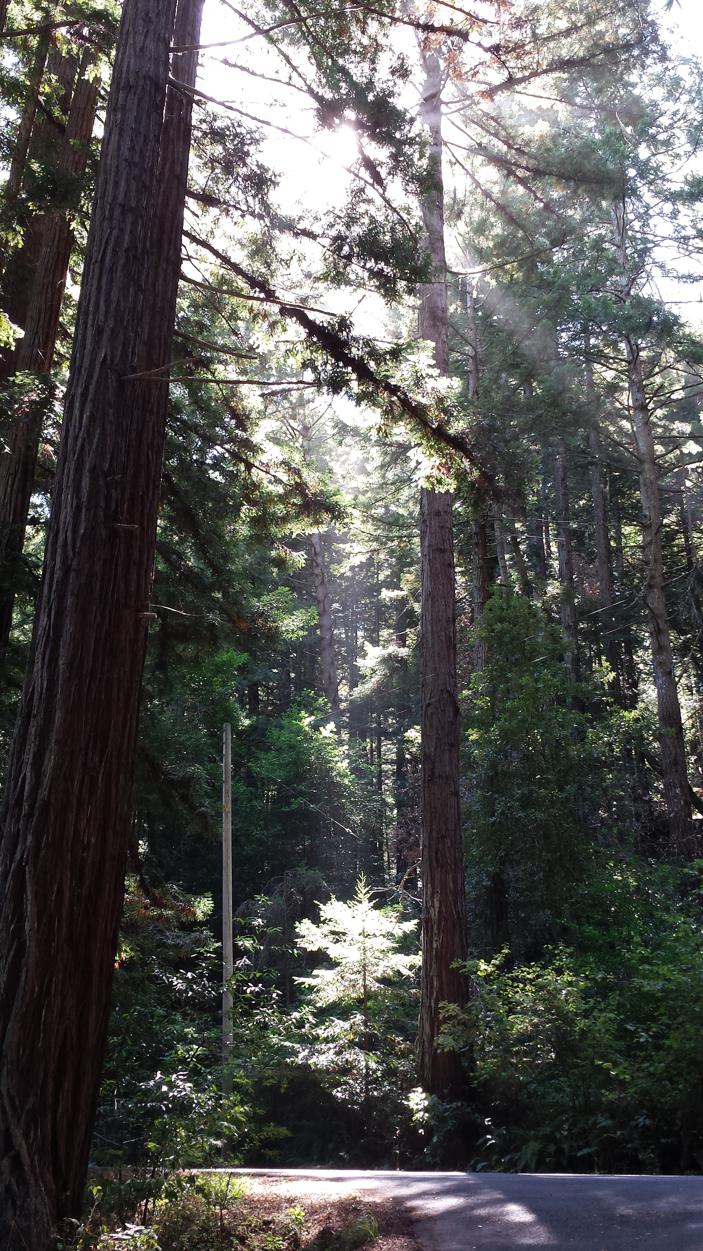
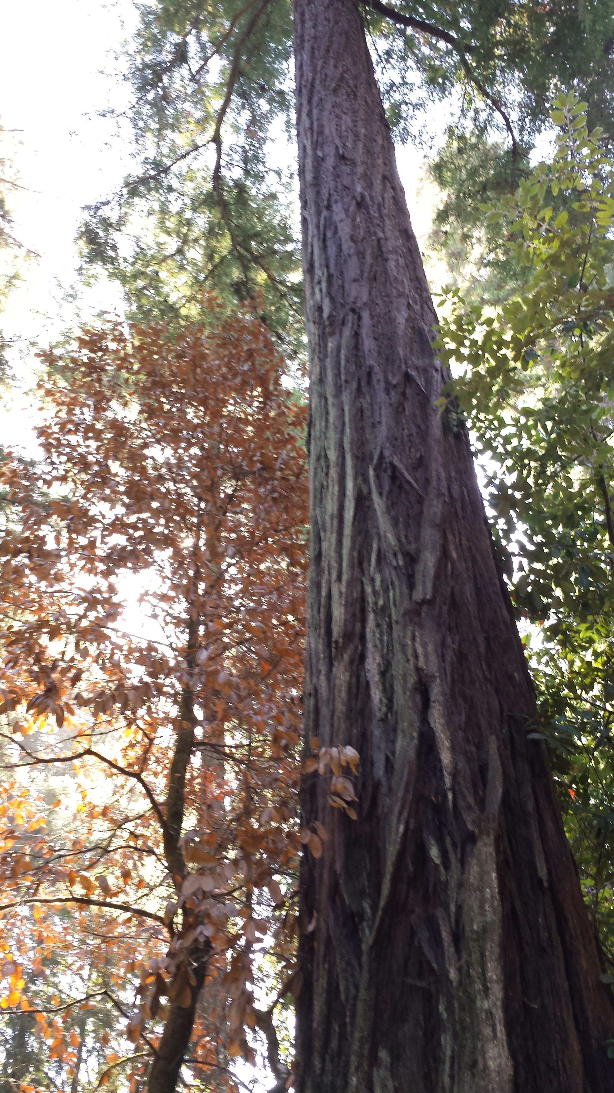
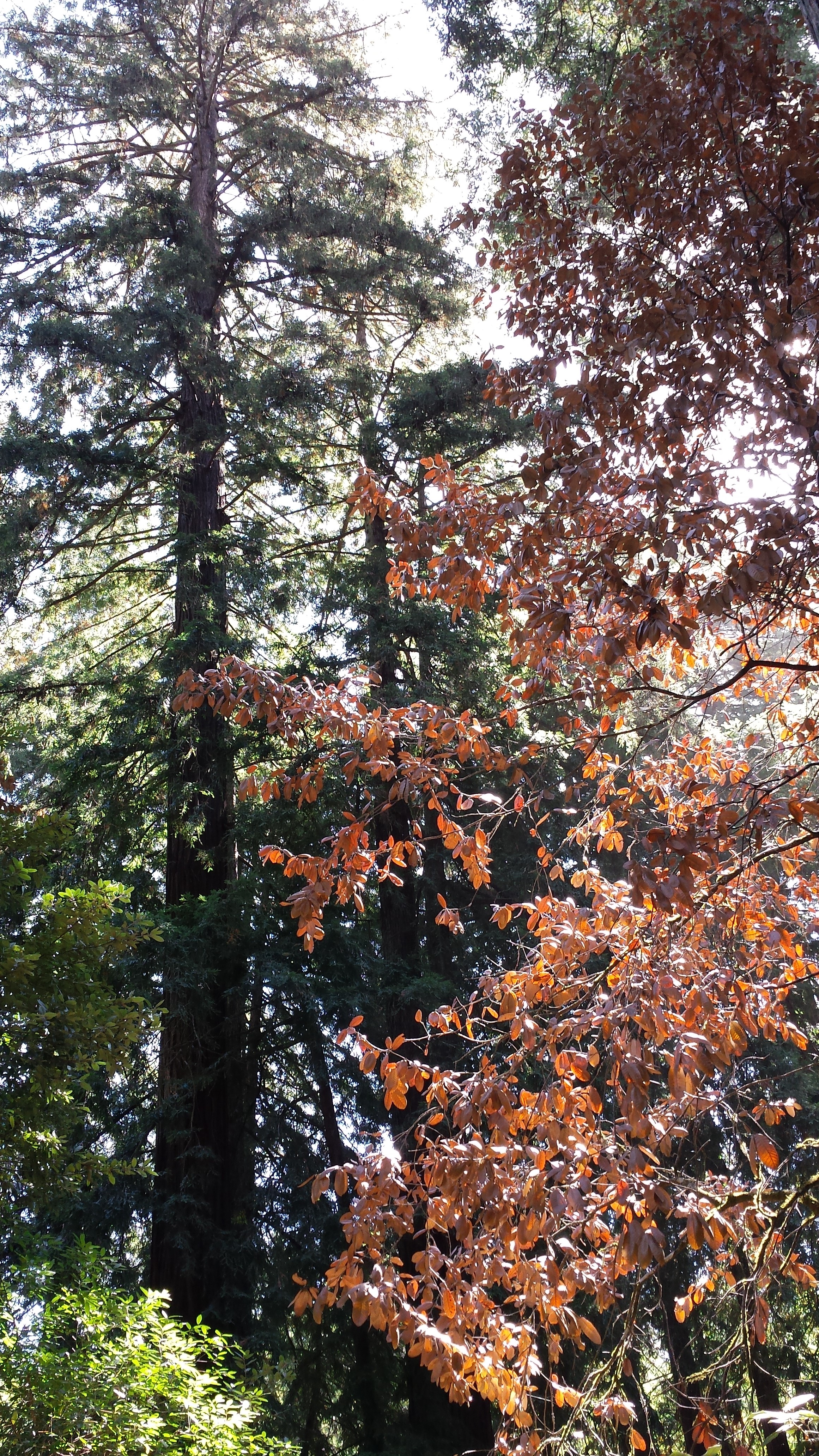
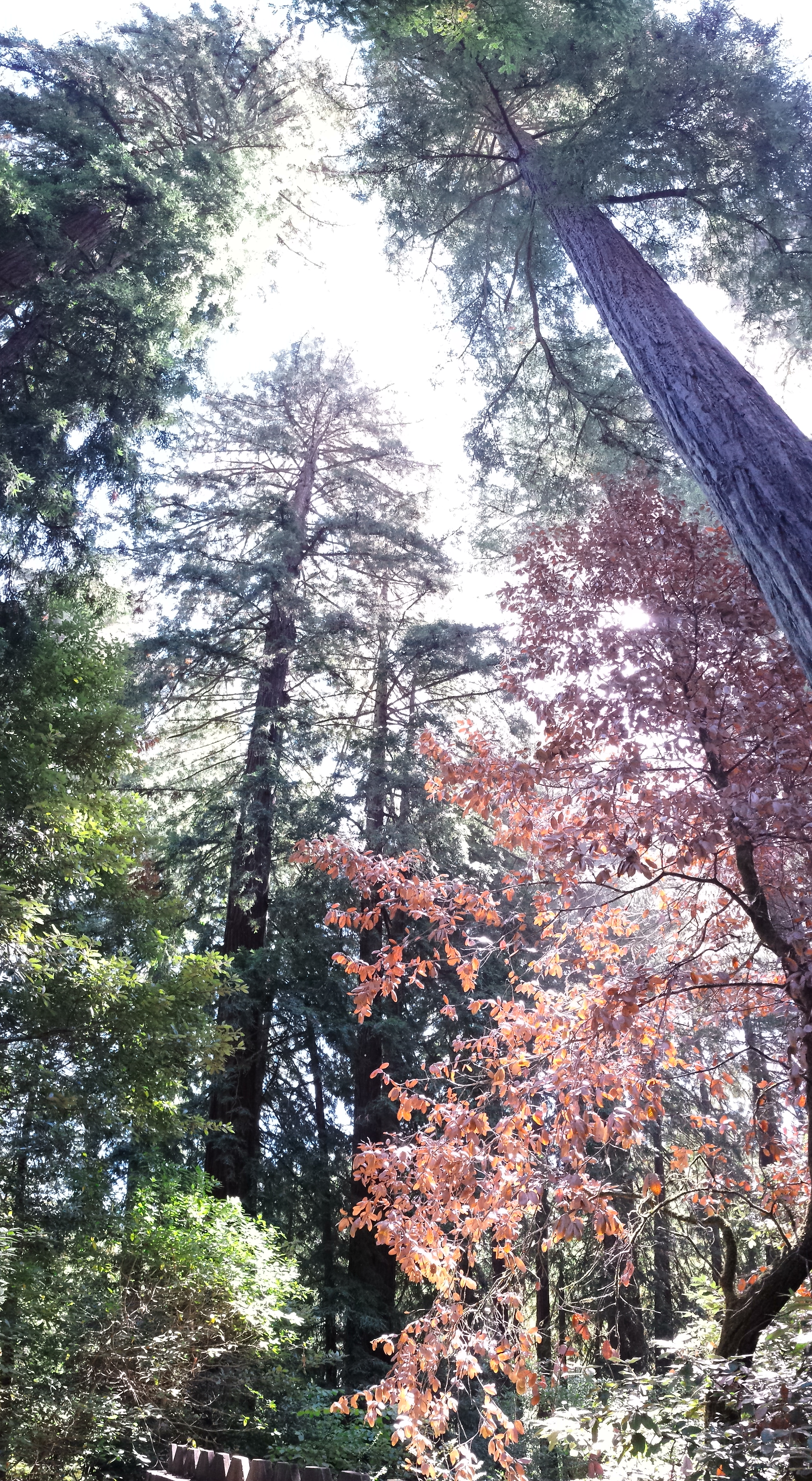
The big, old trees did not disappoint. While this path is not the Muir Woods, it still has a solemn visual grandeur – these trees are like nothing else in the United States, hundreds of feet tall, hundreds of years old, breaking the sunlight up into beams and hazy columns, carpeting the forest floor with their needles, bringing thoughts of what this region was like 10,000 years ago when humans were still being eaten by bears and mountain lions.
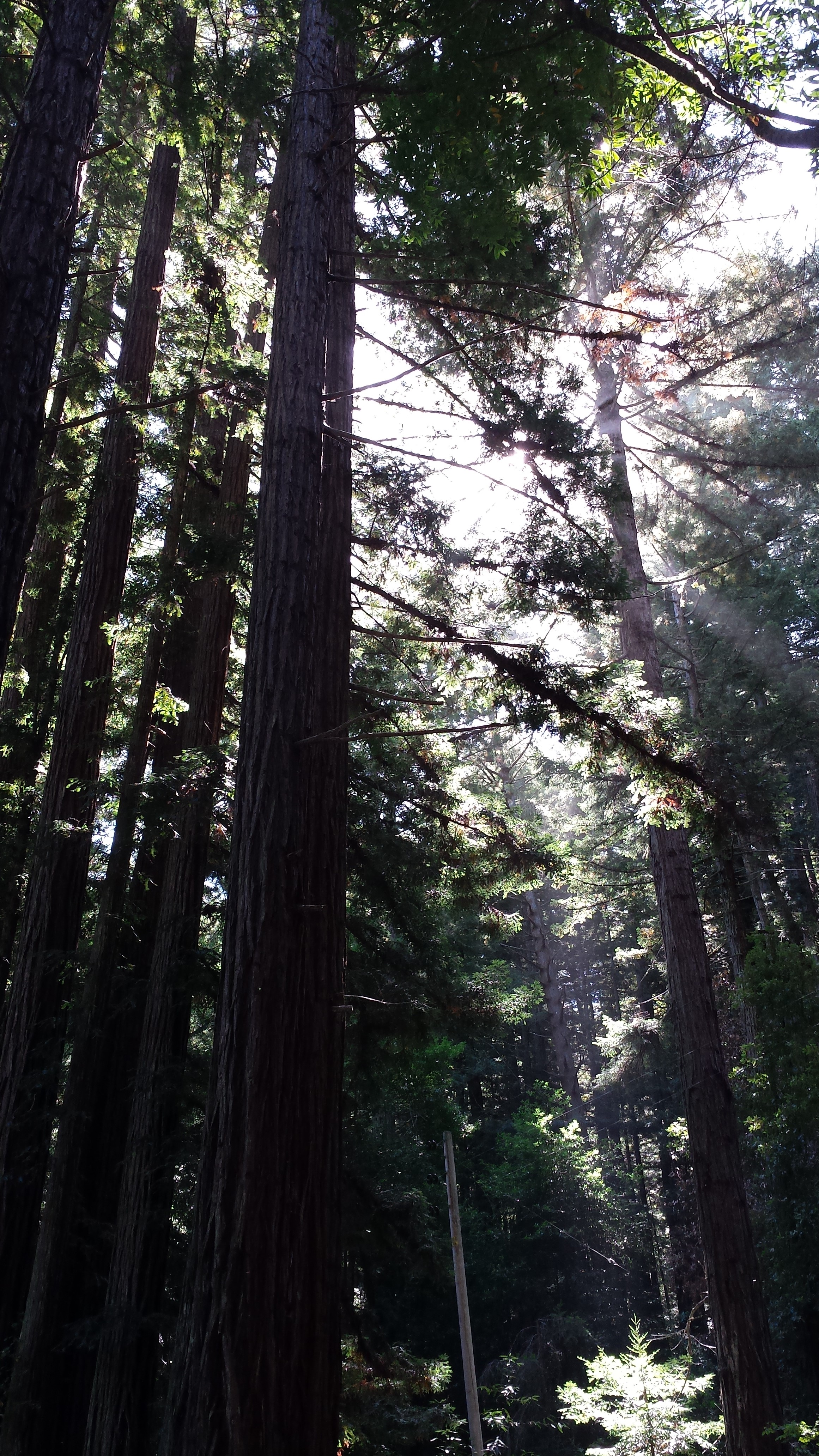
Gratuitous artistic photo attempt:
More majestic redwoods grabbing some sky:
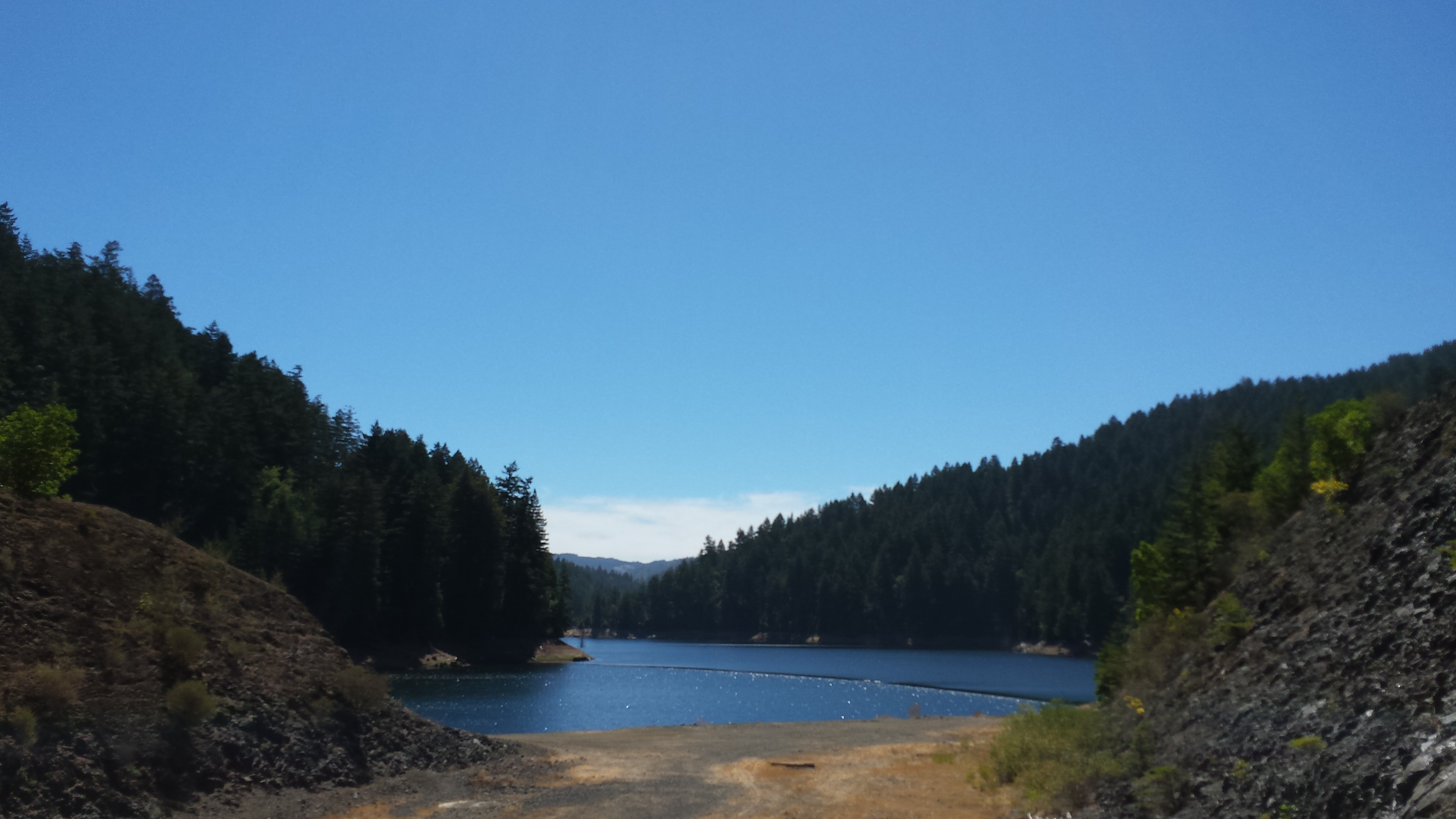
We reached the end of the main path and crossed over Sir Francis Drake Boulevard, finding an interesting option to stare over a railing and try to discern spawning salmon from 200 feet up a hill before attempting to bike up the Shafter Grade. The 15% grade and loose gravel defeated us, but after a couple of hundred feet of climbing and hauling bikes, we made it to Kent Lake. Pretty dramatic evidence of the ongoing drought in California – a dry spill way and water levels visibly down 10-15 feet from previous levels. The trickle of water flowing through Lagunitas Creek helped reinforce what the burned brown hillsides and fields were telling us – California is suffering the same over-use and under-supply pressures that our home state of Texas is:
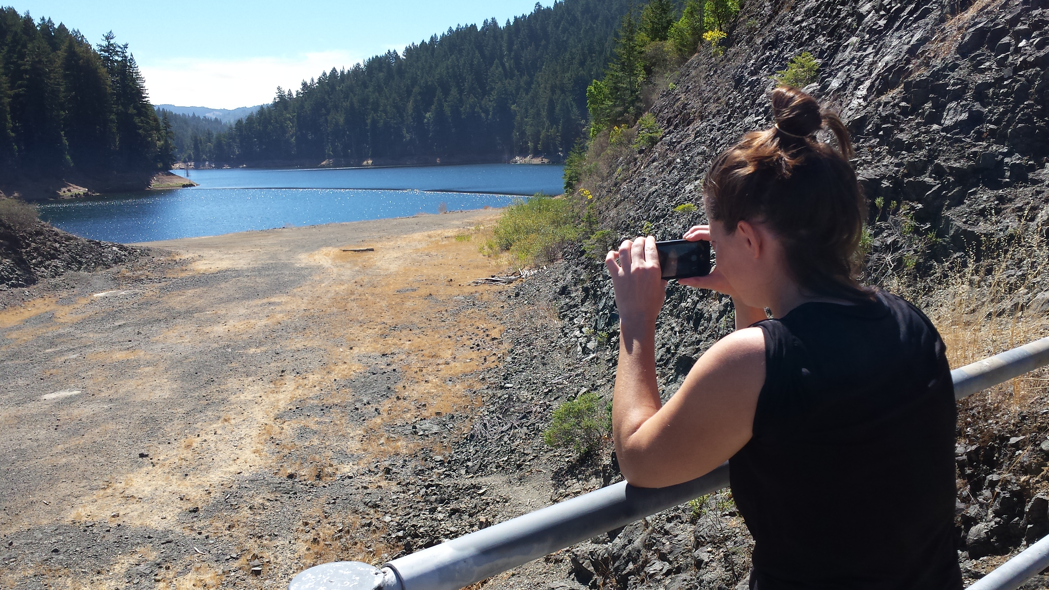
Capturing some grim statistics:
The only flat part of the Shafter Grade – getting up here on a mountain bike was more than we could pull off:
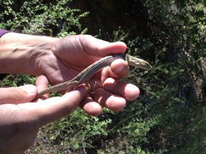
Evidently the lizard population is not upset about the lack of water – this one waited until almost being stepped on. Fortunately for it, we were not a hungry roadrunner or raccoon:
The return trip was a refreshing and quick ride – the trail is a visual treat without too much difficulty. Be aware that you’re riding less than 100 yards from a major northern California road for the entire way, with the associated campgrounds packed full of urban refugees and the hum of cars blasting CO2 into the trees. We don’t know if the redwoods will be here in 500 years, but one can hope.
2014 08 30 – The Problem Tire
You’d think after finding a flat first thing in the morning and having to borrow a random passerby’s pump to fix it would have led us straight back to the rental shop to a) ensure we had a working pump and b) to get the tube replaced. You’d think.
The road to hell is paved with good intentions.
After a bit of exploration and running up and down Limantour Road, we wound up at the head of the Coast Trail. Amazingly, my front tire had all of about 10% of the needed air for trail riding in it, and I still have no pump. Umm.
At this point, it’s ride the trail and hope to stop someone with a Presta-valve pump, or just hope that the bike makes it all the way out and back, or just be ready to walk. A 15-mile round-trip back to Point Reyes was not a good option. A wobbly chase down the Coast Trail all the way to Santa Marina Creek ensued:
For a view like this, I’ll take the wobbles:

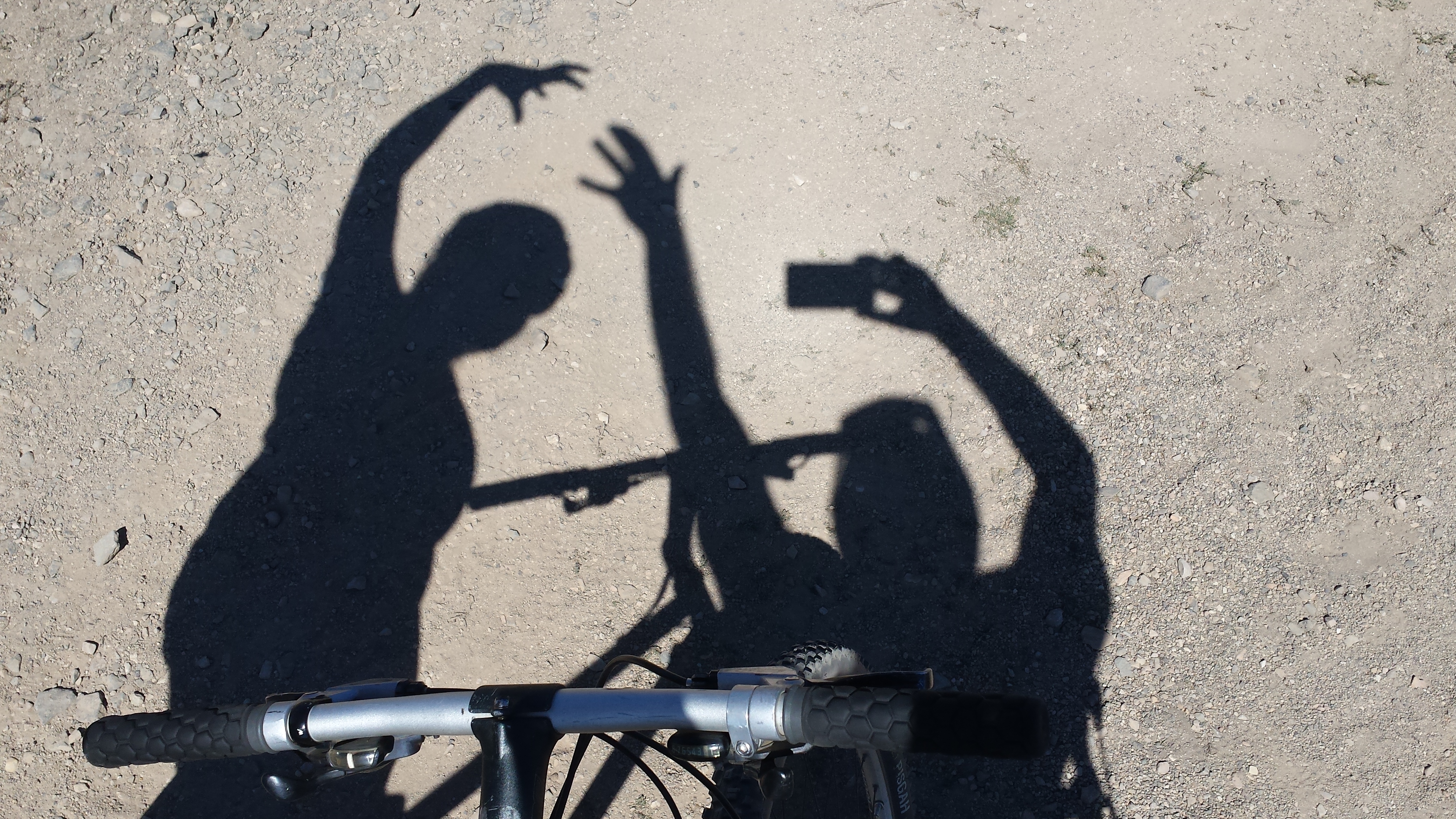
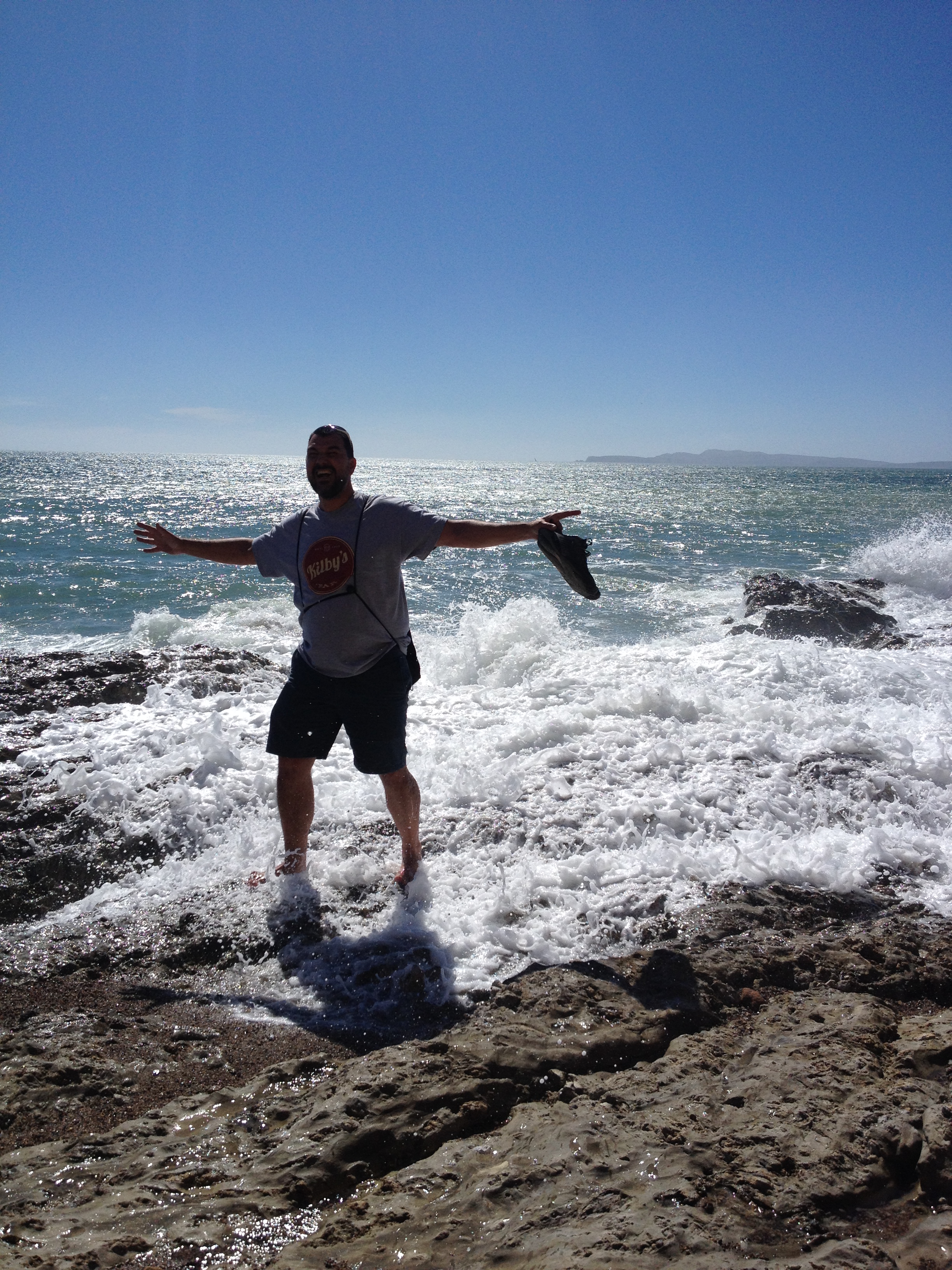
Mandatory shadow-pose picture:
We were pretty sure we wound up at Sculptured Beach, but based on Google Maps, we were actually about a mile north. Our bike-rental-oracle had mentioned high tides making the beach inaccessible, but what we were able to get to was pretty nice:
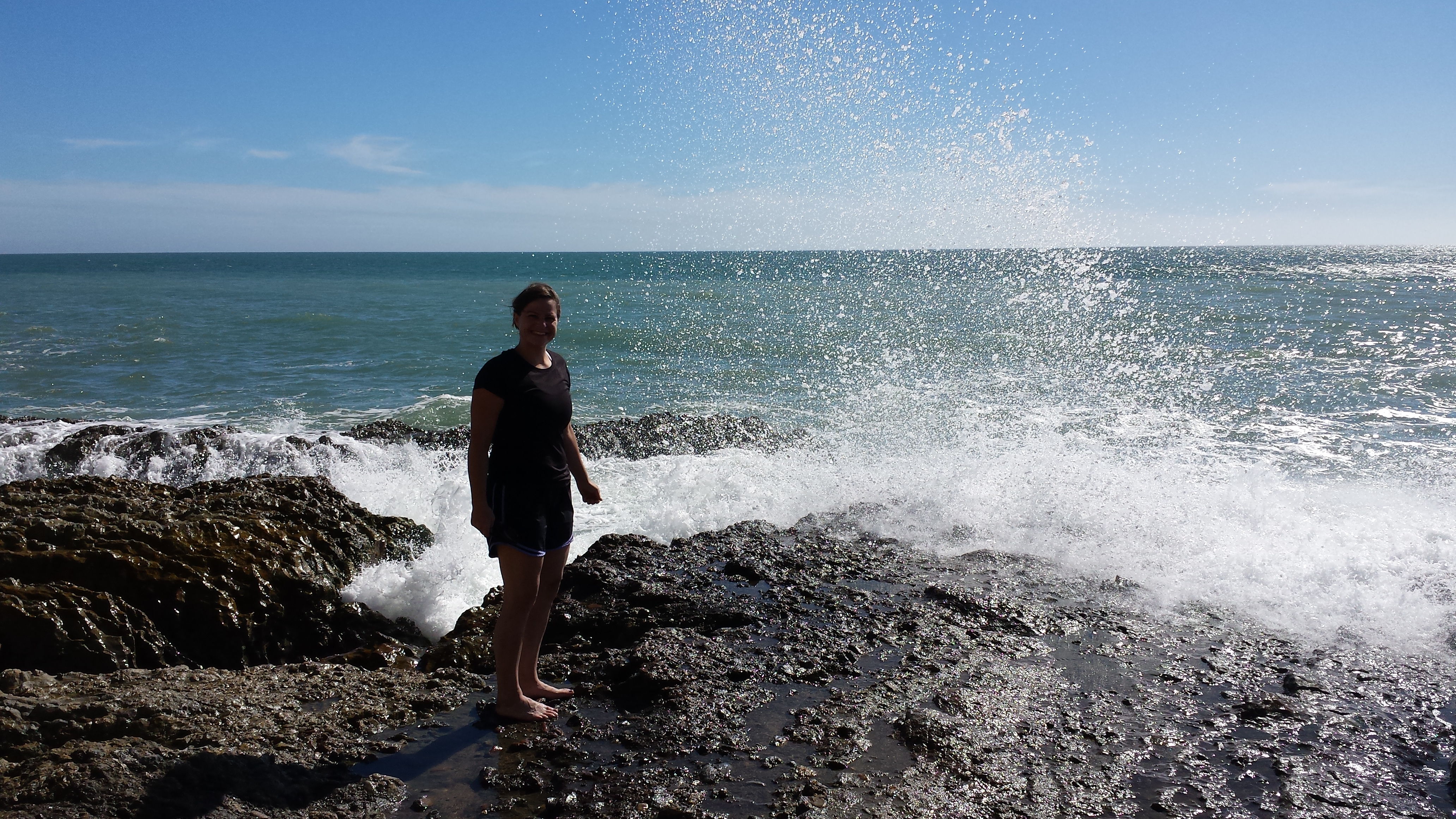
Nothing like 55-degree water on your back to wake you up after a long bike ride:
A less pneumonia-inducing location:
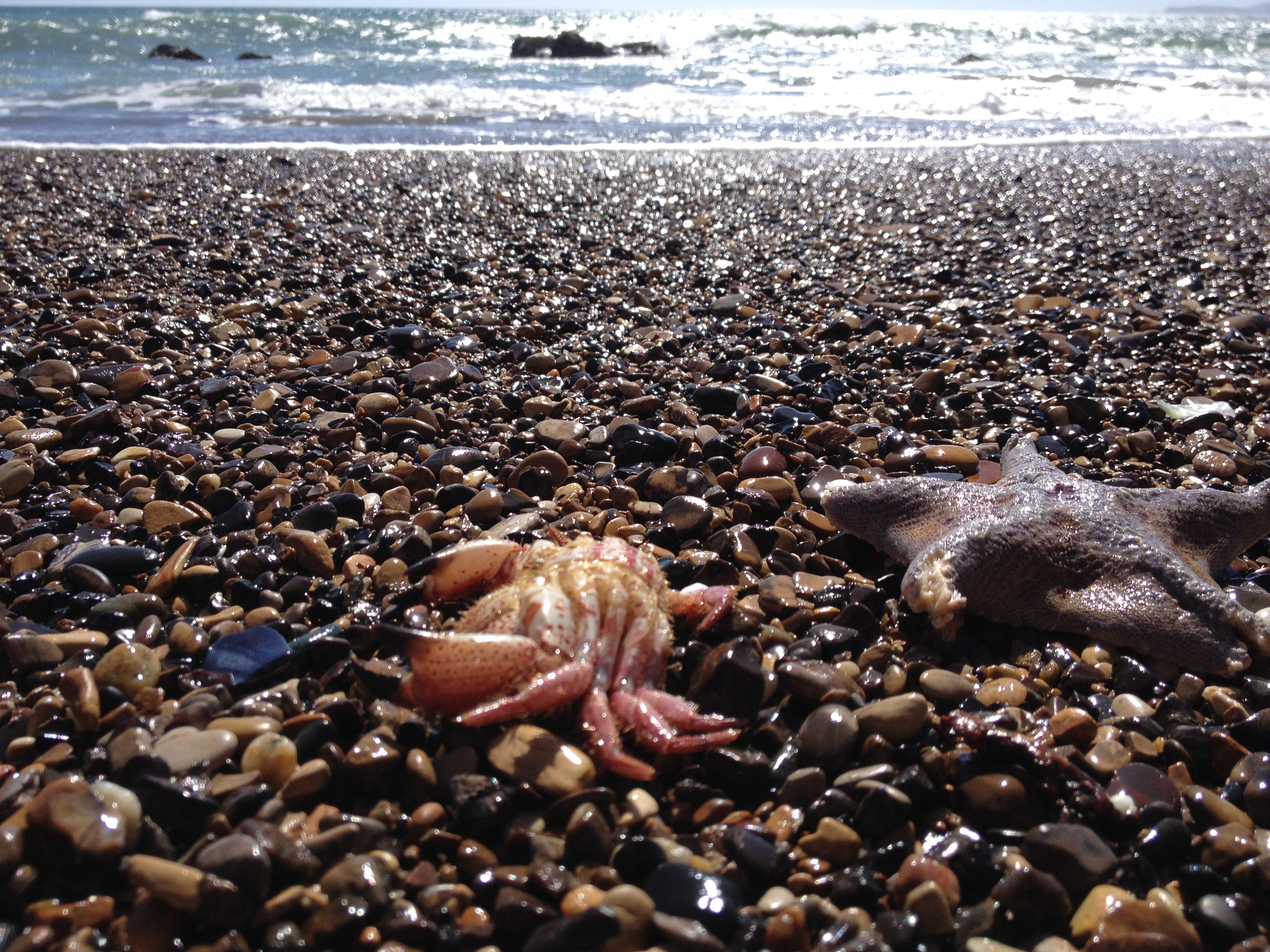
Patrick and Mr. Krabs evidently enjoyed their mussels too much:
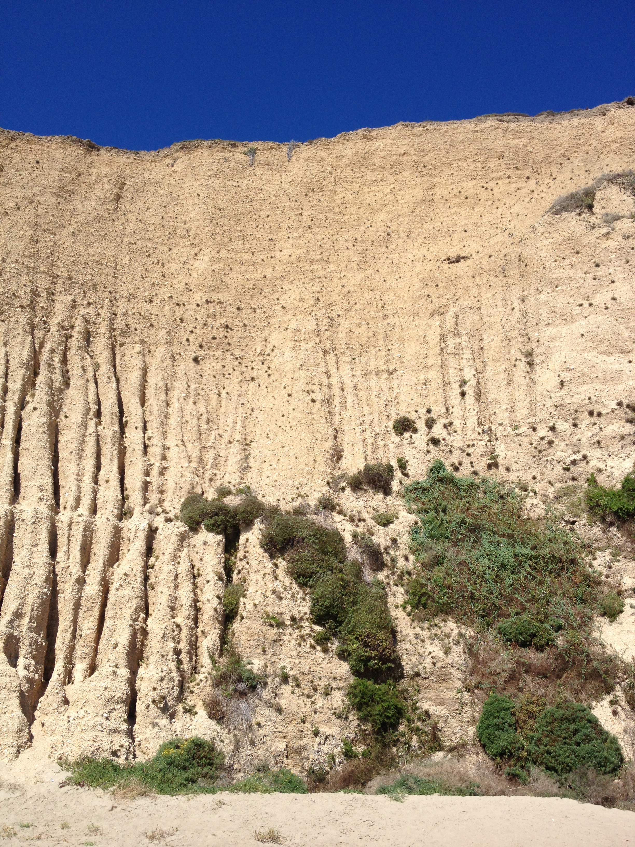
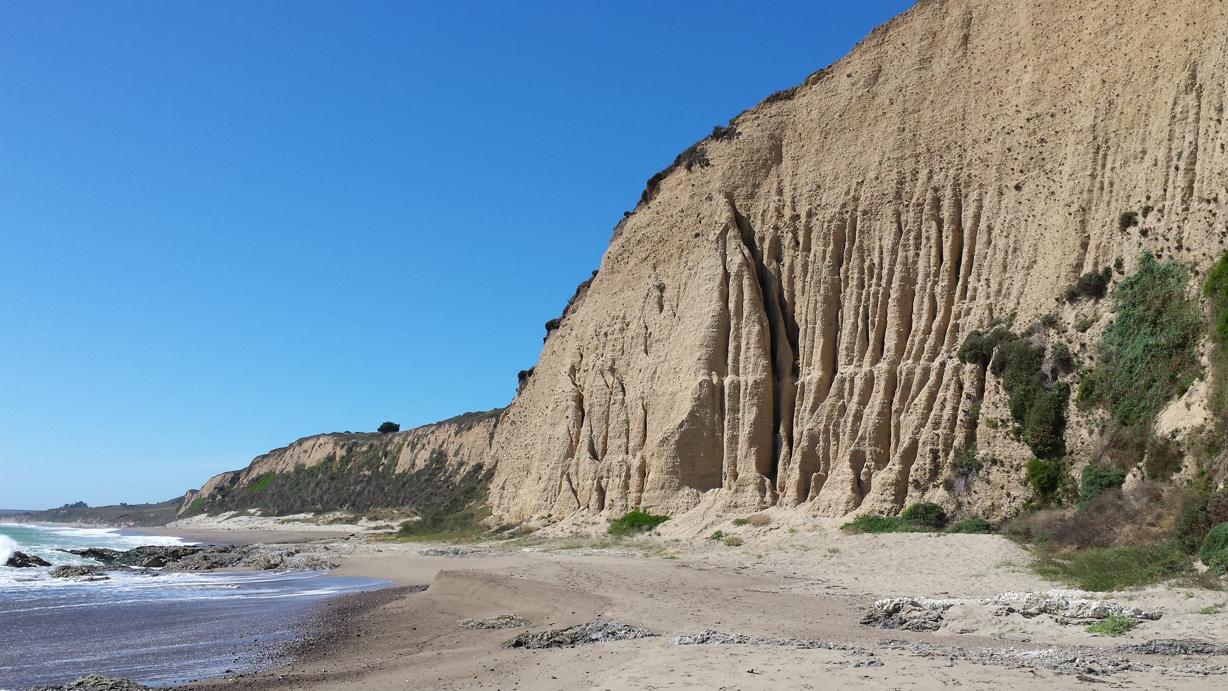
Erosion is cool:
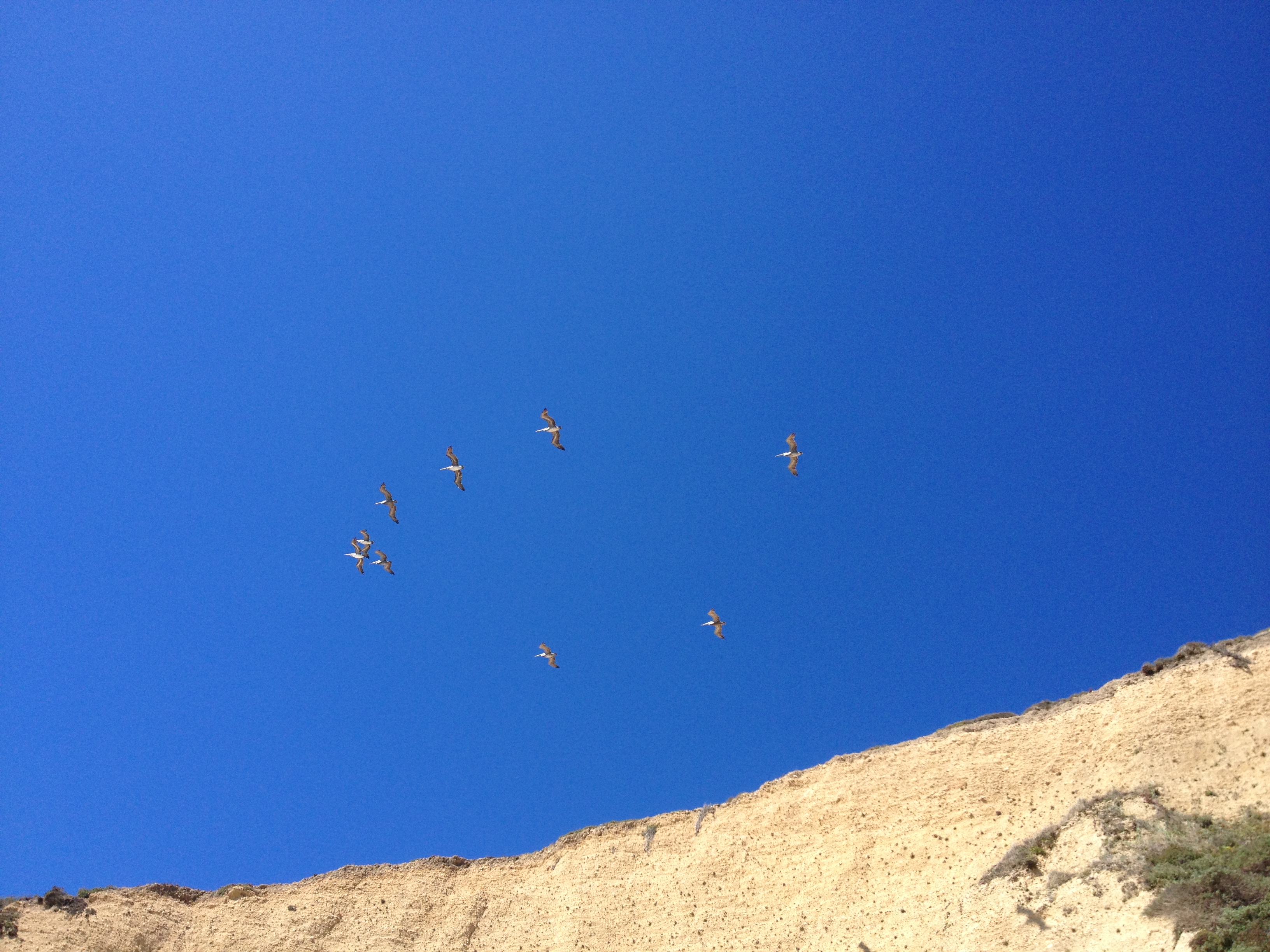
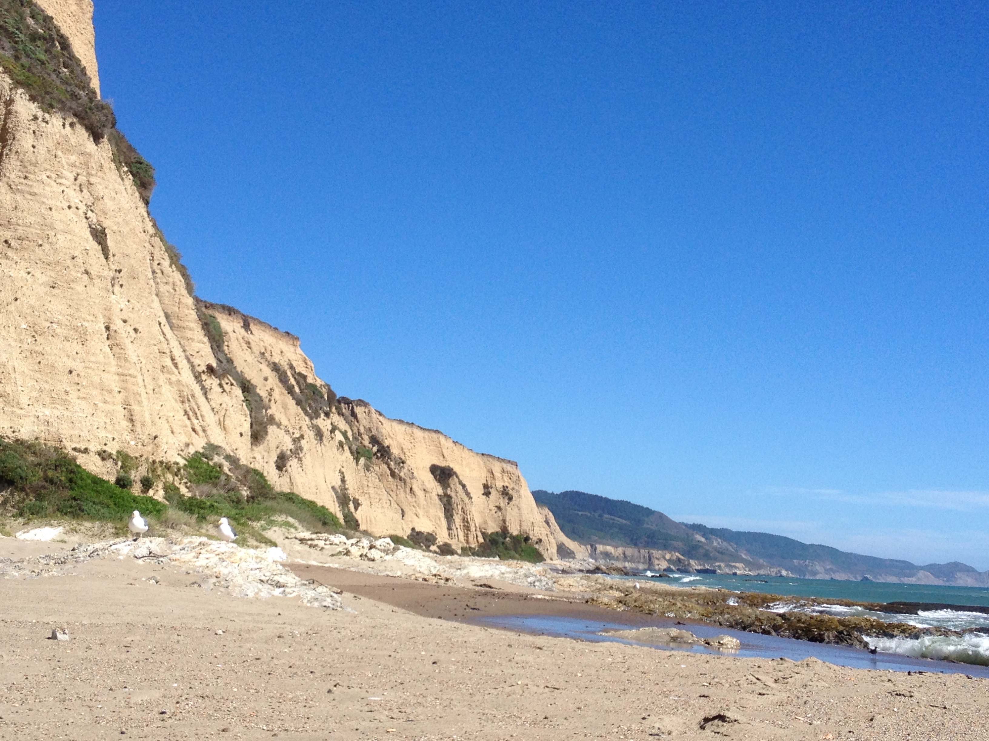
Swimming was not exactly an option – sneaker waves and lack of insulating feathers on our bodies meant we were stuck on the beach. Not a bad place to be stuck – looking up from a short, sun-bathed nap, we got lucky and spotted pelicans cruising the cliffside updrafts. No bombs were dropped:
The gulls were not impressed:
What you don’t see in this pic is the overloaded European family (husband, wife, and toddler) piled onto two bikes with a handlebar babyseat and what looked like a condominium worth of belongings strapped to themselves. Fortunately, buried in the condo was … <drumroll>a Presta-equipped hand pump</drumroll>! After borrowing gear from someone once again, the ride smoothed out, letting us enjoy the return trip:
After a winding drive back over the coastal ridge, a well-earned nap was attended to. All-in-all a great, easy ride and beach walk with some expansive views to take in.
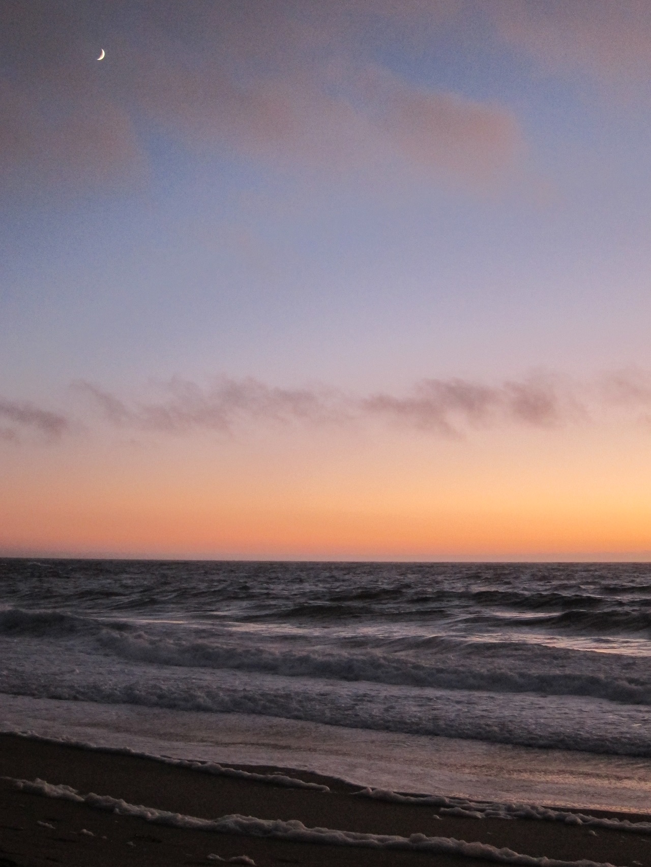
2014 08 30 – Pacific Sunset
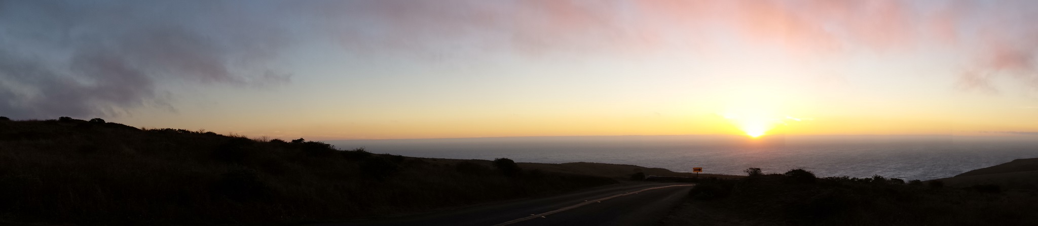
After two lengthy rides and a whole lot of ups and downs, a nap was in order, but we had to see the sun set over the Pacific at least once during our trip. With a 7:43PM sunset time, we pulled our aching bodies out to the car and headed north from Inverness towards Tomales Point. We pulled across the top of the last hill before the last major bend in the road just in time for this:
Having driven all the way up here, we had to go explore some more A short 1/2 mile walk down to the beach was nice, only interrupted by a family of 20 heading back up to their cars:
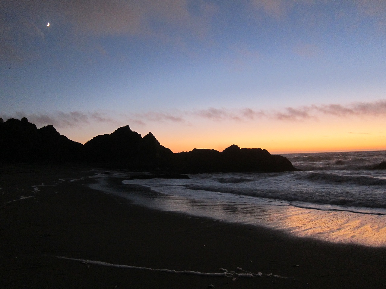
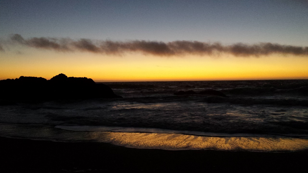
The beach here was nothing like the long stretches of sand further south. This was heavy Pacific surf crashing in hard enough to leave spume on the sand and keep a steady low roar in our ears. Walking on loose sand is some intense exercise, but we made it another 1/2 mile south to see this – the moon rising and the sunset fading over an outcropping of rock with some 5-10 foot breakers crashing against it:
No way to get a picture, but a seal shadowed us for about 20 minutes, floating in the crashing surf and staring at us whenever it surfaced.
As the final light of the day faded, we headed back, catching a few more pictures against the western horizon:
Heading back up an unlit trail through a narrow canyon, surrounded by deep brush, I had time to think about the warnings of mountain lions in the area. My Assistive Light app did not inspire confidence, but we made it back without any unexpected encounters. Mission accomplished, we followed a slow-driving minivan down the hill through the ranches and dairies that divide the point with fences. Dodging a galloping skunk proved to be the only dangerous wildlife encounter for the evening. A veggie burger and drinks at the Station House Café wrapped up the day nicely – crowd-watching in northern California is always entertaining.
2014 08 31 – Laboring on Highway 1
After every great weekend comes the unfortunate trip home. I’ve been trying to figure out how to be a travel writer since I first learned about food porn, so I wouldn’t have to ever come back from vacation. No luck yet. We at least planned to see a section of Highway 1 on the way back.
First stop was dropping off the bikes – they had been entertaining at least. Not very hungry but needing caffeine, we tracked down Toby’s Coffee Bar located inside Toby’s Feed Barn (of course!). While waiting for espresso, we were asked an important question:
Once we answered that (of course we have, who hasn’t?), it was time to head south. The bicycling hordes kept the many bends and hills along 1 very exciting – dodging cyclists on the right and oncoming traffic weaving over the double yellow lines on the left – but no one was hit by a rearview mirror or a bumper. As we passed the various trailheads leading into the national seashore area, we fought temptation to stop and go wander.
Traffic started piling up as the morning departed, making our first stop to figure out what was sitting in the middle of Bolinas Lagoon a bit sketchy. I can verify by having looked through a pair of binoculars (shared by the hairiest retiree I have seen in years) that this fuzzy digitally zoomed photo includes a small gang of harbor seals:

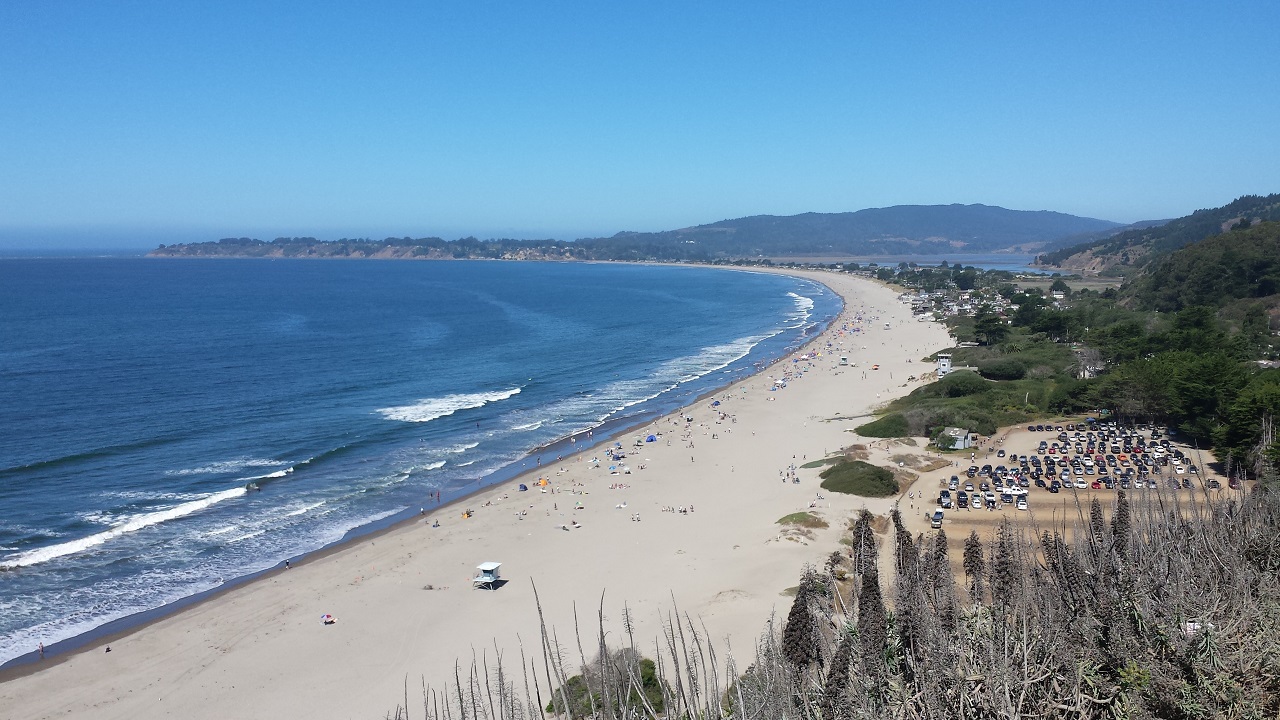
We thought about pulling into Stinson Beach and seeing the ocean one more time. After seeing the main drag packed with a Labor Day crowd and circling through the beach parking area in a vain attempt to find space, we headed south again. The climb out of town was a reminder of the insanity that is California. From central Stinson all the way around the end of the peninsula, northbound traffic was bumper-to-bumper and moving 1 mile per hour. We saw several people able to just get out of their cars and walk over to the roadside for a picture without slowing things down any further. Sounds like a great way to spend your day off from work.
The view back across Stinson Beach – beautiful, if you ignore the swarm of bipeds stomping all over the place:
A better view with less crowd:

I mentioned the traffic – see the right side here:
Riding with one hand out the window is fun:

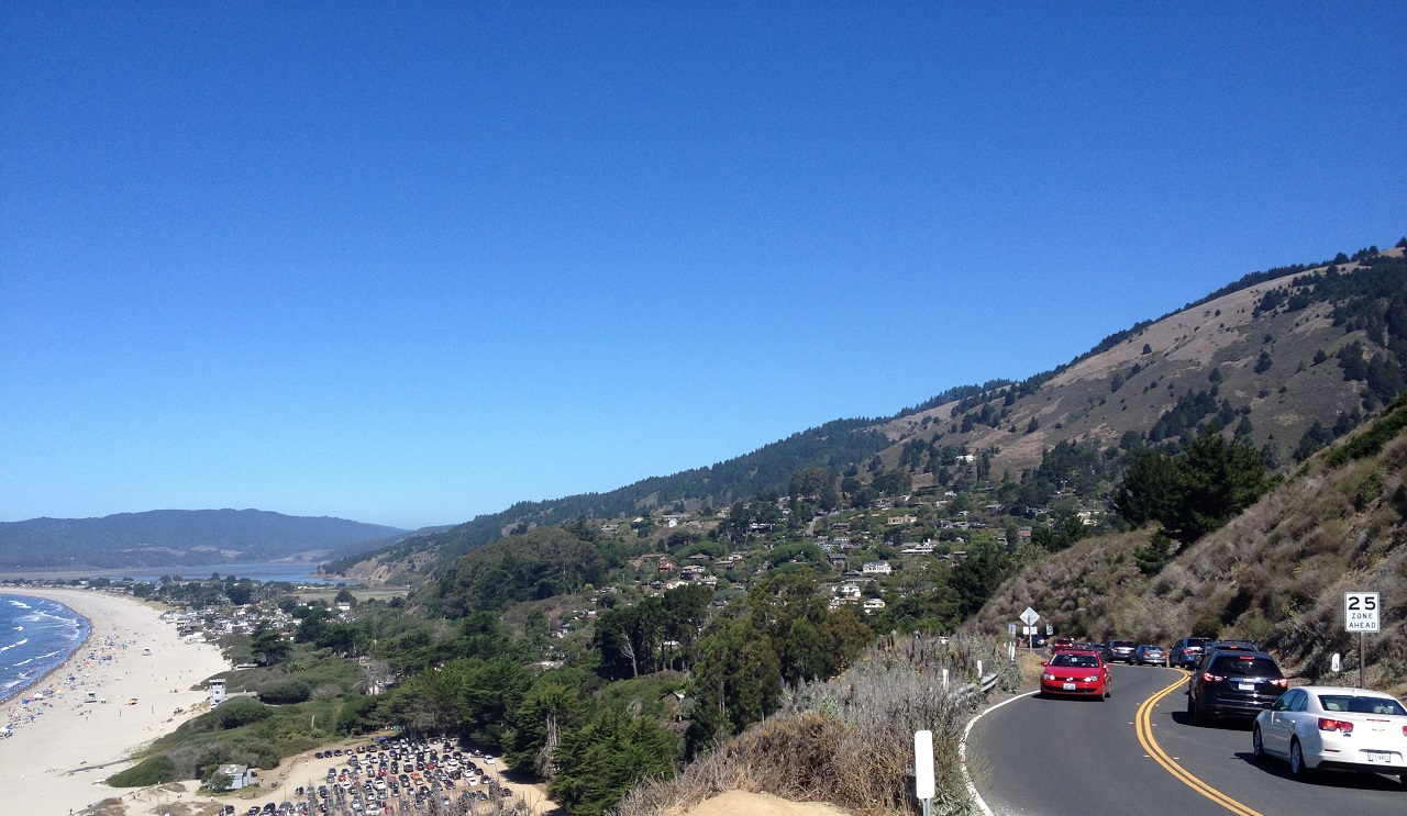
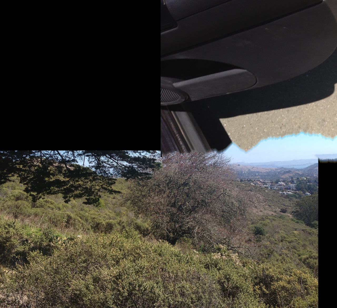
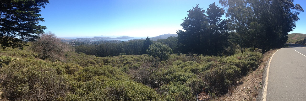
Before we got back into town, we stopped overlooking Marin County. The iPhone camera can be a bit non-intuitive to use – they actually did not replace the skyline of San Rafael and Sausalito with the passenger door of a Jeep Compass:
Second try, more successful:
The Muir Woods were on the itinerary, but the Labor Day weekend defeated us. Parking 3 miles from the park entrance and dodging between double-parked cars and oncoming tour buses looked like less fun than your average oral surgery. Maybe next time. All-in-all, still an impressive drive, leading us down to the Golden Gate Bridge …
2014 08 31 – Golden Gate Chaos
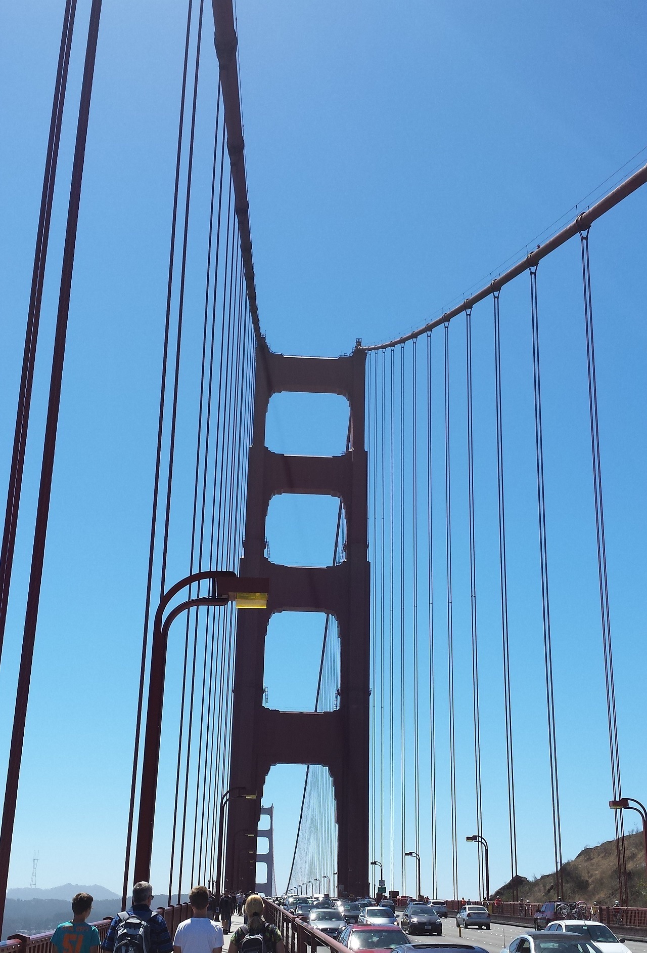
Before we made it into downtown, we had to make a stop a the Golden Gate. We originally planned to rent bikes and ride back and forth, but our wandering return to the city cut us a bit short on time. I knew the northern end of the bridge and associated parks would be busy, but neglected to factor in the Labor Day weekend. I’ve been in calmer places. Managing to jump off the freeway and get behind a departing bicyclist dad and his son in the parking lot, 30 minutes later we were wading into the fray. With the west side of the bridge being bicycles only (discovered after nearly being run over by a few), we found the ramps under the freeway to the east side. Up, down, sideways, between the hundreds of people going every direction. One the one hand, I was impressive to see the number of nationalities and families. One the other hand, after the relative quiet of the Point Reyes shore, the bridge felt more like a zoo.
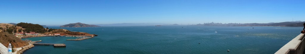
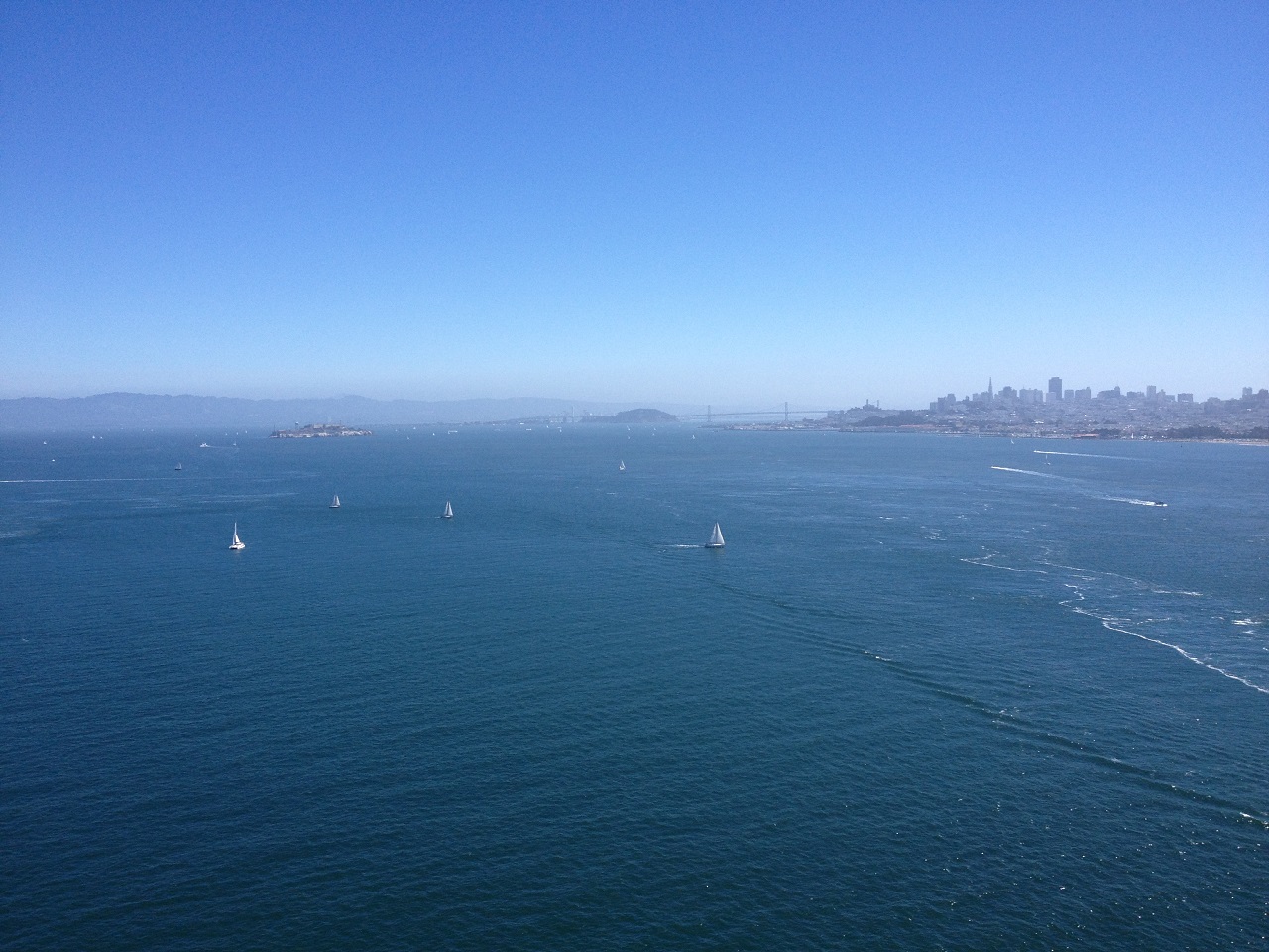
From the north end, the view to the east is pretty impressive – clear weather let us see Alcatraz, Treasure Island, the Oakland Bay Bridge, downtown, and the flotilla of boats cutting through the powerful currents streaming under the bridge into the bay:
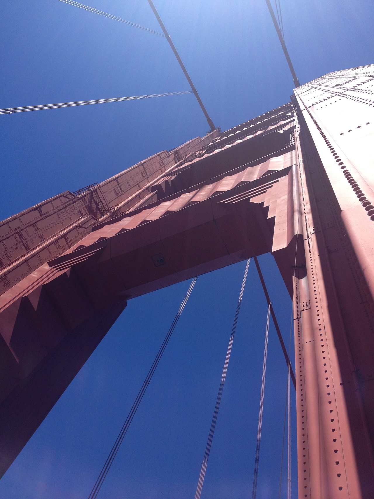
I’d driven across the bridge once before, but being on foot makes the scale of these towers much more impressive:
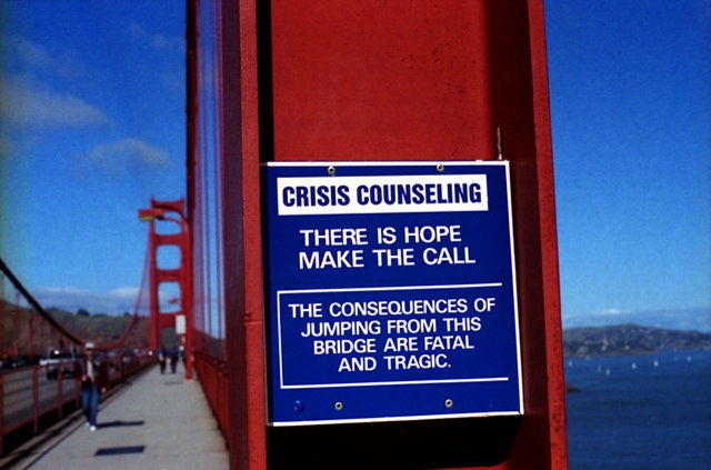
A grim reminder of how many people end up on this bridge looking for something other than the view:
2014 08 31 – Crowds, Hills, and Good Food
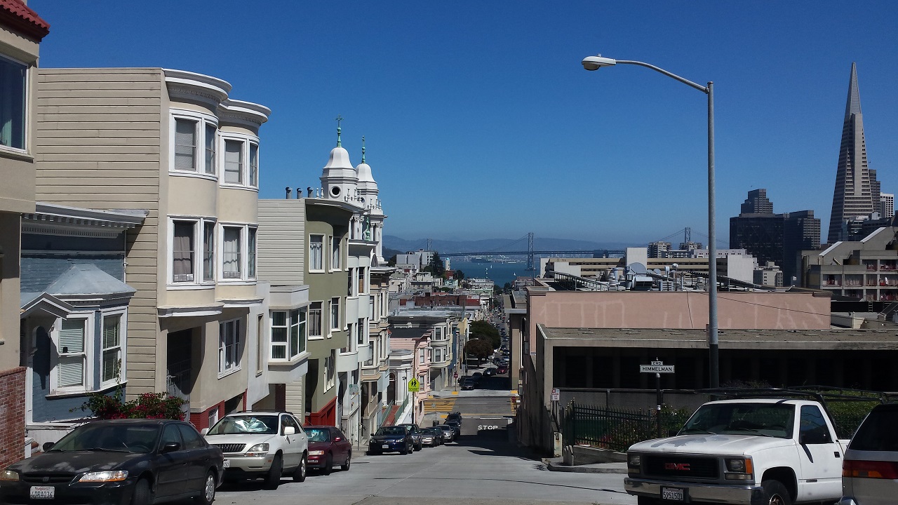
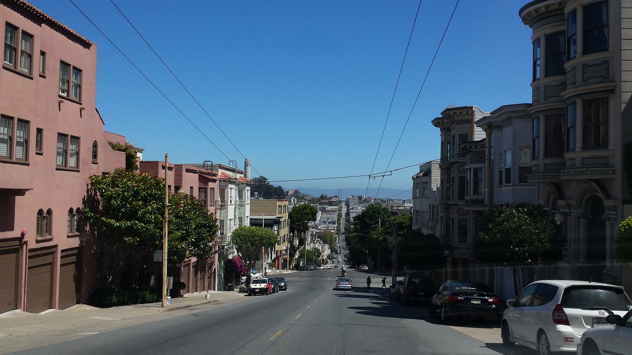
After a relaxed weekend away from the city, we decided to make a quick tour of San Francisco on our way to the airport. It is one of those cities that is completely distinct, architecturally, geographically, and culturally. I am fairly certain if you were magically dropped into the middle of any part of the peninsula, once you opened your eyes you’d know where you were in less than a minute. The areas around Nob and Russian Hill provide the unique 30% grades and hills dropping away or climbing for blocks:
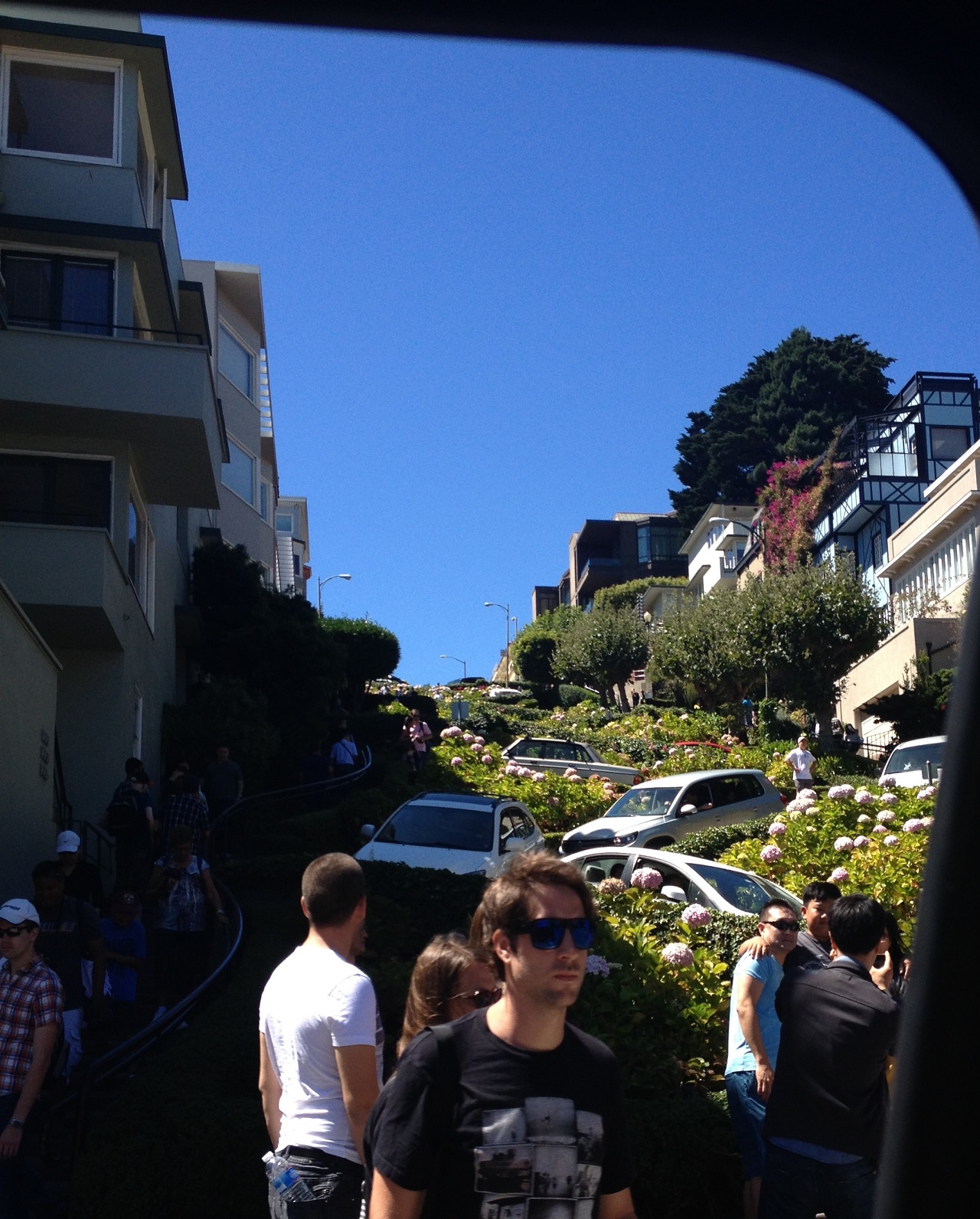
We momentarily entertained the thought of driving Lombard Street, but the 2 hour wait to drive a block of winding road seemed a little silly. We settled for angering the traffic cop at the bottom so we could snap a slightly confused pedestrian with the hill in the background:
All that excitement left us hungry and thirsty, so we looked around for somewhere quiet to stop before we hit the airport. Google knows all and pointed us to the corner of Mason and Union and the Trattoria Contadina. On any night of the week, I am sure this place is jammed full of noisy people, but at 1:30PM on a Saturday, it was perfect – nearly empty, great view of the street, a nice slice of San Francisco culture. The deviled eggs and the Molto Bueno (an awe-inspiring mess of breakfast on top a salad with balsamic vinegar dressing – damn) were great. Equally good were the people outside the café windows – a young couple trying to figure out a two-seater bike ride south up Union (they didn’t make it), the guy on crutches with only one working foot who made it up and down the hill, and the two college kids walking home, one carrying the toilet paper, one carrying a roll of paper towels.
A nice end to the week, but time to head to the airport.
