
Arkansas was more of an accident than an organized adventure. Mid-2011, we found ourselves with an unexpectedly obligation-free holiday weekend (this is normally how the trips start) and debated our options. We had taken a few short road trips, mainly in Texas, and one quick trip to Santa Fe, NM, which involved air travel. Up until now, free time was limited with two school-aged kids in one house, full-time, chaotic work, school and sports schedules, and life.
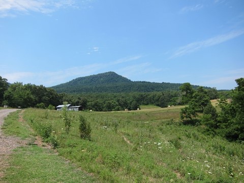
The goal was to do something different, go somewhere new but within driving distance. A cabin in the woods sounded appealing, but … Texas. “Cabin in the woods” options are limited. We considered Oklahoma again, but since we had some extra time, one state further out seemed manageable. Neither one of us had ever explored Arkansas (or even been there), so the Ozarks it was. Searching the ever-expanding Internet, we found a tiny cabin on VRBO (exciting newness in the ancient year of 2011) which fit the requirements. Located in a town called Snowball, smack in the middle of the rolling hills of Arkansas, it looked like a promising fit for a weekend escape.
Friday 2011 07 02
Seven hours of driving on a Friday night after work? We got this. Work finished around 5, and we determined it would be pointless to get on the highways going out of DFW as they would be slammed with traffic. Why wait in traffic when we could wait while eating seafood and having a post-work beverage?
After getting on the road, we discovered (again) holiday weekend traffic sucks – this was sufficient rationale for another stop before completely leaving DFW. Free time at this point in our lives felt so limited that any time we were untethered, it was time to jam oodles of activity into the day. Translation: Slow progress, multitudinous beverages and calories, and eye-wateringly late arrivals at all stops. Three hours into this one, and we were right on track …
We knew it would be a long night as we headed east on I-30 through east Texas while the sun disappeared behind moderately promising storm clouds.

It was well past dark when we crossed the border into Arkansas. By the time we hit Little Rock we found that at least judging by recreation areas named Toad Suck and the shelves on the gas stations, our perceptions about Arkansas were correct. We were tired, out of conversation and focused on the destination. Many hours later than planned, we finally turned north and disobeyed speed limits on US 65, eyes propped open with straws and coffee.
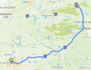
When we rolled into Marshall, a little town sitting on US 65, we knew we were getting close. We didn’t realize how long that last 30 minutes would be. Marshall to Snowball is only about 13 miles, but on this night it felt like 100. Dodging deer while we navigated seemingly endless winding hills at the end of a long late night drive was a change from our Texas home, where roads are straight, flat and unobstructed with such obstacles as trees. A cabin in the woods is a great idea for a vacation, but not when your arrival is after midnight and streetlights are non-existent. Working by the light of the moon, we drove the little Kia Spectra over gravel roads, following the carefully laid out instructions by the owners. They might have modified those had they known guests would be arriving in the wee hours of the morning.
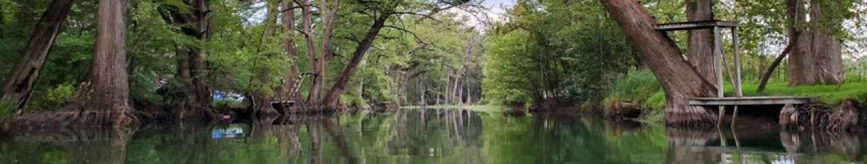
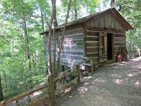
Arriving at a bend in the gravel road a sign matching our instructions led us to a large gate, surrounded by trees in the middle of nowhere. Only a short drive to bed now. It would have been a great place to explore in the middle of the night (we’d do that later) but at this point, we just wanted a bed. Any bed. Noting a stuffed black bear hanging out in the very rustically decorated living room, we dumped gear on the floor. The scenic loft was two seconds further away than the main floor bed – we chose the one downstairs.
Saturday 2011 07 02
One benefit of a cabin far out in the woods – quiet. We did not wake up early. Aware of a lot of exploration to be done, exhaustion took priority. Emerging from our comfortable bed into the Arkansas swelter, we determined the screened in porch was perfect. We would come to appreciate that more in the evening, when the army of central Arkansas insects and spiders multiply and attempt to land on, cling to, and in some cases suck blood out of anything not covered in DEET. For now, we only encountered the less aggressive members of the arthropod family as we wandered around the acres on this property:
The first of many (many, many, many …) insects to attach themselves to the Kia Spectra – this one would seem to be poisonous but the internet says it’s just a friendly Banded Tussock Moth caterpillar:

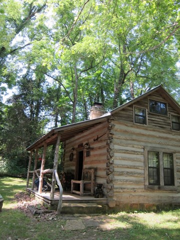
Admiring the 100-year-old cabin in the daylight, we congratulated ourselves on a random and minimally organized trip starting off pretty well:
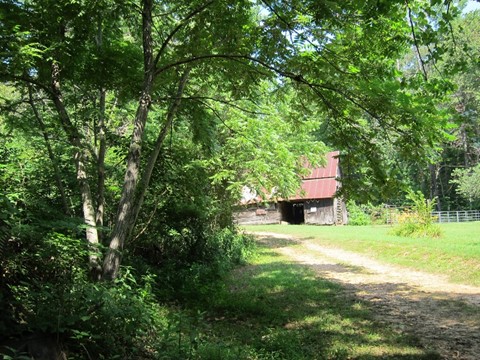
One of several buildings scattered around the property, the leaning and ramshackle barn demanded closer investigation:

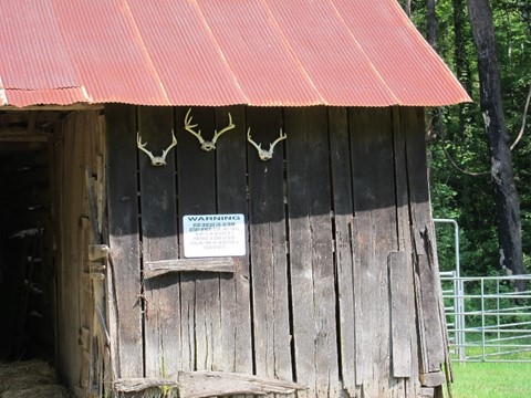
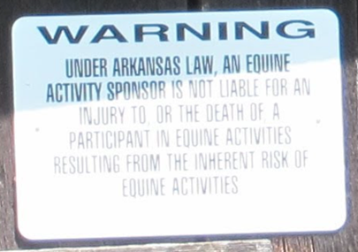
Moving past what look like exotic flowers, we noted the less friendly warning sign, accented by the parched remains of Bambi’s family …
After 100 years of living in the heat, humidity, and winter-time cold (which we dreamed of on this trip) of the Ozarks, the back of the barn isn’t faring so well. We wondered how many years it has left before it crumbled …

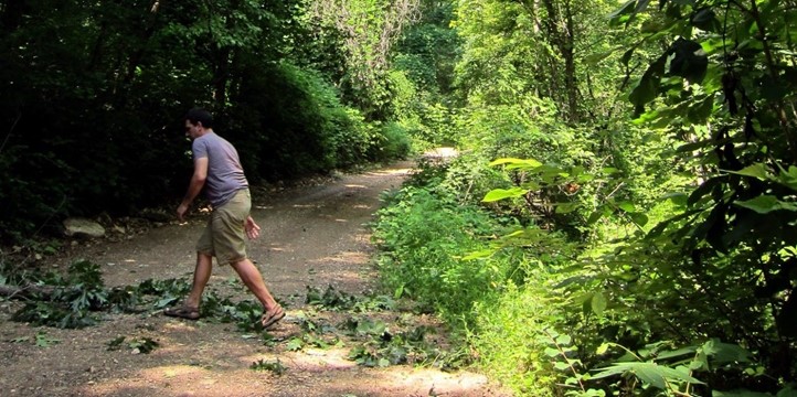
At this point, we still packed food for trips, so after breakfast (or timing-wise, brunch) in the cabin we headed out to explore. We were curious what was on the other side of Snowball, the area to the northwest that borders the Buffalo River, and which shows as a big green blob on Google Maps. Navigating the farm and ranch roads and skipping a few logging trails that led off into the woods, we quickly lost ourselves wandering. Reminder that our vehicle was the durable little Spectra, not exactly the ideal transport for off-road exploring.
Despite the bumpy ride, views were beautiful, as long as we kept the windows rolled up and the AC on high.
The further we traversed on this dusty old road, the more difficult it was to get through. Some spots required us to hop out and clear the brush before continuing, resulting in photos that could be mistaken for Bigfoot brazenly crossing the desolate forest road in the daylight:
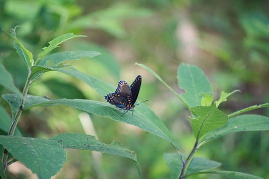
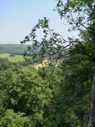
Along the way, we finally spotted a hiking trail and got out to take a walk in the brutal, sticky heat. Arkansas is gorgeous from the inside of an air-conditioned vehicle. Stepping outside requires one’s body to adapt. A few steps out of the vehicle, and the body immediately tries to start pouring sweat out of all available pores, almost as if it’s consciously rejecting the Ozark air. Unfortunately, that air already has more water in it than one would think possible – keep your sweat, puny human. We fought our way through what felt like the inside of an oven, and hiked through the trees, looking for poison ivy, eating spiderwebs, and occasionally snapping a picture.


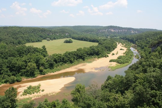
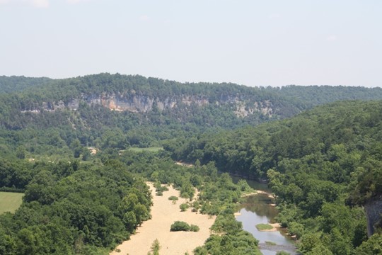
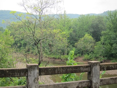
In 2011, maps weren’t quite as proficient as current day, therefore we had no idea where we were or what was over the next bump in the trail – the good old days. Navigating through some brush and pushing some branches out of the way, we found ourselves on the side of a cliff overlooking a broad, deep river valley, stretching east and west next to the farm and ranchlands. Right. The Buffalo National River. That’s where we were.
Looking at what we thought was a sadly depleted river, we worried about evidence of multiple dry years. This is actually normal for the Buffalo, which gets large amounts of water in the spring and fall but drops significantly in mid to late summer.
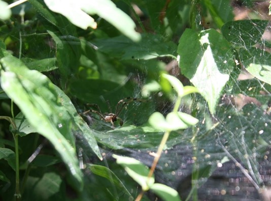
More wildlife to document on the way back to the car, with the first of many spiders …
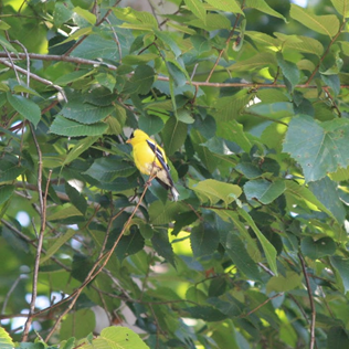
And birds …
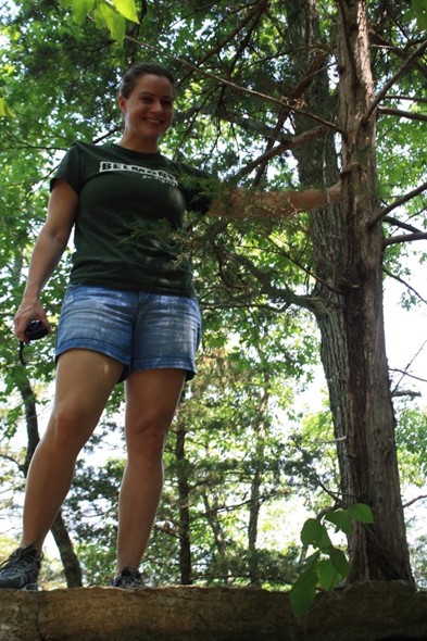
Trees to climb …
And creeks to hop across … Almost as much water here as in the river.

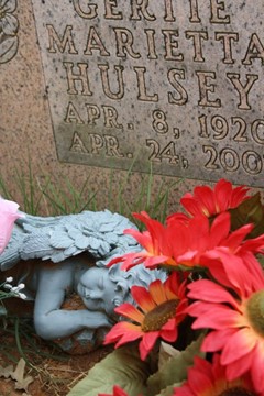
After our short hiking adventure, we got back in the Kia and headed in the general direction of Snowball. It was time to find some lunch – we were still getting a grip on our remoteness here. On the way into the tiny town, we passed the gate for the Snowball cemetery, and we had to stop. For a central US location, this isolated little cemetery has been around a while. Headstones dated back to the late 19th century, and like many other rural cemeteries we would find, some people had to make do with less than professional typing on their memorials:
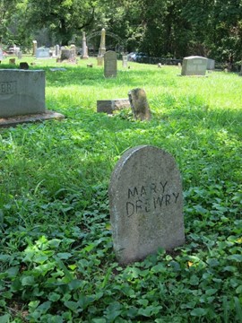
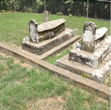

Imagining what life would have been like in this area in the mid-1800s, we were immediately thankful for bug spray, air conditioning, and cars, not to mention indoor plumbing. The facilities available to the still living cemetery guests were less than optimal. Inspection (but not use), showed a … Folgers can? Finding no specific labels, we were left guessing Folgers Coffee = men’s; plastic flower bouquet = women’s.


Driving away from the graveyard, the names stayed in my head. Who were they? Where did they come from? There were multiple stones with the last name “Drewry”, one specifically whose stone claimed she was “asleep in Jesus” since her death in 1968. What were their stories? In another hundred years, would anyone know they ever existed? That incidental little trip to the Snowball cemetery would result in many years (still counting) of fascination with cemeteries, history and of course, ghost towns.
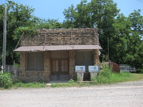
Snowball looked a little different in the daylight. It doesn’t appear that this is a functioning town, but someone is partially keeping up some of the buildings. As far as we could tell, there was only this unattended and faded gas station and the old general store left. The name Snowball was unintentional. A Masonic lodge built in the 1880s was called Snow Hall, after the sheriff, Benjamin Franklin Snow. This was misinterpreted by the postmaster as Snowball, and the name stuck. It was once a thriving town, according to Google, doing well in the years after establishment (1912) but struggled to recover from a fire in 1945 that wiped out most of its businesses. The post office finally closed in 1966, after five decades of operating.
This is what it looks like now:

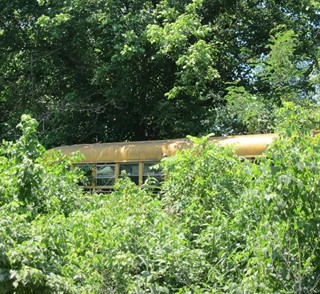
A few houses are scattered down the small grid of streets among the trees, some disappearing into the underbrush, like this retired school bus hiding in the bushes.
After hiking and grave stalking, we were starving. We discovered there are not a lot of options for food in this part of Arkansas. We typically require alcohol with our non-breakfast meals (and in some cases, with the breakfast meal), and this one was no different. An exhaustive (well, 5-minute) search for bar/grill turned up Mateo’s – a little Mexican place just outside of Marshall. They were 1) open, 2) offered drinks, and 3) had food. Sold! We sat down in the empty dining room and admired the mural of a very thirsty man through what seemed to be a feedyard’s worth of flies circling the tables.

The owners sixth sense of the future was evident in their bathroom signage – prepping for a pandemic in 2011:

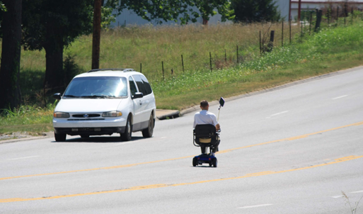
Margaritas and average Mexican food fit the requirements nicely. Full and a bit dizzy, we headed further into Marshall for some shopping. First stop: Harp’s for necessities, some groceries and some items we had neglected to pack. A short list meant this would be a quick mission, so only one of us went into the store to retrieve. The other remained in the car, still under the influence of Mateo’s tequila and lime concoctions. Singing along to the radio while reviewing recent photos the digital camera, she spotted something out the corner of her eye. A bit west on the road, a tiny object moving east towards Harp’s. Too small for a car, wrong shape for bike, didn’t look like an animal. Using the zoom on the digital camera, an image slowly came into focus.
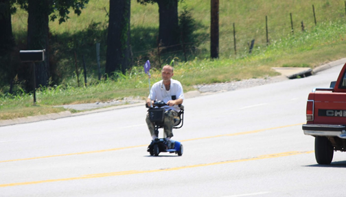
In the middle lane of a busy four-lane highway, there he was. This Arkansas resident just rolling down to the store, on a not quite highway legal vehicle. This may be a common sight – we were in a pretty rural town after all. Motorized vehicles or public transit might not always be accessible.
Our visitor appeared healthy and happy. Inspired by his courage, the intoxicated tourist in the car watched in amazement as he navigated his way through and across traffic and into the parking lot of Harp’s without being obliterated by a semi or pickup. Viewing through the camera, it was difficult to determine how close he actually was, but that didn’t matter, right? Just watching here…
Lowering the camera for a second, the rider of the wheelchair was ten feet away and looking directly at the passenger. “Shit.” It was the scene from Jurassic Park, where the kid lowers the binoculars only to find the velociraptor right in front of his face. Fewer teeth, but …
Unsure how to handle this potential confrontation, our observer slowly started to slump down in the seat, shielded by the door sill. Waiting a full five minutes (that felt like twenty), the passenger finally lifted eyes over the edge and breathed a sigh of relief. The unexpectedly sensitive roller was nowhere in sight – maybe to the store, maybe for a ride around the parking lot, who knows? He was no longer concerned with having his picture taken.
Still hearing Jurassic Park theme music, the passenger silently apologized to wheelchair rider for exploiting his moderately disabled travels. The right to wander through Arkansas without drunk tourists documenting your day through telephoto lenses is an innate American right.
Oh, wait. There he was again – going west into the sunset. One more picture. For old time’s sake:
Successful Harp’s expedition completed and assault by wheelchair driver avoided, we determined Walmart would be the source for items we didn’t find at Harp’s. This turned out to be a questionable decision.
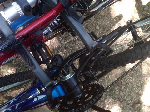
Wandering through the outdoor aisles, there were so many bikes for sale at this small-town Walmart our tequila infused brains told us that we must purchase those bikes. Exercise would be good, we thought. An area this beautiful and hilly cannot be experienced properly unless one is on two wheels. Bike purchase decided upon, it occurred to us: either those bikes would need to be attached to the Kia, or we would need to ride the bikes and ditch the car in the Walmart parking lot (maybe for the wheelchair man to pick up). Choosing to continue our journey in a vehicle with four wheels, we went in search of a bike rack which of course the Marshall Walmart offered.
The Walton family happily accepted a larger pile of our money and a nice employee helped us carry the new toys to the car. He watched in amazement as we attached the rack onto the small car, then maneuvered the oversized mountain bikes onto the rack like we were champion (or average – the alcohol may have inflated the reality of actual ability) Tetris players. Sure, one bike was upside down and the other on backwards in order to make them fit, but with enough bike chain and sweat, they would at least make it out of the parking lot with us ….
Problem solved. Bikes would be our new thing. Excited to explore Arkansas with the new toys, we headed out of Marshall.
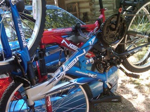
Wandering south, half heartedly searching for bike trails, we discussed options. Bikes, we’d determined, were going to be really fun to ride, but not to remove from the tangled pile on the back of the car. What if we leave the bikes alone and tackle cycling trails tomorrow? That way, we could admire our Tetris skills a little longer.
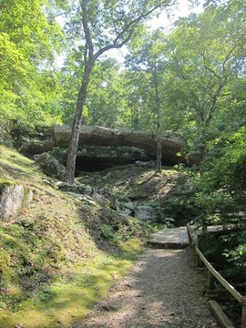
While this mulling was going on, somewhere a little north of Clinton, we spotted signs for the Natural Bridge, which led us down a precipitous drop to a parking area near apparently abandoned cabins. Realizing this was a pedestrian-only location, late in the afternoon (having wasted a majority of our day eating Mexican food, watching local wheelchair drivers and purchasing bikes), we opted for hiking instead of biking. Physical activity feels mandatory when on vacation in the hills of Arkansas, but it requires bottles of bug spray, gallons of sunscreen and mental toughness to endure the jungle heat that will blanket you as soon as you step outside.
In order to access the trails which allegedly would guide us to a beautiful natural bridge deep in the woods, we were required to first enter this little building. We were greeted by a nice attendant who pleasantly gave us some background on the area (which we promptly forgot) and then pleasantly advised there was hefty admission fee to view this elusive Natural Bridge. We paid, since going somewhere else sounded complicated.
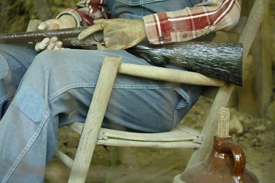
Bike trails, had we found them and had we not been too lazy to remove them from the bike rack, would have been free. Instead, we took an expensive walk into the Arkansas wilderness. As we headed towards the trail, we stopped to explore the random items in this creepy cabin dangling off the edge of the trail.
A corn cob? Or …

Corn cobs and gourds and broomsticks… history or a horror movie?
Oh, hello, another prop for a horror movie.
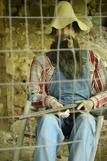
Is the man missing his wooden fingers guarding the corn the cob? Sure looks that way. We supposed he had all fingers required to pull the trigger, so the corn cob is safe for now.
With appropriate “do you hear banjos” thoughts planted in our heads, we headed out down the trail. Stocked with water and a camera each, we were mentally prepped for a hike of a decent length. A quarter-mile of walking and … is that a bridge up there? It can’t be – we barely started this adventure. Surely that’s the “appetizer” bridge – a teaser to the real thing, which we expected would be much more spectacular than this. An abrupt end to the trail showed us that this indeed was the spectacular, wondrous, expensive “Natural Bridge”.
Summary for The Natural Bridge:
- Admission fee: $25
- Trail Length: Less than 0.5 miles
- Creepy things: at least 10
- Overall rating: Save your cash


Bike trails would have been free.
After the Natural Bridge adventure, or lack thereof, we checked our beverage supply and hunger levels. Liquor (along with towns) is scarce in this area of Arkansas, and we knew we would need more supplies for the next day. While in Harrison we replenished the drinking supplies and found sustenance at a now defunct pizza place in an old mill.
We didn’t do much photo documentation on the way home, but enjoyed a relaxing drive along windy Arkansas roads as the summer sun set. We were back at the cabin in time to watch lightning bugs from the screened in porch, and called it a day at last.
Sunday 2011 07 03
As the day started Sunday, we again realized we had no plan. After a late wake-up, we threw together some breakfast, and enjoyed a quiet mid-morning porch. Trying to ignore the slowly heating sauna that is summer in Arkansas, it was time to detach the bikes. Lack of a trail on the property didn’t stop us – we just pedaled over the farmhouse lawn, up the big hill, around the house, past the barn. Bikes, we decided, were an excellent investment. Attempting to cram them back on the ill-fitting bike rack after our ride, we reconsidered the previous day’s inebriated confidence in our racking and stacking. Maybe we weren’t quite the Tetris masters we had imagined. After some rearranging, we packed a cooler of food and headed out for the day, bikes questionably attached on the back, one right-side up, one upside down. What next?
Remembering an ad for caverns on the way to Harrison, about 10 miles north, we headed that direction. Heading north on 65, we spotted a sign for a canoe rental company. That was something that hadn’t occurred to us, despite having looked over and photographed, and crossed a river 4 times the prior day. Rolling the window down a bit and inhaling the baking air, being on or in a possibly cool river sounded much better than bikes or hikes or caves. “Gilbert: 7 miles that way. Float here!” the sign begged us, and it was an offer we couldn’t refuse. We’ll just head down to Gilbert and check it out …
Turning right off the highway, we followed the narrow, curving road as it descended into the river valley. After passing farm houses and vacation properties and side roads pointing to camping and cabins, we found ourselves in this tiny, beautiful little town at the bottom of the valley. [link to pictures from subsequent trips] A rustic white chapel on the first turn into the town introduced us to a spotless little place which appeared well taken care of. Craftsman-style farm houses on widely spaced lots lined the two main streets in town, sprawling porches were covered with rocking chairs, large, green yards the hills leading out of town.
Stopping across from the post office, we knew we were in the right place. A large van with a trailer carrying multiple canoes was idling on the right side of the road. We found a parking spot and wandered up to the Gilbert General Store, an aging and ramshackle building . Across the huge front porch decorated with brochure racks and well-worn wooden benches sat a gang of potential floaters with the town dog lolling at their feet, waiting for their ride to the river.
Inside, aisles full of Buffalo River t-shirts, hats, shoes were stuffed in next to tables full of necessities, like sunscreen and coolers. We headed to the counter and inquired about a renting a canoe. There were so many options – one or two-person kayaks, small and large canoes, long river trips, short river trips, innertube floats – it was overwhelming. The folks working the counter simplified things for these out-of-towners and explained that for beginners, a six-mile trip in a two-person canoe would probably be a great start.
After skimming over the fine print on the rental contract and forking over a credit card, we were advised:
- They reminded us to wear life jackets and not pass the shore at the end of the trip
- Passing the pull-in spot would result in delayed pick up, if any at all
- “You could spend the night on the river,” they warned or
- We could wind up in Mississippi or
- If we had glass bottles in our cooler, we could end up in a police car and
- Any trash had to go into the net bag and
- Cars parked on the property would be parked at our own risk and …
Necks sore from nodding, we promised we would remain on the course, then joined the other vacationers on the front porch and waited patiently for our big white van to take us to a spot six miles up the river. Piling into a hot van with what felt like a small town worth of other passengers, we exchanged glances if wondered if we had made the right choice. We typically try to avoid claustrophobic spaces and crowds while on vacation and this was both of those things. Nothing to do for it now – the van zoomed away from the store in a cloud of blue smoke as our driver attempted to reach ludicrous speed …
Bouncing through the Tyler Bend campground about fifteen minutes later, the van rolled to a stop at the river’s edge, and we piled out with the other noisy canoe trippers. Feeling a bit fifth-wheel, we all watched our chauffeur expertly unload a stack of canoes and paddles and life jackets. Rules announced again: no alcohol! (oops) … wear or pretend to wear your life jacket (sure) … and don’t float past the end (fair enough).
Putting our feet into the water (ahhhhhh) and tentatively stepping into our two-seater canoe, we pushed off and were on the way. It took a few minutes to sort out paddling in tandem – canoeing requires teamwork if the two navigators want to move in the right direction. One of our party being better at things requiring coordination, we eventually figured it out, at least quicker than most who dropped in the river with us. Paddling past the slow learners, we headed down the river and tried to get away from the noise. For a minute, our area was people free, but a holiday weekend in the heat turns the river into a people magnet. Taking the first turn we found ourselves catching up the last van of humans to hit the river – there was no escape.


Even scattered groups of noisy people do little to detract from the gorgeous scenery and relaxing flow of the Buffalo. Yes, there are probably more scenic rivers, more exciting rapids, better canoe trips, more isolated and wild places, but keep in mind, we’re from north Texas where rivers are primarily sluggish, muddy, cow-crap filled sloughs winding between algae-clogged lakes with wheat fields stretching out from the banks. Additionally, we had spent much of the prior decade or more raising children with limited funds and means to explore such places. This was shaping up to be a perfect day – a clear flowing river threading around ancient rocky cliffs with wide blue skies and no obligations, no schedules, and enough booze in our cooler to keep us happy for days (or at least the afternoon) …
A few samples of our view from the boats are here – beautiful shots of the wonder that is the Buffalo National River. To protect the innocent, photos of the photographers in various states of intoxication and questionable clothing choices have been redacted …
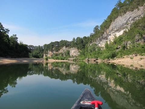


A few lazy turns down the river, we came up to a short swift current dropping us into a crowded spot, with lots of boaters parked on the gravel bar and picnickers next to their trucks shepherding kids and dogs and fishing rods. Steep cliffs towered over the river on the left side, leaning over what was obviously an easily accessible diving pool. There were people everywhere, climbing up, standing at the top, looking down at the river. Some were five feet up, some twenty or more. Hearing a yell, we watched a brave soul put his arms up and fling himself off a high ledge and into the cold water below. As soon as his head cleared the water, another jumper followed. Ready for a break, we thought this looked like decent entertainment.
Beaching our canoe, we waded into the river to enjoy the show. Watching people from ages 5 to 50 work their way over slippery rocks and up a narrow set of footholds to various diving platforms, our first thoughts were “They’re crazy. We would never do that. Plus we’re too old.” The expected fear-frozen grade-schoolers blocked the diving while impatient high school teens pushed past them to cascade off the rocks. After a bit, and seeing someone’s middle-aged uncle clamber to a spot 3 stories over the water to do a backflip into the river, we decided we could not leave this river without participating in the fun. Slipping and sliding and wobbling, two slightly woozy mid-thirties first-time river trippers made it to second lowest ledge, and steeling ourselves for what looked like 20 feet but was probably 5, jumped off. Mission accomplished!


After the adrenaline rush, it was time to move on – we swam back to the landing, dislodged the canoe, and moseyed down the river, listening to the sounds of jumpers smacking themselves into the river behind us. The swimming hole worked nicely as a crowd-stopper, so we finally found ourselves alone in the quiet – time for a relaxing swim in clear, cool water slipping by conveniently placed boulders on a sunny afternoon.
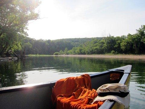
Timing and pacing and swimming breaks put us in the perfect place – as far as we could tell we were the last ones on the river. The sun started to get lower in the sky, and not knowing exactly where the finish line was, we weren’t sure if we would end up stuck here in the dark. Reluctantly, we piled back into the boat and moved on.
Having enjoyed a casual float thus far, navigating the last few miles was rough. Water levels were not completely sufficient to support canoes in some places, so we were forced to get out and drag the boat over rough rocks. This probably would have been more comfortable with river shoes instead of a set of Vibram Five Fingers … and a bigger dose of sobriety.
Having not planned for a 6-hour river trip during our absent-minded packing that morning, we had neglected to pack any substantial food. Our fuel on the river consisted mostly of small snacks and booze, which were an okay start, but toward the end of the trip, the lack of adequate calories was being felt. Arms and legs were aching and hands blistered from unplanned paddling, and feet were bruised from walking on river rocks just the right size to roll an ankle over. Adding sunburn from sitting in an open boat without sunscreen and it was time to get out of the water. Exhausted, we finally turned around the last bend in the river and saw the sign for Gilbert, marking the end of a spontaneous, longer-than-expected, draining, relaxing, perfect trip.
Dragging the boat onto the river bank and bruising the last few spots that we’d missed earlier in the day was the final physical challenge. After a short hike uphill toward the Gilbert Store, we were ready to collect the car, and hopefully food (in our minds at this point, that was spelled FOOD …). The car was there but food wasn’t going to happen in Gilbert. The store was closed, and if they’d been open we’d have been dining on ice cream and potato chips. Realizing there was nothing else in Gilbert except a post office and some cabins, we headed up the road toward civilization and found ourselves back on 65.
We figured Harrison would be the best option for food, about 30 miles north. Trying to silence the growling of our stomachs long enough to get there, off we went. A few miles up the road, we passed by an unobtrusive sign on the right side of the road that said Big Springs Trading Company and something about “BBQ”. Brakes applied, and looking more closely, we weren’t sure if there was a restaurant, a house, or something else. A short debate took us half a mile up the road, and we turned around to check it out. Pulling into the driveway, we found ourselves in a parking lot of sorts covered with grass and gravel with no actual parking spots. Undeterred, we parked and shuffled inside, dressed in dirty river clothes and smelling questionable.
Inside, we found a small room, a few tables, and a counter, with the smell of smoked meats wafting from the kitchen, and evidently tied to the tasty looking bundles hanging behind a display window. A friendly hostess with a mellow Arkansas accent sat us at a wobbly table in the corner and handed over a menu with approximately three options after the list of “we’re out of …” was finished. Tempted to say “all of the above” we dialed in on the brisket sandwich option, and focused on emptying our water glasses to rehydrate. Sunday evening service pace meant that about fifteen minutes later, we were served plates full of brisket sandwiches, potato salad, and baked beans. Plowing through our food at hyena pace, we decided this was the best restaurant ever, and the most delicious food (even served on mismatching plates) we’d ever had. Everyone should eat here, we decided, as long as they did it when we weren’t there.
Navigating between one semi-functional bathroom and one that was evidently going to flood central Arkansas, we decided the day was basically over. Having spent all our daylight hours on the river, we left Big Spring and we drove back to Snowball in the dark, happy, raggedly tired, and full. We’d forgotten what day it was, so we were confused as we heard a few loud booms on the way, but looking around we realized there was a fireworks display – it was almost Independence Day. Since the road we were driving on was elevated and we had an excellent view of the valley to the north, we pulled over at (where else?) a convenient cemetery and enjoyed the fireworks.
Monday 2011 07 04
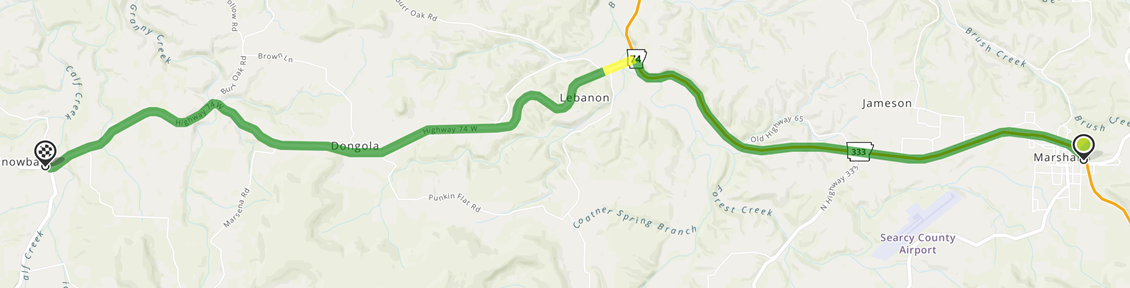
We might have ended up staying up even later after arriving at the cabin, with a midnight hike past the lightning bugs up the hill behind the property, and eventually collapsing into sleep in the early morning hours. Monday morning arrived too quickly – it was time to depart the perfect cabin. Packing clothes, cooler, beverages, and the Tetris-inspired bike rack, we rattled down the road and said goodbye to the farmhouse. There was some sort of schedule to adhere to, but daylight driving inspired us to take the longer way home – southwest (and south, and northeast, and northwest, and maybe east) through the mountains instead of heading back through Little Rock. This had two benefits – amazing scenery and a lot less traffic and small towns with bored constabulary looking to ticket Texas-plated cars for minor speeding infractions.
This spaghetti string of a route through the Ozark National Forest is a beautiful drive, forcing a driver to slow down on the sharp turns and hills and valleys winding across a gorgeous preserve of ancient forest and mountains.
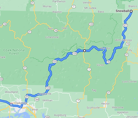
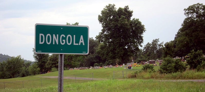
Mountain town names in Arkansas run the gamut from normal and boring (Witts Springs), to historic (Ben Hur), to the questionable. Driving by the town sign for Dongola, I heard Elf when he meets Francisco. “Dongola! That’s a fun name.” Big smile.

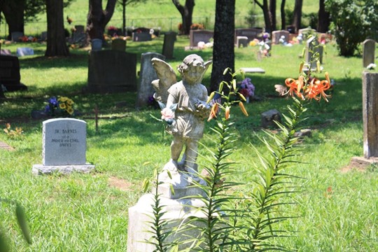
Given a large number of dead people in Arkansas, there were a few additional cemeteries which required stops on these windy roads. The graveyards appear to be frequently visited as they are well taken care of, leaving acres of colorful graves tucked into the rolling hills of the Ozarks.


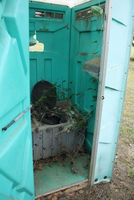
We didn’t think it was possible, but the facilities at the Witt Springs cemetery were even more scary than the flower and Folgers can at Snowball …

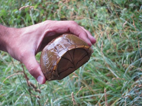
In addition to frightening cemetery toilets and Confederate flags, there’s a lot of trees, and occasional wildlife to be seen. Our friend below was attempting to cross the road in a light mist – attempting to keep him from being plastered on the road, we helped him from one side to the other. You’re welcome, Mr. Box.
After turtle rescue, we came across this fading and aging bridge. Listed as a historic location on the official Arkansas register, Big Piney Creek Bridge has been supporting vehicles over the Sugar Creek since 1931.


It’s a beautiful little spot that crosses the Sugar Creek along with various hiking trails that wander through the area, and is evidently a popular spot for fishing and canoeing here in the hills.

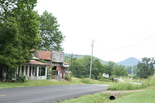
Somewhere around Hagarville, we came across more crumbling storefronts, including this one with a sign that appears to read: AB Adkins, est. 1938.
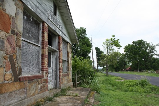
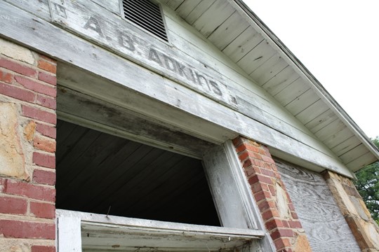
Not much left now, we rolled past more abandoned and decrepit buildings that at some point were part of a town.
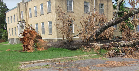
After a sharp descent past Hagarville, the Ozark National Forest ends and the scenery fade into flat, straight highways and residential areas. The first town out of the forest is Clarksville, a little spot sitting right on I-40. In any other year, we might not have paid much attention to this little place, but western Arkansas appeared to have had a traumatic 2011. Storms evidently ravaged the area in the spring, and the result of an EF4 tornado that swept through Clarksville and surrounding towns on May 25th, a little over a month before our trip, was clearly visible.
https://www.arkansasonline.com/news/2011/may/25/tornadoes-cause-damage-areas-state/
https://en.wikipedia.org/wiki/Clarksville,_Arkansas
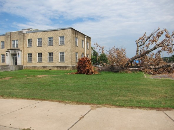
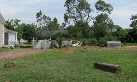

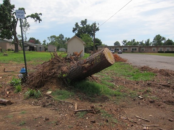
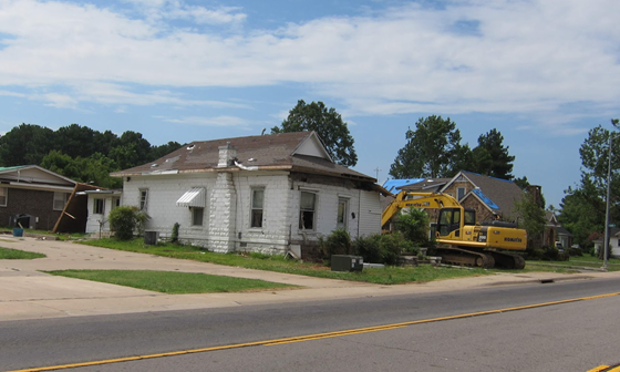
Glad we were not responsible for cleaning up the mess, we exited Clarksville and accelerated down the interstate in an attempt to reach home before midnight.
For a trip that started on a whim and without any sort of plan, we felt pretty good – we’d found a relaxing and remote location in the Ozarks which would turn into a favorite vacation spot for our families for years to come, explored a new mode of exercise, and gathered hundreds of photos to remind us that we’d need to wander this area again.
